East Tytherley / Estderlegh / Estuderley / Tederleg / Thundersleye / Tiderlege / Tidelei / Tuderley / Tyderleg / Tydresle
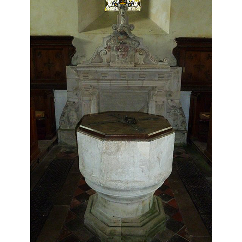
Image copyright © Basher Eyre, 2011
CC-BY-SA-2.0
Results: 2 records
view of font and cover
Copyright Statement: Image copyright © Basher Eyre, 2011
Image Source: digital photograph taken 30 June 2011 by Basher Eyre [www.geograph.org.uk/photo/2520035] [accessed 4 August 2011]
Copyright Instructions: CC-BY-SA-2.0
view of church exterior
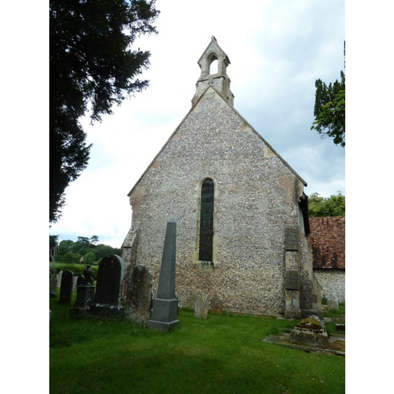
Copyright Statement: Image copyright © Basher Eyre, 2011
Image Source: digital photograph taken 30 June 2011 by Basher Eyre [www.geograph.org.uk/photo/2520053] [accessed 4 August 2011]
Copyright Instructions: CC-BY-SA-2.0
INFORMATION
Font ID: 17540TYT
Object Type: Baptismal Font1
Font Century and Period/Style: 13th century (late?), Decorated
Church / Chapel Name: Parish Church of St. Peter
Font Location in Church: Inside the church
Church Patron Saint(s): St. Peter
Church Address: East Tytherley, Salisbury SP5 1LE, UK
Site Location: Hampshire, South East, England, United Kingdom
Directions to Site: Located off (W) the B3084, 3-4 km N of Lockerley
Ecclesiastic Region: Diocese of Winchester
Historical Region: Hundred of Thorngate -- Hundred of Broughton [in Domesday]
Additional Comments: disappeared font? (the one from the Domesday-time chapel-of-ease here?)
Font Notes:
Click to view
There are three entries for [East] Tyrtherley [variant spellings] in the Domesday survey [http://opendomesday.org/place/SU2929/east-tytherley/] [accessed 13 September 2018], one of which reports seven churches in it [i.e., the parish church of Mottisfont and six dependent chapelries -- cf. Index entry for Mottisfonm]. The entry for this parish in the Victoria County History (Hampshire, vol. 4, 1911) notes: "At the time of the Domesday Survey [i.e., 1086] East Tytherley was a chapelry annexed to Mottisfont and forming part of the property of Thomas, Archbishop of York, [...] but it was afterwards separated from it and became a separate parish. [...] The history of the church is of the simplest; the chancel and nave as they now stand were built about the middle of the 13th century and remained unaltered until 1863, when the porch, transept, vestry and tower were added, the latter in 1893 [...] and the whole building rather drastically restored. The tower was added in 1898 [...] The late 13th-century font has an octagonal bowl and a circular moulded stem and base." The entry for this church in Historic England [Listing NGR: SU2931927832] notes: "At W C13 font of large octagonal bowl on round column on octagonal base". [NB: we have no information on the earlier font of the church/chapel noted in Domesday]
COORDINATES
UTM: 30U 599217 5657372
Latitude & Longitude (Decimal): 51.05929, -1.5842
Latitude & Longitude (DMS): 51° 3′ 33.44″ N, 1° 35′ 3.12″ W
MEDIUM AND MEASUREMENTS
Material: stone
Font Shape: octagonal, mounted
Basin Interior Shape: round
Basin Exterior Shape: octagonal
LID INFORMATION
Material: wood, oak?
Apparatus: no
Notes: octagonal and flat, with metal decoration and ring handle; probably modern
REFERENCES
- Victoria County History [online], University of London, 1993-. URL: https://www.british-history.ac.uk.