Sherfield English / Sherefeld Englysshe / Shervill / Shirefelde / Shyrfeld / Sirefelle
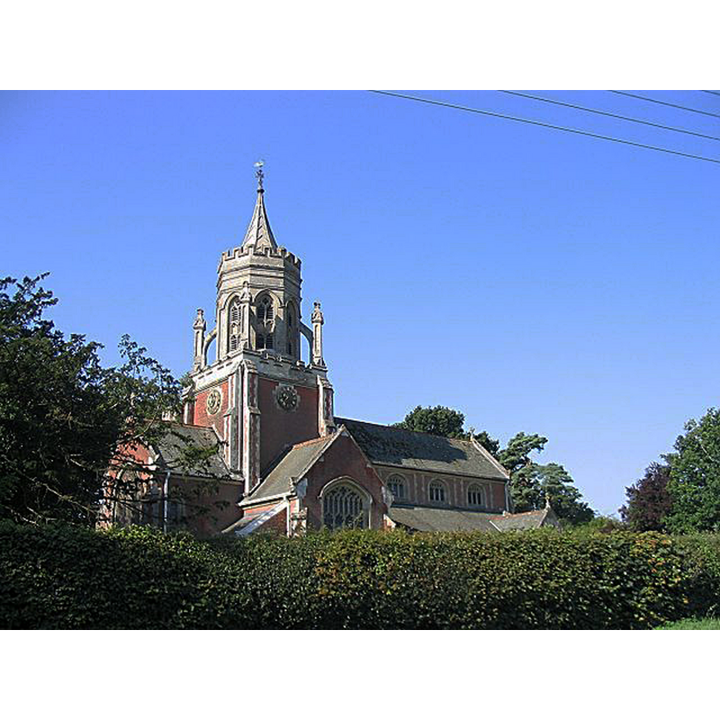
Image copyright © Rosemary Oakeshott, 2007
CC-BY-SA-2.0
Results: 1 records
view of church exterior in context
Scene Description: Source caption: "St Leonard's Church, Sherfield English. This lavishly built Anglican church was given as a memorial to her daughter by Lady Ashburton, of the Baring family, in 1902. It replaced the original church which was north of the A27."
Copyright Statement: Image copyright © Rosemary Oakeshott, 2007
Image Source: digital photograph taken 11 August 2007 by Rosemary Oakeshott [www.geograph.org.uk/photo/649026] [accessed 13 September 2018]
Copyright Instructions: CC-BY-SA-2.0
INFORMATION
Font ID: 17538SHI
Object Type: Baptismal Font1?
Font Century and Period/Style: Medieval
Church / Chapel Name: Parish Church of St. Leonard
Church Patron Saint(s): St. Leonard
Church Address: Salisbury Road, Sherfield English, Romsey SO51 6FN , UK
Site Location: Hampshire, South East, England, United Kingdom
Directions to Site: Located off the A27, 6 km NE of Romsey
Ecclesiastic Region: Diocese of Winchester
Historical Region: Hundred of Thorngate -- Hundred of Broughton [in Domesday
Additional Comments: disappeared font?
Font Notes:
Click to view
There is an entry for Sherfield [English] [variant spelling] in the Domesday survey [http://opendomesday.org/place/SU2922/sherfield-english/] [accessed 13 September 2018] but it mentions neither cleric nor church in it. The entry for this parish in Victoria County History (Hampshire, vol. 4, 1911) notes: "The advowson of Sherfield English belonged to the lords of the manor until the middle of the 17th century [...] The church of [St. Leonard], built in 1903 [...] is on practically the same site as that built [...] in 1858, but pulled down in 1902–3 on account of its insecurity." The VCH does not mention an earlier church, but notes: "The altar rails and font cover are of 18th-century date", and reports that the baptismal register: "contains mixed entries 1640 to 1746; the second and partly parallel, 1693 to 1702 curiously combined with churchwardens' accounts; the third, baptisms and burials 1741 to 1811". The VCH also notes: "At the rectory is a panelled octagonal font of late date removed from the old church." [NB: the initial date of baptismal registers in English churches is not indicative of the start of baptisms in the parish; registers were introduced in many English churches in the 16th century, whereas other parish registers start well into the 17th century]. The entry for this church in Historic England [Listing NGR: SU2946523219] notes: "At W end C19 stone font on marble shafts".
COORDINATES
UTM: 30U 599127 5650739
Latitude & Longitude (Decimal): 50.99968, -1.5873
Latitude & Longitude (DMS): 50° 59′ 58.85″ N, 1° 35′ 14.28″ W
REFERENCES
- Victoria County History [online], University of London, 1993-. URL: https://www.british-history.ac.uk.