South Tidworth / South Tedeworth / South Tedworth / Suthtudeword / Suthtudeworthe / Tedorde / Thodeworth / Thudeworth / Todeorde
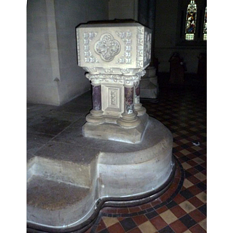
Image copyright © Basher Eyre, 2013
CC-BY-SA-2.0
Results: 2 records
view of font and cover
Scene Description: the modern font
Copyright Statement: Image copyright © Basher Eyre, 2013
Image Source: digital photograph taken 5 February 2013 by Basher Eyre [www.geograph.org.uk/photo/3380774] [accessed 30 August 2018]
Copyright Instructions: CC-BY-SA-2.0
view of church exterior - southwest view
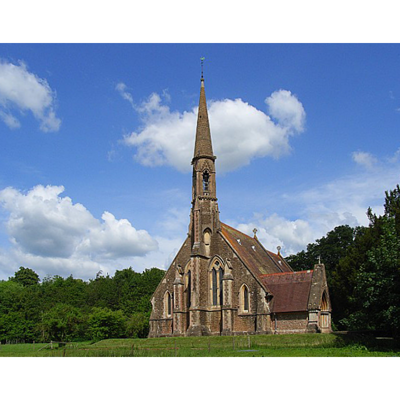
Scene Description: Source caption: "St Mary's, South Tidworth. Late nineteenth century church, now redundant and in the custody of the Churches Conservation Trust."
Copyright Statement: Image copyright © Andrew Smith, 2007
Image Source: digital photograph taken 20 May 2007 by Andrew Smith [www.geograph.org.uk/photo/441801] [accessed 30 August 2018]
Copyright Instructions: CC-BY-SA-2.0
INFORMATION
Font ID: 17525TID
Object Type: Baptismal Font1
Font Century and Period/Style: 11th century, Pre-Conquest? / Norman
Church / Chapel Name: Old Parish Church [disappeared]
Church Notes: disappeared medieval church; replaced by 1878-1880 building now in the care of the Churches Conservation Trust
Church Address: address and coordinates given for the 19thC church: Shipton Road, South Tidworth SP9 7ST, United Kingdom
Site Location: Hampshire, South East, England, United Kingdom
Directions to Site: Located off the A338, 16 km W of Andover, by the Wiltshire border [NB: North Tidworth is part of Wiltshire]
Ecclesiastic Region: Diocese of Winchester
Historical Region: Hundred of Andover -- Hundred of Broughton [in Domesday]
Additional Comments: disappeared font? (the one from the Domesday-time church here)
Font Notes:
Click to view
There are three entries for [South] Tidworth [variant spellings] in the Domesday survey [http://opendomesday.org/place/SU2347/south-tidworth/] [accessed 30 August 2018], one of which reports a church in it. The entry for this parish in the Victoria County History (Hampshire, vol. 4, 1911) notes: "The church of South Tidworth is mentioned in Domesday Book with the larger holding of Robert son of Gerold [...] The church of St. Mary the Virgin is an entirely modern building erected in 1880 [...] The register [...] has baptisms from 1627 to 1643." The entry for this church in Historic England [Listing NGR: SU2353947699] notes: "The square font is raised on 2 steps in front of a niche (within the massive west-end buttress)"; it is a late-19th --century font. [NB: we have no information on the font from the earlier church on this site]
COORDINATES
UTM: 30U 593253 5676064
Latitude & Longitude (Decimal): 51.228333, -1.664444
Latitude & Longitude (DMS): 51° 13′ 42″ N, 1° 39′ 52″ W
REFERENCES
- Victoria County History [online], University of London, 1993-. URL: https://www.british-history.ac.uk.