Thruxton nr. Andover / Thorcleston / Throkeleston / Throkeston / Throxton / Thruckleston / Thurkcleston / Turcleston / Turkilleston
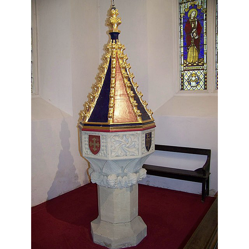
Image copyright © Maigheach-gheal, 2008
CC-BY-SA-2.0
Results: 3 records
view of font and cover
Scene Description: Source caption: "Font, The Church of St Peter and St Paul, Thruxton. The font of 1844 is by Osmond of Salisbury. The cover is oak of pyramidal form and was gilded and painted by Fisher of Salisbury."
Copyright Statement: Image copyright © Maigheach-gheal, 2008
Image Source: digital photograph taken 3 August 2008 by Maigheach-gheal [www.geograph.org.uk/photo/919610] [accessed 30 August 2018]
Copyright Instructions: CC-BY-SA-2.0
view of basin
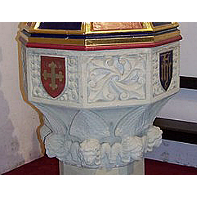
Scene Description: of the modern font
Copyright Statement: Image copyright © Maigheach-gheal, 2008
Image Source: edited detail of a digital photograph taken 3 August 2008 by Maigheach-gheal [www.geograph.org.uk/photo/919610] [accessed 30 August 2018]
Copyright Instructions: CC-BY-SA-2.0
view of church exterior - southeast view
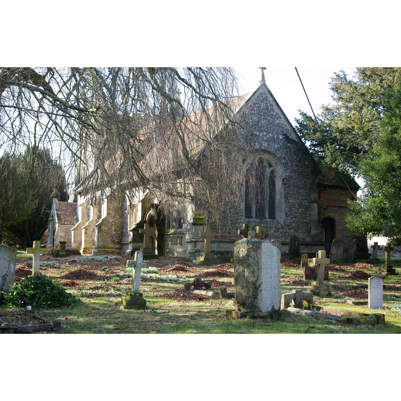
Copyright Statement: Image copyright © Andrew Mathewson, 2010
Image Source: digital photograph taken 5 March 2010 by Andrew Mathewson [www.geograph.org.uk/photo/1737694] [accessed 30 August 2018]
Copyright Instructions: CC-BY-SA-2.0
INFORMATION
Font ID: 17524THR
Object Type: Baptismal Font1, fragment
Font Century and Period/Style: Medieval
Church / Chapel Name: Parish Church of St. Peter and St. Paul
Font Location in Church: [cf. FontNotes]
Church Patron Saint(s): St. Peter & St. Paul
Church Address: Cedar View, Thruxton, Andover SP11 8NQ , UK -- Tel.: 01264 772872
Site Location: Hampshire, South East, England, United Kingdom
Directions to Site: Located off (N) the A303, 8 km W of Andover
Ecclesiastic Region: Diocese of Winchester
Historical Region: Hundred of Andover
Additional Comments: damaged font - only fragments left -- disappeared font? (the one from the Domesday-time church here)
Font Notes:
Click to view
There is an entry for this Thruxton [variant spelling] in the Domesday survey [http://opendomesday.org/place/SU2845/thruxton/] [accessed 30 August 2018]; it reports a church in it. The entry for this parish in the Victoria County History (Hampshire, vol. 4, 1911) notes: "In 1086 the Norman abbey of Cormeilles held the church of Thruxton" and remarks on the church: "Owing to the very complete modernizing of the building there is little left to tell its story. [...] The chancel [...] was probably rebuilt late in the 15th century, but the nave, though retaining no early detail, is doubtless much older [...] The font, which stands in the tower, dates from 1844 and replaced one of 1814, which in turn had replaced another which was broken by the fall of the tower in 1796. A piece of it and the 1814 font are now in the foundations of the porch". The entry for this church in Historic England [Listing NGR: SP2972544049] reports "the font and seating 1844". [NB: we have no information on whether or not the buried fragment belonged to the original medieval font]
COORDINATES
UTM: 30U 598610 5674026
Latitude & Longitude (Decimal): 51.20911, -1.5883
Latitude & Longitude (DMS): 51° 12′ 32.8″ N, 1° 35′ 17.88″ W
MEDIUM AND MEASUREMENTS
Material: stone
Number of Pieces: fragment
REFERENCES
- Victoria County History [online], University of London, 1993-. URL: https://www.british-history.ac.uk.