Quarley / Cornby? / Cornelea / Ferlei / Querle / Querlye / Qwarley / Qwharley
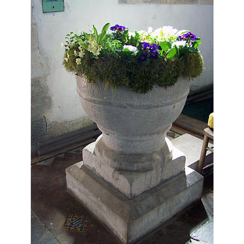
Image copyright © Maigheach-gheal, 2010
CC-BY-SA-2.0
Results: 3 records
view of font
Scene Description: not known whether the mouldings are original or part of the later re-carving
Copyright Statement: Image copyright © Maigheach-gheal, 2010
Image Source: digital photograph taken 23 April 2010 by Maigheach-gheal [www.geograph.org.uk/photo/1821517] [accessed 30 August 2018]
Copyright Instructions: CC-BY-SA-2.0
view of church exterior - northeast view
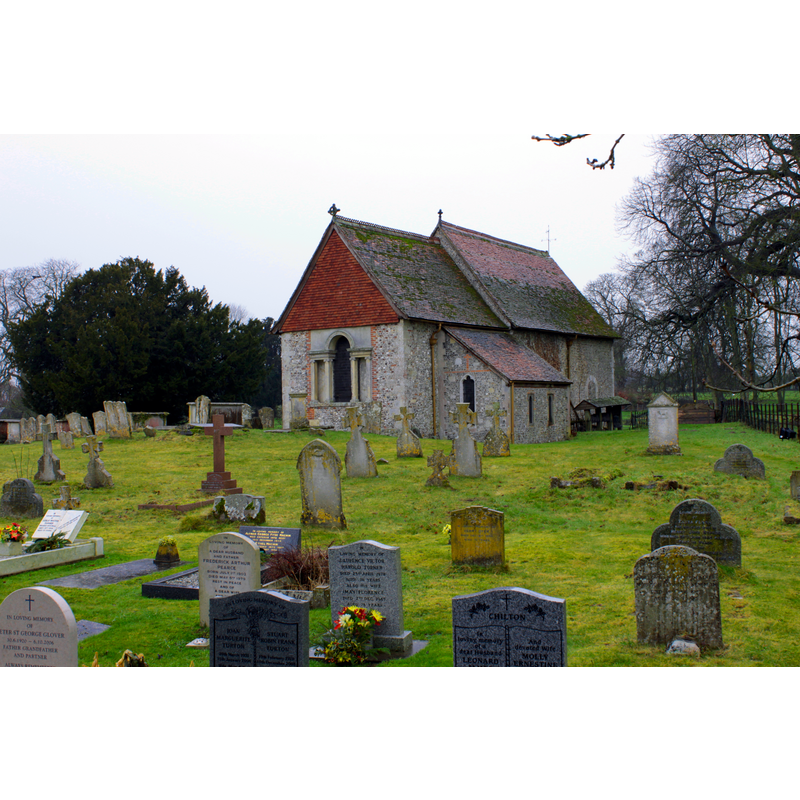
Scene Description: not known whether the mouldings are original or part of the later re-carving
Copyright Statement: Image copyright © Mike Cattell, 2011
Image Source: digital photograph taken 6 January 2011 by Mike Cattell [https://commons.wikimedia.org/wiki/File:St._Michael's_Parish_Church,_Quarley,_Hampshire.jpg] [accessed 31 August 2018]
Copyright Instructions: CC-BY-SA-2.0
view of church exterior - southeast view
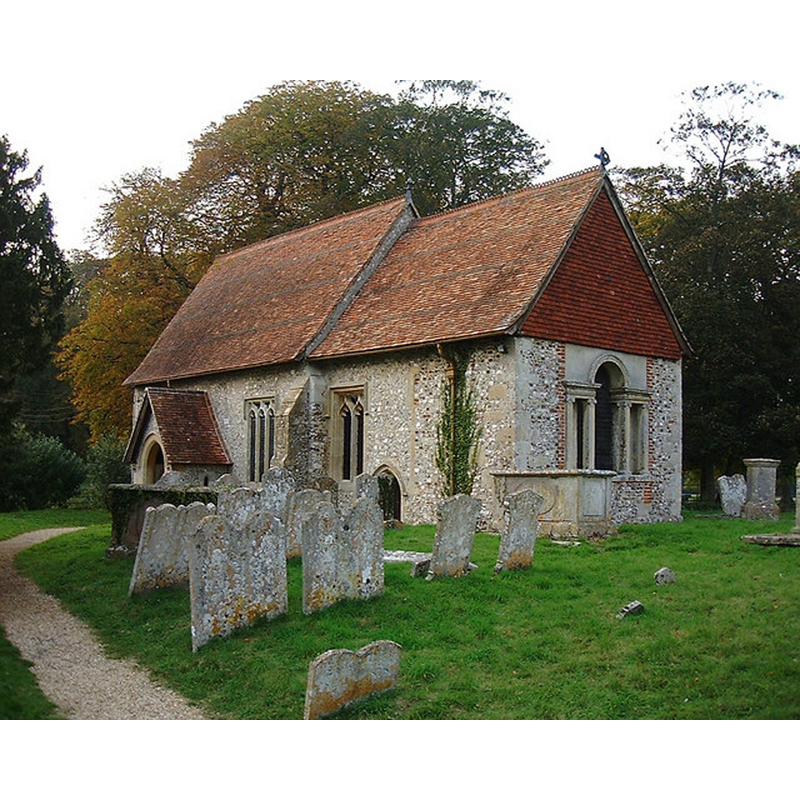
Copyright Statement: Image copyright © Chris Talbot, 2007
Image Source: digital photograph taken 11 October 2007 by Chris Talbot [www.geograph.org.uk/photo/582052] [accessed 30 August 2018]
Copyright Instructions: CC-BY-SA-2.0
INFORMATION
Font ID: 17523QWA
Object Type: Baptismal Font1
Font Century and Period/Style: 13th century [re-tooled?], Early English [altered]
Church / Chapel Name: Parish Church of St. Michael
Font Location in Church: Inside the church
Church Patron Saint(s): St. Michael
Church Address: 1 Park Ln, Quarley, Andover SP11 8QB, UK
Site Location: Hampshire, South East, England, United Kingdom
Directions to Site: Located off (S) the A303, 11 km W of Andover
Ecclesiastic Region: Diocese of Winchester
Historical Region: Hundred of Andover
Additional Comments: altered font? re-tooled? (the present font) -- disappeared font? (the one from the Domesday-time church)
Font Notes:
Click to view
There is an entry for Quarley [variant spelling] in the Domesday survey [http://opendomesday.org/place/SU2743/quarley/] [accessed 30 August 2018]; it reports a church in it. The entry for this parish in the Victoria County History (Hampshire, vol. 4, 1911) notes: "The church [...] is mentioned in Domesday Book [...] The nave is not later than the beginning of the 12th century [...] There was no doubt a chancel smaller than the present one, which appears to be an enlargement of the 15th century [...] The font has been partly retooled and is probably of 13th-century workmanship; it has a round cup-shaped bowl on a short round stem." The entry for this church in Historic England [Listing NGR: SU2737643665] reports a "Plain tub font" in it.
Credit and Acknowledgements: We are grateful to Allan Soedring, of www.astoft.co.uk, for his photograph of this church
COORDINATES
UTM: 30U 597056 5672327
Latitude & Longitude (Decimal): 51.1941, -1.611
Latitude & Longitude (DMS): 51° 11′ 38.76″ N, 1° 36′ 39.6″ W
MEDIUM AND MEASUREMENTS
Material: stone
Font Shape: tub-shaped, mounted
Basin Interior Shape: round
Basin Exterior Shape: round
REFERENCES
- Victoria County History [online], University of London, 1993-. URL: https://www.british-history.ac.uk.