Litchfield / Leteshelve / Liddesulde / Lidescelve / Lideshull / Lidulse / Lieuselva / Livescelve / Liveschella / Liveshelle / Lodeschylve / Luddeshelve / Ludeshul / Ludeshulff / Ludeshull / Ludshelf / Lydeshelf
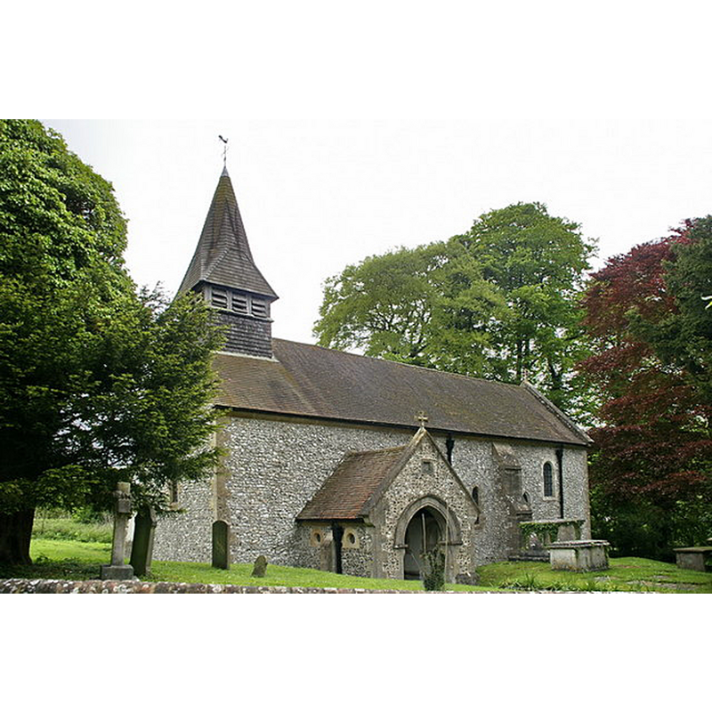
Image copyright © Alexander P Kapp, 2009
CC-BY-SA-2.0
Results: 1 records
view of church exterior - southwest view
Copyright Statement: Image copyright © Alexander P Kapp, 2009
Image Source: digital photograph taken 15 May 2009 by Alexander P Kapp [www.geograph.org.uk/photo/1317474] [accessed 21 August 2018]
Copyright Instructions: CC-BY-SA-2.0
INFORMATION
Font ID: 17505LIT
Object Type: Baptismal Font1
Font Century and Period/Style: 12th century, Late Norman
Church / Chapel Name: Parish Church of St. James the Less
Font Location in Church: [cf. FontNotes]
Church Patron Saint(s): St. James the Less [aka James the Lesser, James the Little, James the Minor, James the Younger]
Church Address: Main road, Litchfield, Whitchurch RG28 7PR , UK -- Tel.: 01256 896888
Site Location: Hampshire, South East, England, United Kingdom
Directions to Site: Located off (E) the A34, between Newbury and Whitchurch
Ecclesiastic Region: Diocese of Winchester
Historical Region: Hundred of Kingsclere -- Hundred of Hurstbourne [in Domesday]
Additional Comments: damaged and disused font, but still kept inside the church, next to the modern one in use
Font Notes:
Click to view
There is an entry for Litchfield [variant spelling] in the Domesday survey [http://opendomesday.org/place/SU4653/litchfield/] [accessed 21 August 2018] but it mentions neither cleric nor church in it. The Victoria County History (Hampshire, vol. 4, 1911) notes: "There was a church in the parish by the middle of the 13th century [...] The 12th-century building on the site consisted of a nave one bay shorter eastwards than at present, with a south aisle divided off by an arcade of two bays, now blocked, the aisle being destroyed. There may have been at first a chancel narrower than the nave, but if so it has left no trace, and the present chancel was added c. 1190, having its eastern bay covered with a stone vault. About the year 1200 an aisle of two bays was added on the north side of the nave, and shortly afterwards an east bay was added to both nave arcades, that on the north opening to the site of a former north-east vestry. There may have been a similar vestry or chapel at the east of the south aisle. The whole building underwent a restoration in 1875 [...] Near the modern font is the bowl of an old one which is considerably damaged and is square with chamfered corners." The modern font is located in the arcade that separates the nave from the N aisle.
COORDINATES
UTM: 30U 615815 5682682
Latitude & Longitude (Decimal): 51.28368, -1.3393
Latitude & Longitude (DMS): 51° 17′ 1.25″ N, 1° 20′ 21.48″ W
MEDIUM AND MEASUREMENTS
Material: stone
Font Shape: square
Basin Exterior Shape: square
REFERENCES
- Victoria County History [online], University of London, 1993-. URL: https://www.british-history.ac.uk.