Saintes No. 2
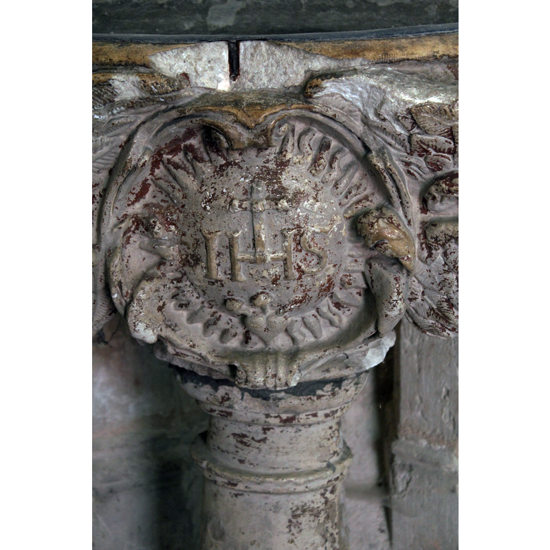
Image copyright © Baptisteria Sacra Index, 2023
CC-BY-NC-ND-4.0
Results: 8 records
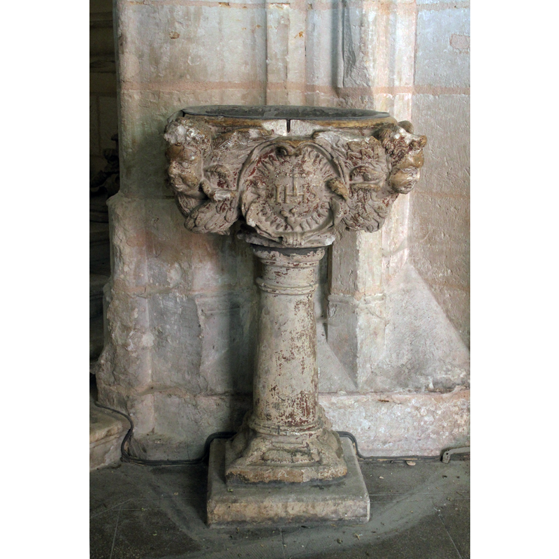
B01: Christ - monogram - IHS - in a cartouche
Copyright Statement: Image copyright © Baptisteria Sacra Index, 2023
Image Source: digital photograph taken 27 June 2011 by Baptisteria Sacra Index
Copyright Instructions: CC-BY-NC-ND-4.0
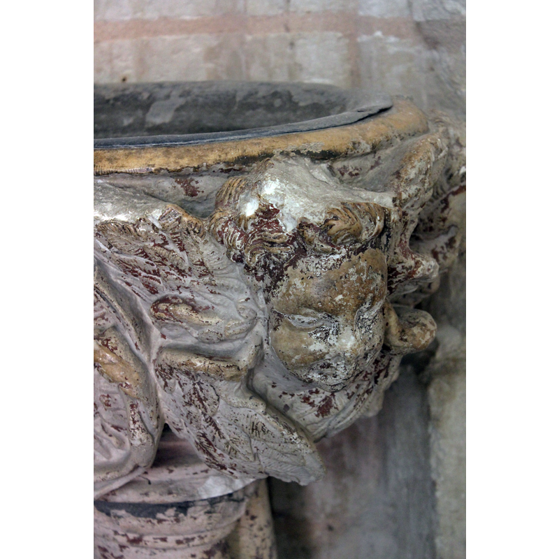
BH01: angel - head
Copyright Statement: Image copyright © Baptisteria Sacra Index, 2023
Image Source: digital photograph taken 27 June 2011 by Baptisteria Sacra Index
Copyright Instructions: CC-BY-NC-ND-4.0
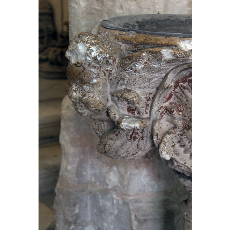
BH02: angel - head
Copyright Statement: Image copyright © Baptisteria Sacra Index, 2023
Image Source: digital photograph taken 27 June 2011 by Baptisteria Sacra Index
Copyright Instructions: CC-BY-NC-ND-4.0
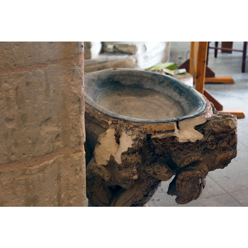
view of basin - upper view
Copyright Statement: Image copyright © Baptisteria Sacra Index, 2023
Image Source: digital photograph taken 27 June 2011 by Baptisteria Sacra Index
Copyright Instructions: CC-BY-NC-ND-4.0
view of stoup in context
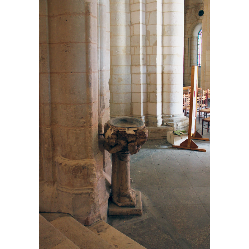
Scene Description: this area of the original transept is now at the west end of the church
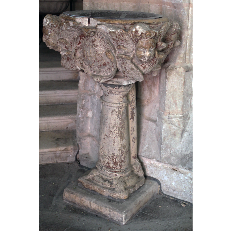
view of stoup - southeast view
Copyright Statement: Image copyright © Baptisteria Sacra Index, 2023
Image Source: digital photograph taken 27 June 2011 by Baptisteria Sacra Index
Copyright Instructions: CC-BY-NC-ND-4.0
view of stoup - south view
Copyright Statement: Image copyright © Baptisteria Sacra Index, 2023
Image Source: digital photograph taken 27 June 2011 by Baptisteria Sacra Index
Copyright Instructions: CC-BY-NC-ND-4.0
information

Copyright Statement: Image copyright © Baptisteria Sacra Index, 2023
Image Source: field notes taken 27 June 2011 by Baptisteria Sacra Index
Copyright Instructions: CC-BY-NC-ND-4.0
INFORMATION
Font ID: 17495SAI
Object Type: Stoup
Font Century and Period/Style: 17th - 18th century, Baroque
Church / Chapel Name: Église priorale Saint-Eutrope [aka Basilique Saint-Eutrope -- since 1886]
Font Location in Church: Inside the church, in the transept, N side
Church Patron Saint(s): St. Eutrope (d. 475; bishop of Orange?)
Previous Font Location(s): The old Collège des Jésuites de Saintes
Church Notes: The original church dates from 1081; the nave of the upper church was pull down in 1803, so the transept is now at the west end. Although much of the original curch estructure has been changed, there are wonderful capitals remaining from the Romanesque period and the crypt, the "oldest religious bulding in Saintonge" is an "exact replica of the choir above" and houses a 4th?/6th? century sarcophagus with the relics of St-Eutrope. (a/p France: a Phaidon Cultural Guide (1985, p. 667). The crypte is really a funerary basilica dating originally to the 11th-century fundation of the church.
Church Address: 56 Rue Saint-Eutrope, 17100 Saintes, France
Site Location: Charente-Maritime, Nouvelle-Aquitaine, France, Europe
Directions to Site: Located on the left bank of the Charente river, off the A10, 33 km NE of Royan, 60 km E of La Rochelle, 100 km N of Bordeaux
Historical Region: Saintonge
Additional Comments: damaged stoup: recent damage
Font Notes:
Click to view
Described and illustrated in the Palissy database [référence PM17000512] as a holy-water stoup probably from the old Jesuit college in this town; the suggested date given in Palissy is the 17th-18th century. On-site notes: the basin front has a cartouche with "HIS" in it; much damage to the basin sides; the local guide informed us that most of the damage to the stoup had been done recently -only a few years ago- and he actually found several pieces of it, including one of the angle heads, on the ground next to the stoup at the time. It consists of a basin that is oval-rectangular on the outside, with heads at the angles, the inner well oval-shaped as well and lead-lined.
COORDINATES
UTM: 30T 684091 5068594
Latitude & Longitude (Decimal): 45.7434, -0.6414
Latitude & Longitude (DMS): 45° 44′ 36.24″N, 0° 38′ 29.04″W
MEDIUM AND MEASUREMENTS
Material: stone
Font Shape: oval, mounted
Basin Interior Shape: oval
Basin Exterior Shape: oval
Drainage System: none found
Diameter (includes rim): 80 cm [max.]
Basin Total Height: 36 cm
Height of Central Column: 72 cm
Font Height (less Plinth): 108 cm
Notes on Measurements: BSI on-site
INSCRIPTION
Inscription Language: initials
Inscription Text: "IHS"