Swarraton / Sarweton / Sereweton / Serveton / Swallowtone / Swareweton / Swarghtone / Swarneton / Swarreton / Swarrotton / Swarroughtone / Swarveton / Swerverton
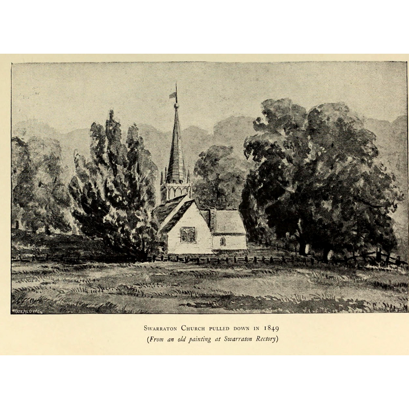
Image copyright © [in the public domain]
PD
Results: 1 records
view of church exterior in context - east view
Scene Description: the 13thC (?) church was demolished in 1849 and never re-built
Copyright Statement: Image copyright © [in the public domain]
Image Source: digital image of an illustration from Herbert Arthur Doubleday's "A history of Hampshire and the Isle of Wight" (1900) [www.flickr.com/photos/internetarchivebookimages/14772689982/] [accessed 14 August 2018]
Copyright Instructions: PD
INFORMATION
Font ID: 17480SWA
Object Type: Baptismal Font1?
Font Century and Period/Style: 13th century (late?), Medieval
Church / Chapel Name: Parish Church [demolished in 1849]
Font Location in Church: [cf. FontNotes]
Church Notes: medieval church demolished 1849
Site Location: Hampshire, South East, England, United Kingdom
Directions to Site: Located off the B3046, 5 km E of Alresford, 15 km NE of Winchester
Ecclesiastic Region: [Diocese of Winchester]
Historical Region: Hundred of Bountisborough
Additional Comments: disappeared font? (the one from the late-13thC (?) church here)
Font Notes:
Click to view
No individual entry for Swarraton found in the Domesday survey. The entry for this parish in the Victoria County History (vol. 4, 1911) notes: "Swarraton is not mentioned in Domesday Book by name [...] There is no mention of a church in Swarraton until the end of the 13th century [...] the old church. [...] The church is in Northington parish, there having been no church in Swarraton since the old one was pulled down in 1849." [NB: we have no information on the font from the disappeared medieval church at Swarraton]
COORDINATES
UTM: 30U 626739 5665776
REFERENCES
- Victoria County History [online], University of London, 1993-. URL: https://www.british-history.ac.uk.