Itchen Abbas / Icene / Ichene / Ichin Abbas / Ichyn
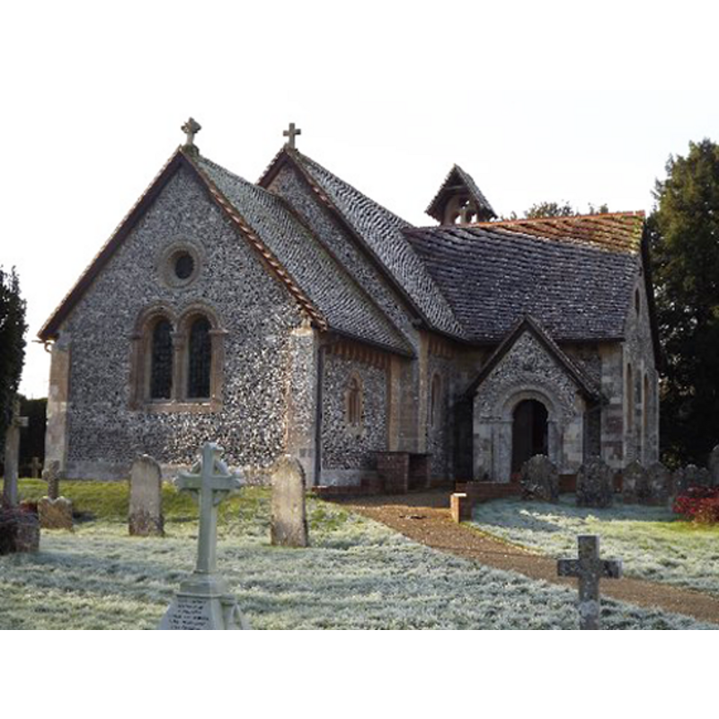
Image copyright © Colin Smith, 2012
Image and permission received (email of 23 January 2012)
Results: 3 records
view of church exterior - northeast view
Copyright Statement: Image copyright © Colin Smith, 2012
Image Source: digital photograph taken 13 January 2012 by Colin Smith
Copyright Instructions: Image and permission received (email of 23 January 2012)
view of font and cover in context
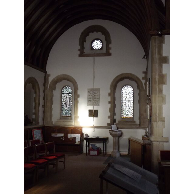
Copyright Statement: Image copyright © Colin Smith, 2012
Image Source: digital photograph taken 13 January 2012 by Colin Smith
Copyright Instructions: Image and permission received (email of 23 January 2012)
view of font and cover
![the 19th-century font in use [cf. FontNotes]](/static-50478a99ec6f36a15d6234548c59f63da52304e5/compressed/1120201020_compressed.png)
Scene Description: the 19th-century font in use [cf. FontNotes]
Copyright Statement: Image copyright © Colin Smith, 2012
Image Source: digital photograph taken 13 January 2012 by Colin Smith
Copyright Instructions: Image and permission received (email of 23 January 2012)
INFORMATION
Font ID: 17478ITC
Object Type: Baptismal Font1?
Font Date: ca. 1110-1120?
Font Century and Period/Style: 12th century (early?), Norman
Church / Chapel Name: Parish Church of St. John the Baptist
Font Location in Church: [cf. FontNotes]
Church Patron Saint(s): St. John the Baptist
Church Address: Itchen Abbas, Winchester SO21 1BJ , UK -- Tel.: 01962 779845
Site Location: Hampshire, South East, England, United Kingdom
Directions to Site: Located off (S) the B3047, 6 km W of Alresford, 7 km N of Winchester
Ecclesiastic Region: Diocese of Winchester
Historical Region: Hundred of Bountisborough
Additional Comments: disappeared font? (the one from the ca. 1110-1120 church here)
Font Notes:
Click to view
There is an entry for Itchen [Abbas] [variant spelling] in the Domesday survey [http://opendomesday.org/place/SU5332/itchen-abbas/] [accessed 13 August 2018] but it mentions neither cleric nor church in it. The Victoria County History (Hampshire, vol. 4, 1911) notes: "The earliest known mention of the church of Itchen Abbas occurs in 1280 [...] The north-east doorway is of very similar detail to the chancel arch but retains very little old stonework: it is evident that the church of which they formed part was built early in the 12th century, probably between 1110 and 1120. [...] The font is of a poor design with a shallow bowl on a tall stem, of early 19th-century date, and in the churchyard is a disused modern Norman font. [...] The whole church was rebuilt in 1867 in 12th-century style in flint and Bath stone, the old chancel arch being re-used and some stones of the north doorway." The entry for this church in Historic England [Listing NGR: SP4850432255] reports: "N[orth] transept has early C19 font with shallow octagonal bowl on arcaded shaft." [NB: we have no information on the whereabouts of the medieval font of the original church].
Credit and Acknowledgements: We are grateful to Colin Smith for his photographs of church and modern font
COORDINATES
UTM: 30U 623383 5661466
Latitude & Longitude (Decimal): 51.091402, -1.238126
Latitude & Longitude (DMS): 51° 5′ 29.05″ N, 1° 14′ 17.26″ W
REFERENCES
- Victoria County History [online], University of London, 1993-. URL: https://www.british-history.ac.uk.