Up Nately / Estropnateley / Natale / Natteleges Estrope / Opnatelegh / Up Natele / Up Nateley / Upnatelegheseththrop
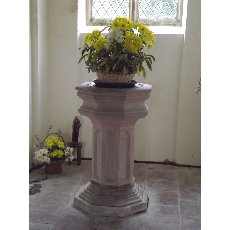
Image copyright © Colin Smith, 2012
Image and permission received (email of 14 May 2012)
Results: 5 records
view of font
Scene Description: the modern font [cf. FontNotes]
Copyright Statement: Image copyright © Colin Smith, 2012
Image Source: digital photograph taken 30 April 2012 by Colin Smith
Copyright Instructions: Image and permission received (email of 14 May 2012)
view of church exterior - southwest view
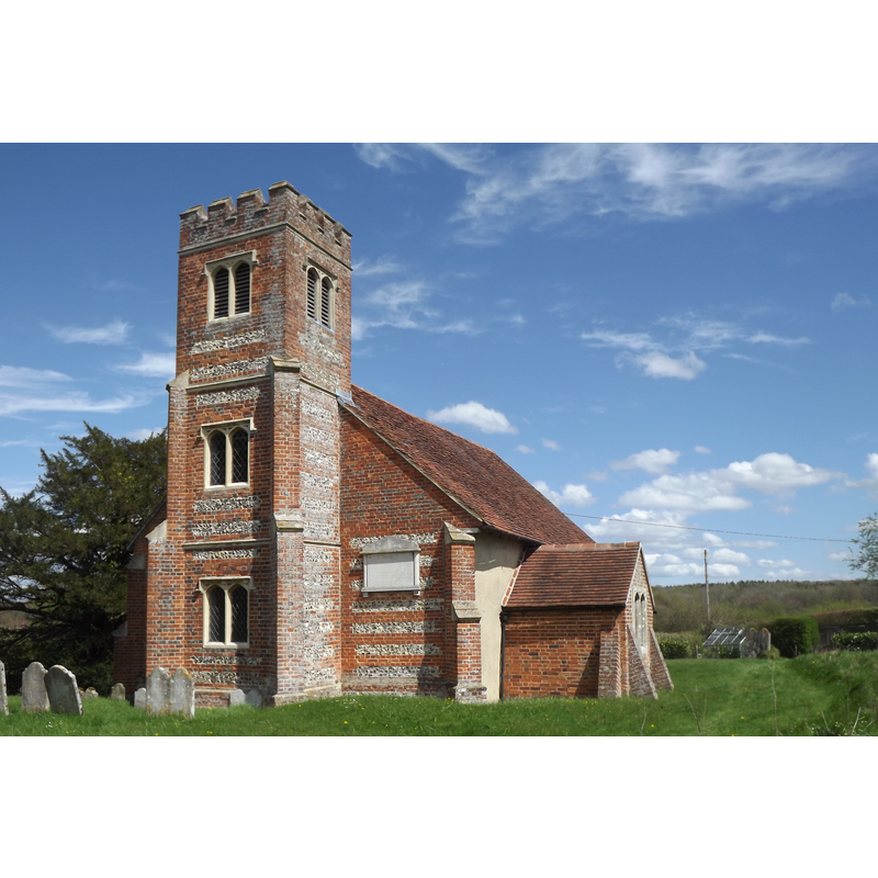
Copyright Statement: Image copyright © Colin Smith, 2012
Image Source: digital photograph taken 30 April 2012 by Colin Smith
Copyright Instructions: Image and permission received (email of 14 May 2012)
view of church exterior - north view
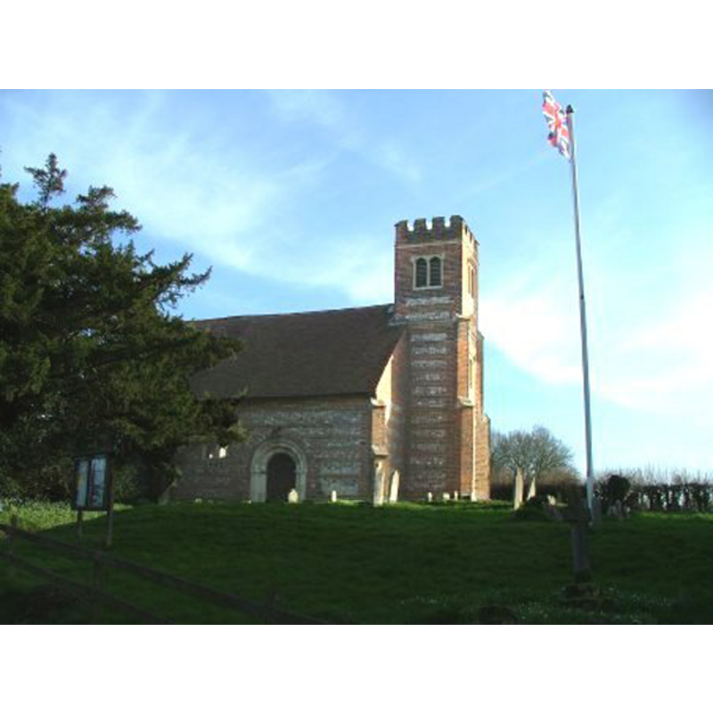
Copyright Statement: Image copyright © Chris Hailey, 2011
Image Source: digital photograph taken by Chris Hayley of Southern Life [www.southernlife.org.uk]
Copyright Instructions: Standing permission
view of font in context
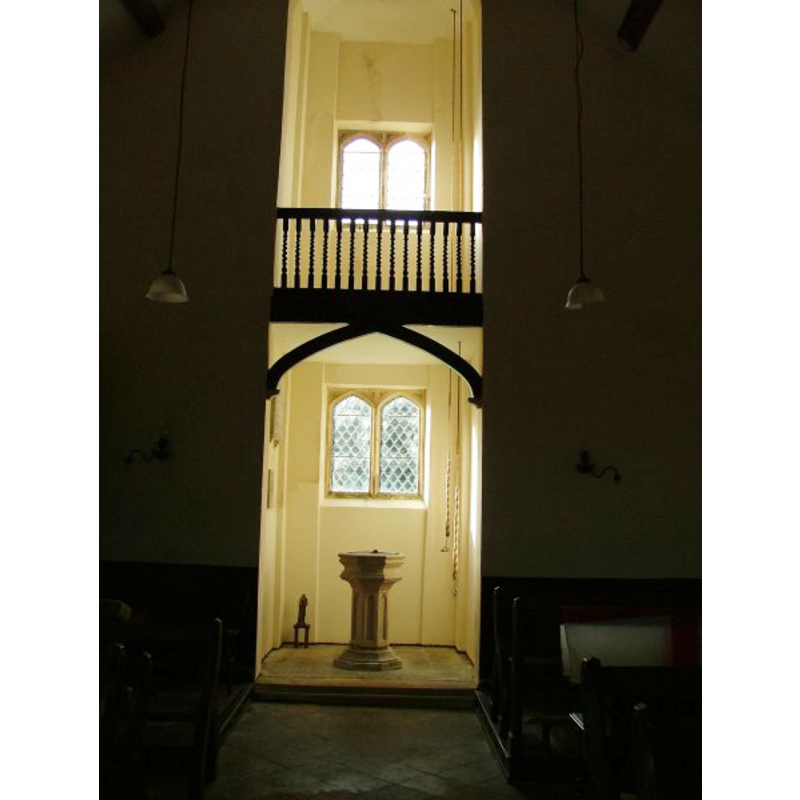
Scene Description: the modern font in the west tower space, at the west end of the nave
Copyright Statement: Image copyright © Chris Hailey, 2011
Image Source: digital photograph taken by Chris Hayley of Southern Life [www.southernlife.org.uk]
Copyright Instructions: Standing permission
view of church interior - nave - looking east
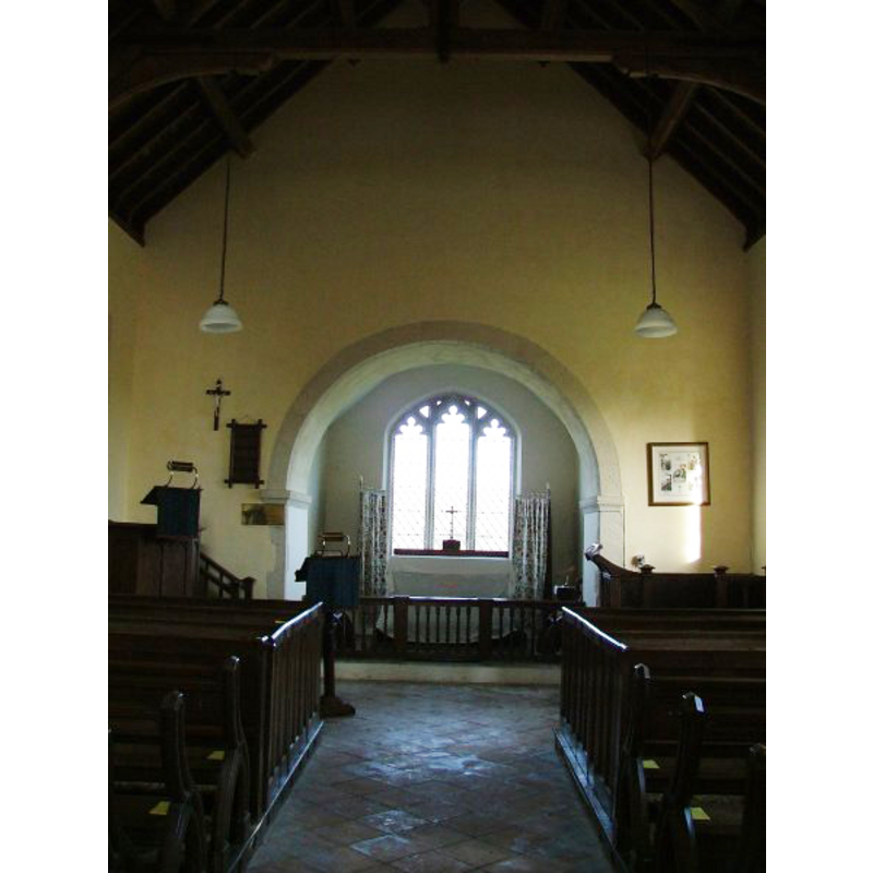
Copyright Statement: Image copyright © Chris Hailey, 2011
Image Source: digital photograph taken by Chris Hayley of Southern Life [www.southernlife.org.uk]
Copyright Instructions: Standing permission
INFORMATION
Font ID: 17469UPN
Object Type: Baptismal Font1?
Font Century and Period/Style: 12th century (late?), Late Norman? / Transitional?
Church / Chapel Name: Parish Church of St. Stephen
Font Location in Church: [cf. FontNotes]
Church Patron Saint(s): St. Stephen
Church Address: Greywell Road, Up Nately, Hampshire, RG27 9PR, United Kingdom -- Tel.: +44 1256 765547
Site Location: Hampshire, South East, England, United Kingdom
Directions to Site: Located off (S) the M3, 6-7 km E of Basingstoke
Ecclesiastic Region: Diocese of Winchester
Historical Region: Hundred of Basingstoke
Additional Comments: disappeared font? (the medieval one from St Stephen's; perhaps another such from the Priory Church?)
Font Notes:
Click to view
No entry found for Up Nately/Nateley in the Domesday survey. The Victoria County History (Hampshire, vol. 4, 1911) notes: "The walls of the nave belong to the original late 12th-century building, but they have been entirely refaced, and later windows have been inserted. The chancel, tower and vestry were built in 1844." There is no mention of a font in the VCH entry. The present font is modern, probably Victorian, and consists of a moulded octagonal basin raised on a pedestal base of the same shape with trefoiled niches in the sides, and a lower base of the same shape as the rest, decorated with a graded moulding. [NB: we have no information on the medieval font]. The VCH (ibid.) informs on the Priory Church and farm at Andwell [St. Mary of Andwell]: "The principal remains are those of the church and of a part of the western range, but the approximate position of the other claustral buildings and the site and extent of the cloisters themselves may be deduced with some certainty. [...] Of the chancel only the lower parts of the north and east walls remain now about 6 ft. in height, and probably partly rebuilt at that, for no traces of windows are left. The church is now used as a barn." The VCH gives the dedication as 1220 A.D. [NB: we have no information on whether this priory church had a baptismal font in it].
Credit and Acknowledgements: We are grateful to Chris Hayley, of Southern Life [www.southernlife.org.uk], and to Colin Smith for their photographs of church and modern font
COORDINATES
UTM: 30U 639749 5680911
Latitude & Longitude (Decimal): 51.2624, -0.997
Latitude & Longitude (DMS): 51° 15′ 44.64″ N, 0° 59′ 49.2″ W
REFERENCES
- Victoria County History [online], University of London, 1993-. URL: https://www.british-history.ac.uk.