Steventon nr. Basingstoke / Stephyngton / Stivelton / Stiventon / Stiveton / Stivetune [Domesday] / Stivington / Stivintona / Stubyngton (Hants.)
![Main image for Steventon nr. Basingstoke / Stephyngton / Stivelton / Stiventon / Stiveton / Stivetune [Domesday] / Stivington / Stivintona / Stubyngton (Hants.)](/static-50478a99ec6f36a15d6234548c59f63da52304e5/compressed/1110606006_compressed.png)
Image copyright © Allan Soedring, 2015
Standing permission
Results: 6 records
view of church exterior - southeast view
Copyright Statement: Image copyright © Allan Soedring, 2015
Image Source: digital photograph [ca. 2001?] taken by Allan Soedring [www.astoft.co.uk/steventondetail.htm] [accessed 1 June 2015]
Copyright Instructions: Standing permission
view of object
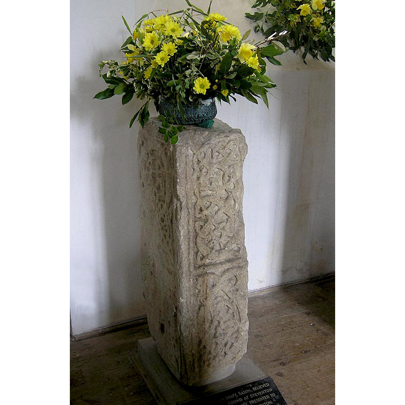
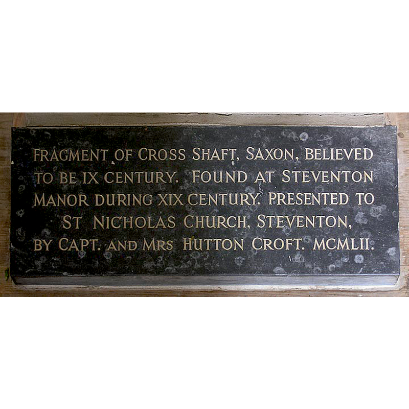
Scene Description: a fragment of the shaft of a 9thC (?) Saxon cross
Copyright Statement: Image copyright © Allan Soedring, 2015
Image Source: digital photograph [ca. 2001?] taken by Allan Soedring [www.astoft.co.uk/steventondetail.htm] [accessed 1 June 2015]
Copyright Instructions: Standing permission
view of font and cover
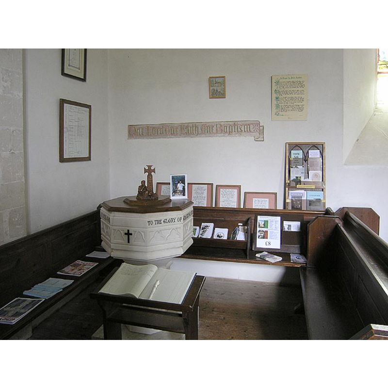
Scene Description: the modern font and its cover
Copyright Statement: Image copyright © Allan Soedring, 2015
Image Source: digital photograph [ca. 2001?] taken by Allan Soedring [www.astoft.co.uk/steventondetail.htm] [accessed 1 June 2015]
Copyright Instructions: Standing permission
view of church interior - nave - looking west
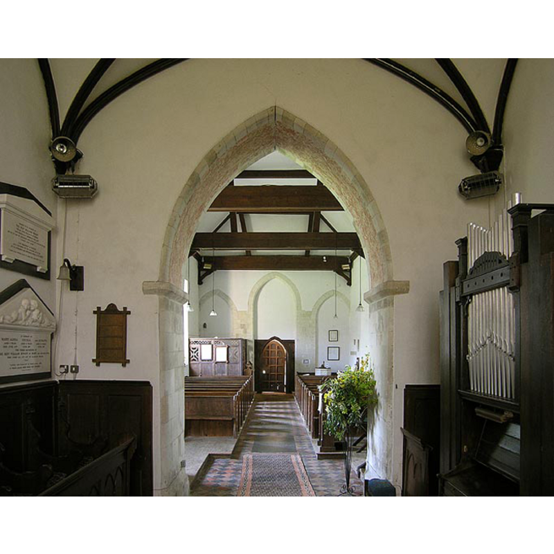
Scene Description: at the back (west) the entranceway; to the right of it, in the bank of pews, the top of the font and its cover can be discerned
Copyright Statement: Image copyright © Allan Soedring, 2015
Image Source: digital photograph [ca. 2001?] taken by Allan Soedring [www.astoft.co.uk/steventondetail.htm] [accessed 1 June 2015]
Copyright Instructions: Standing permission
information
Copyright Statement: Image copyright © Allan Soedring, 2015
Image Source: digital photograph [ca. 2001?] taken by Allan Soedring [www.astoft.co.uk/steventondetail.htm] [accessed 1 June 2015]
Copyright Instructions: Standing permission
view of font cover
![[cf. FontNotes]](/static-50478a99ec6f36a15d6234548c59f63da52304e5/compressed/1110606009_compressed.png)
Scene Description: [cf. FontNotes]
Copyright Statement: Image copyright © Allan Soedring, 2015
Image Source: digital photograph [ca. 2001?] taken by Allan Soedring [www.astoft.co.uk/steventondetail.htm] [accessed 1 June 2015]
Copyright Instructions: Standing permission
INFORMATION
Font ID: 17467STE
Object Type: Baptismal Font1?
Font Date: ca. 1200?
Font Century and Period/Style: 12th - 13th century, Transitional / Early English
Church / Chapel Name: Parish Church of St. Nicholas
Font Location in Church: [cf. FontNotes]
Church Patron Saint(s): St. Nicholas of Myra
Church Notes: the church has a fragment of pre-Conquest cross said to be 9thC; was there a church here that early?
Church Address: Steventon, Hampshire, RG25 3BE, UK
Site Location: Hampshire, South East, England, United Kingdom
Directions to Site: Located off (S) the B3400 [aka Andover Rd], N of the M3, 12 km WSW of Basingstoke, between Overton, Oakley and North Waltham
Ecclesiastic Region: Diocese of Winchester
Historical Region: Hundred of Basingstoke
Additional Comments: famous people font (disappeared?): Jane Austen and her sisters were born here and would have been baptised in the disappeared font of this church
Font Notes:
Click to view
There is an entry for this Steventon [varian spelling] in the Domesday survey [http://opendomesday.org/place/SU5448/steventon/] [accessed 1 June 2015], but it mentions neither cleric nor church in it. The Victoria County History (Hampshire, vol. 4, 1911) notes: "The church has been little altered since its first building, c. 1200, and is a very interesting building, the stone being of excellent quality, and chiefly from Binstead in the Isle of Wight. [...] The font is a white marble one of 1868 and the other furniture is also modern." This modern font is located in the northwest corner of the nave. ASTOFT [www.astoft.co.uk/steventondetail.htm] notes: "The font has an oak cover which was a Millenium project funded by Wisconsin members of the Jane Austen Society of North America (JASNA). It was carved by Jim Smyth, a local Hampshire craftsman."
Credit and Acknowledgements: We are grateful to Allan Soedring, of www.astoft.co.uk, for his photographs of this church and font
COORDINATES
UTM: 30U 624863 5675968
Latitude & Longitude (Decimal): 51.221432, -1.211968
Latitude & Longitude (DMS): 51° 13′ 17.15″ N, 1° 12′ 43.09″ W
REFERENCES
- Victoria County History [online], University of London, 1993-. URL: https://www.british-history.ac.uk.