Mapledurwell / Mapedrewell / Mapeldereworth / Mapeldorwelle / Mapeldurewelle / Mapelth / Maperderewell / Mapeth / Maplederwell / Mapledrewelle / Mapuldurwell
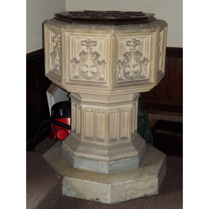
Image copyright © Colin Smith, 2012
Image and permission received (email of 14 May 2012)
Results: 3 records
view of font and cover
Scene Description: the modern font [cf. FontNotes]
Copyright Statement: Image copyright © Colin Smith, 2012
Image Source: digital photograph taken 30 April 2012 by Colin Smith
Copyright Instructions: Image and permission received (email of 14 May 2012)
view of church exterior - southeast view
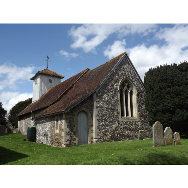
Copyright Statement: Image copyright © Colin Smith, 2012
Image Source: digital photograph taken 30 April 2012 by Colin Smith
Copyright Instructions: Image and permission received (email of 14 May 2012)
view of church interior - nave - looking east

Copyright Statement: Image copyright © Colin Smith, 2012
Image Source: digital photograph taken 30 April 2012 by Colin Smith
Copyright Instructions: Image and permission received (email of 14 May 2012)
INFORMATION
Font ID: 17465MAP
Object Type: Baptismal Font1?
Font Century and Period/Style: 12th - 13th century, Medieval
Church / Chapel Name: Parish Church of St. Mary the Virgin
Font Location in Church: [cf. FontNotes]
Church Patron Saint(s): St. Mary the Virgin
Church Address: Church Ln, Mapledurwell, Hampshire, RG25 2LH, United Kingdom -- Tel.: +44 1256 765547
Site Location: Hampshire, South East, England, United Kingdom
Directions to Site: Located off (S) the M3, 5 km ESE of Basingstoke
Ecclesiastic Region: Diocese of Winchester
Historical Region: Hundred of Basingstoke
Additional Comments: disappeared font? (the medieval one)
Font Notes:
Click to view
There is an entry for Mapledurwell [variant spelling] in the Domesday survey [http://opendomesday.org/place/SU6851/mapledurwell/] [accessed 8 August 2018] but it mentions neither cleric nor church in it. The Victoria County History (Hampshire, vol. 4, 1911) notes: "early in the 12th century—there was no chapel in Maplederwell, but one had been built before the end of the 13th century. [...] The nave [of the present church] dates from the end of the 12th or beginning of the 13th century [...] The altar pulpit, font, &c., are all modern." [NB: we have no information on its medieval font]
COORDINATES
UTM: 30U 638401 5679920
Latitude & Longitude (Decimal): 51.253822, -1.016694
Latitude & Longitude (DMS): 51° 15′ 13.76″ N, 1° 1′ 0.1″ W
REFERENCES
- Victoria County History [online], University of London, 1993-. URL: https://www.british-history.ac.uk.