Eastrop / Esthrop / Estrip / Estrop Brayboef / Estropa / Estrope / Estroppe / Esttroup
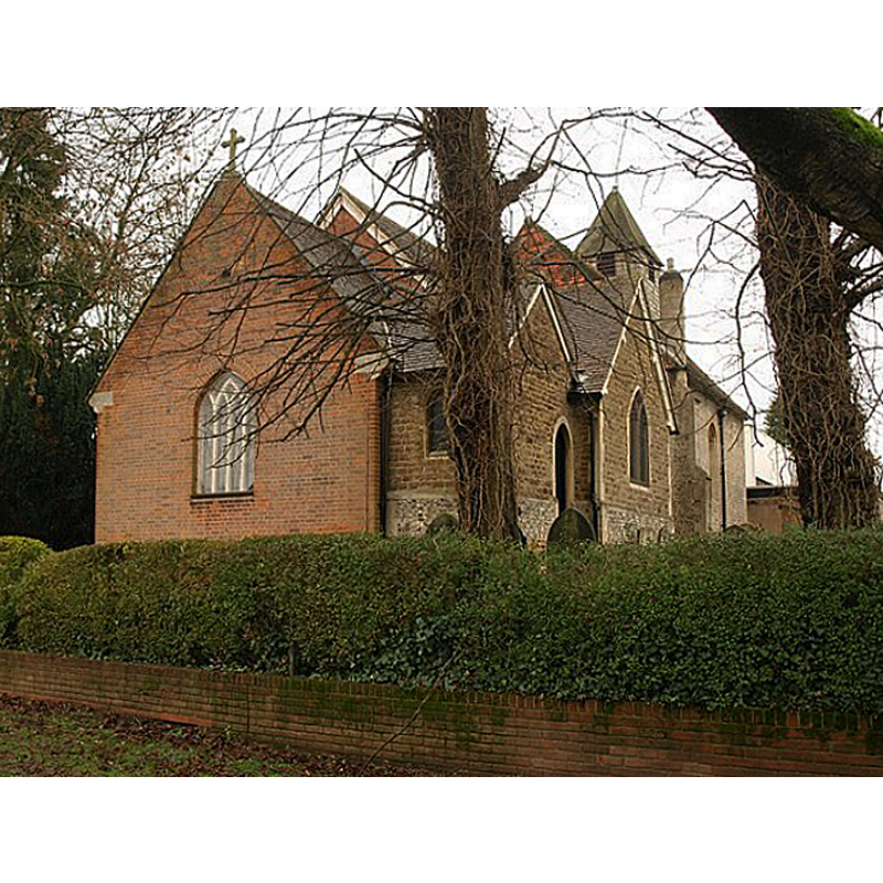
Image copyright © Derek Harper, 2011
CC-BY-SA-2.0
Results: 2 records
view of church exterior - northeast view
Copyright Statement: Image copyright © Derek Harper, 2011
Image Source: digital photograph taken 14 January 2011 by Derek Harper [www.geograph.org.uk/photo/2278852] [accessed 8 August 2018]
Copyright Instructions: CC-BY-SA-2.0
view of church exterior - southeast view
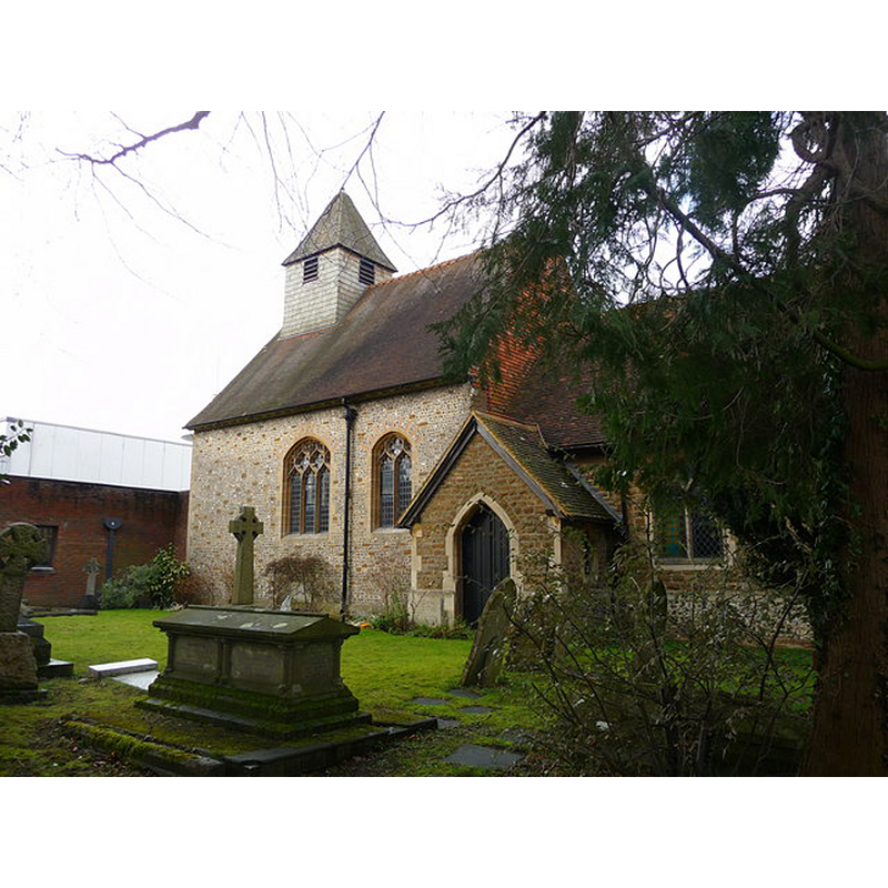
Copyright Statement: Image copyright © Chris Talbot, 2010
Image Source: digital photograph taken 27 February 2010 by Chris Talbot [www.geograph.org.uk/photo/1855845] [accessed 8 August 2018]
Copyright Instructions: CC-BY-SA-2.0
INFORMATION
Font ID: 17464EST
Object Type: Baptismal Font1?
Font Century and Period/Style: Medieval
Church / Chapel Name: Parish Church of St. Mary the Virgin
Font Location in Church: [cf. FontNotes]
Church Patron Saint(s): St. Mary the Virgin
Church Address: Goat Ln, Eastrop, Basingstoke RG21 7PZ, UK -- Tel.: +44 1256 464249
Site Location: Hampshire, South East, England, United Kingdom
Directions to Site: Located off (S) the A3010 (Churchill Way East), W of the A339, in the E outskirts of Basingstoke
Ecclesiastic Region: Diocese of Winchester
Historical Region: Hundred of Basingstoke
Additional Comments: disappeared font? (possibly the one from the medieval chapel here?)
Font Notes:
Click to view
There is an entry for Eastrop [variant spelling] in the Domesday survey [http://opendomesday.org/place/SU6452/eastrop/] [accessed 8 August 2018] but it mentions neither cleric nor church in it. The Victoria County History (Hampshire, vol. 4, 1911) refers to documentary evidence of the church here in the 14th century ["a dispute between the Prior of Selborne and the rector of the church concerning the tithes"], but the present church is a small modern edifice but "Beyond two 17th-century gravestones and a later one there is nothing of any age in the building". [NB: not clear whether the medieval church/chapel had baptismal rights and a font].
COORDINATES
Latitude & Longitude (Decimal): 51.265239, 1.082008
REFERENCES
- Victoria County History [online], University of London, 1993-. URL: https://www.british-history.ac.uk.