Rotherwick / Retherwic / Retherwyke / Rotherweek / Rotherwicke / Rotherwyke / Rutherwyk / Rytherwyke
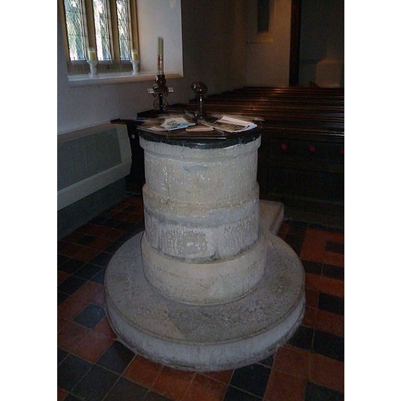
Image copyright © Basher Eyre, 2012
CC-BY-SA-2.0
Results: 4 records
view of font and cover
Copyright Statement: Image copyright © Basher Eyre, 2012
Image Source: digital photograph taken 2 November 2012 by Basher Eyre [www.geograph.org.uk/photo/3242307] [accessed 2 August 2018]
Copyright Instructions: CC-BY-SA-2.0
view of church exterior - north view
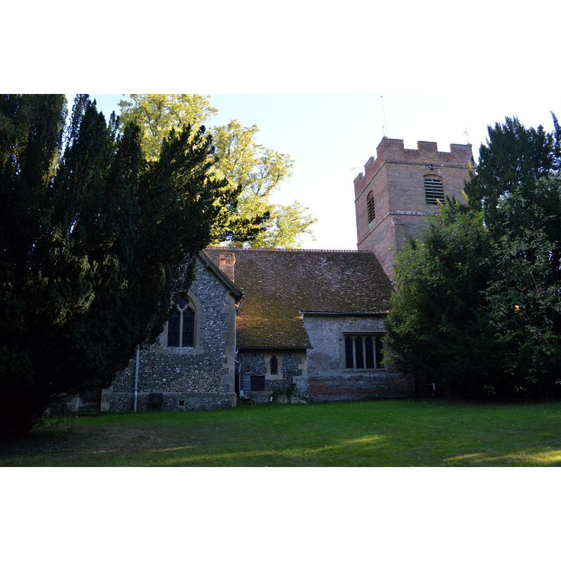
Copyright Statement: Image copyright © Lewis Hulbert, 2013
Image Source: digital photograph taken 4 September 2013 by Lewis Hulbert [https://commons.wikimedia.org/wiki/File:Rotherwick_Church_from_behind.JPG] [accessed 2 August 2018]
Copyright Instructions: CC-BY-SA-2.0
view of church exterior - southeast view
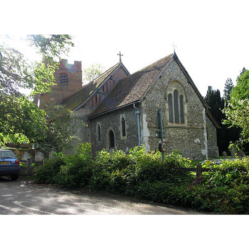
Copyright Statement: Image copyright © John Salmon, 2011
Image Source: digital photograph taken 21 May 2005 by John Salmon [www.geograph.org.uk/photo/343917] [accessed 2 August 2018]`
Copyright Instructions: CC-BY-SA-2.0
view of church interior - nave - looking east
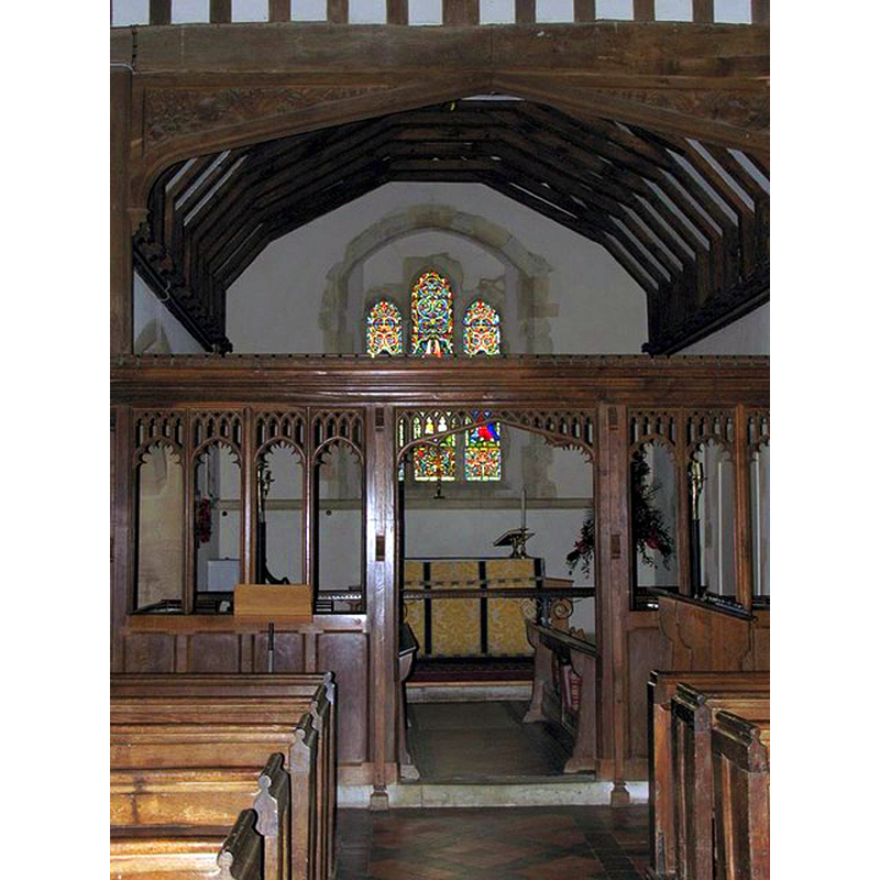
Copyright Statement: Image copyright © John Salmon, 2011
Image Source: digital photograph taken 21 May 2005 by John Salmon [www.geograph.org.uk/photo/343919] [accessed 2 August 2018]
Copyright Instructions: CC-BY-SA-2.0
INFORMATION
Font ID: 17457ROT
Object Type: Baptismal Font1
Font Century and Period/Style: 12th - 13th century [basin only], Medieval
Church / Chapel Name: Parish Church
Font Location in Church: Inside the church, at the W end of the nave, by the S doorway
Church Address: 86 The St, Rotherwick, Hook RG27 9BG, UK -- Tel.: +44 1256 760169
Site Location: Hampshire, South East, England, United Kingdom
Directions to Site: Located off (E) the A33, 2-3 km NNW of Hook, 5-6 km NW of Odiham, 12 ENE of Basingstoke
Ecclesiastic Region: Diocese of Winchester
Historical Region: Hundred of Odiham
Additional Comments: altered font (the base of the present font is a modern replacement)
Font Notes:
Click to view
No entry found for Rotherwick in the Domesday survey. The Victoria County History (Hampshire, vol. 4, 1911) notes: "Rotherwick was a chapelry dependent on Odiham until 1867 [...] The oldest part of the building is the chancel, which [...] dates from the latter part of the 13th century [...] The font has a plain cylindrical bowl on a modern base, and may be as early as the 12th century; it stands close to the south door of the nave." The entry for this church in Historic England [Listing NGR: SU7134556292] reports "an old font" in it, without further details.
COORDINATES
UTM: 30U 640787 5685323
Latitude & Longitude (Decimal): 51.30179, -0.9804
Latitude & Longitude (DMS): 51° 18′ 6.44″ N, 0° 58′ 49.44″ W
MEDIUM AND MEASUREMENTS
Material: stone
Font Shape: cylindrical, mounted
Basin Interior Shape: round
Basin Exterior Shape: round
Drainage Notes: lead lined
LID INFORMATION
Date: modern?
Material: wood, oak?
Apparatus: no
Notes: octagonal and flat, with ball finial/handle; appears modern
REFERENCES
- Victoria County History [online], University of London, 1993-. URL: https://www.british-history.ac.uk.