Hartley Wespall / Harlei / Herlei [Domesday] / Hertle / Hertle Waspayl / Hertligh Vespal / Hurtleghe
![Main image for Hartley Wespall / Harlei / Herlei [Domesday] / Hertle / Hertle Waspayl / Hertligh Vespal / Hurtleghe](/static-50478a99ec6f36a15d6234548c59f63da52304e5/compressed/1110605018_compressed.png)
Image copyright © Chris Hailey, 2011
Standing permission
Results: 3 records
view of font and cover
Scene Description: the modern font in 12th-century style
Copyright Statement: Image copyright © Chris Hailey, 2011
Image Source: digital photograph taken by Chris Hayley, of Southern Life [www.southernlife.org.uk]
Copyright Instructions: Standing permission
view of church exterior
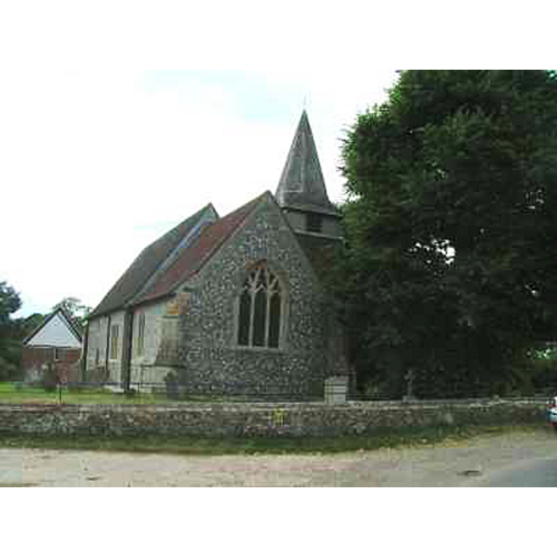
Copyright Statement: Image copyright © Chris Hailey, 2011
Image Source: digital photograph taken by Chris Hayley, of Southern Life [www.southernlife.org.uk]
Copyright Instructions: Standing permission
view of church interior - west end
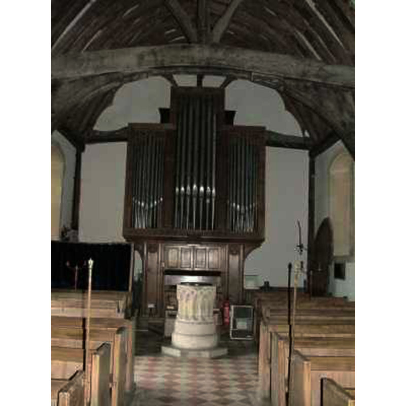
Scene Description: the modern font in front of the organ
Copyright Statement: Image copyright © Chris Hailey, 2011
Image Source: digital photograph taken by Chris Hayley, of Southern Life [www.southernlife.org.uk]
Copyright Instructions: Standing permission
INFORMATION
Font ID: 17448HAR
Object Type: Baptismal Font1?
Font Century and Period/Style: 12th century, Late Norman
Church / Chapel Name: Parish Church of St. Mary the Virgin [aka The Blessed Virgin]
Font Location in Church: [cf. FontNotes]
Church Patron Saint(s): St. Mary the Virgin
Church Address: Hartley Wespall, Hook RG27 0BB, UK
Site Location: Hampshire, South East, England, United Kingdom
Directions to Site: Located off [S] the A33, 4 km NE of Hook, 10 km NE of Basingstoke
Ecclesiastic Region: Diocese of Winchester
Historical Region: Hundred of Holshot
Additional Comments: disappeared font? (the one from the pre-1193 church here)
Font Notes:
Click to view
There is are two entries for Hartley [Wespall] [variant spellings] in the Domesday survey [http://opendomesday.org/place/SU6958/hartley-wespall/] [accessed 31 July 2018], neither of which mentions priest or church in it. The Victoria County History (Hampshire, vol. 4, 1911) notes: "Externally the building is entirely modern, except the west end of the nave, but its walls inclose the main timbers of the nave of a half-timber church of c. 1330, a very remarkable and interesting survival. [...] The font is modern, in 12th-century style, with an arcade of interlacing arches, placed in the church by Dr. Keate in 1852"; the VCH entry, however, refers to a document that mentions "Alexander, parson of the church of Hartley, dated Christmas 1193", which support the dating of the medieval church here at least to that date. The entry for this church in Historic England [Listing NGR: SU7002957698] mentions no font in it.
Credit and Acknowledgements: We are grateful to Chris Hayley, of Southern Life [www.southernlife.org.uk] for his photographs of church and font
COORDINATES
UTM: 30U 639380 5687274
Latitude & Longitude (Decimal): 51.31967, -0.9998
Latitude & Longitude (DMS): 51° 19′ 10.81″ N, 0° 59′ 59.28″ W
REFERENCES
- Victoria County History [online], University of London, 1993-. URL: https://www.british-history.ac.uk.