Farnborough nr. Aldershot / Fameborough / Farenberg / Farnborowe / Farnburghe / Ferneberga / Fremborough
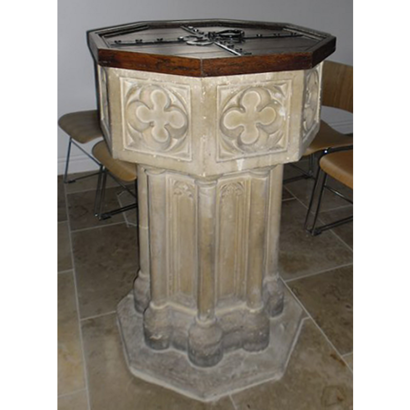
Image copyright © Basher Eyre, 2012
CC-BY-SA-2.0
Results: 3 records
view of font and cover
Scene Description: the modern font of mixed 13th (base) and 15th century (basin) design
Copyright Statement: Image copyright © Basher Eyre, 2012
Image Source: digital photograph taken 4 May 2012 by Basher Eyre [www.geograph.org.uk/photo/2931407] [accessed 7 January 2015]
Copyright Instructions: CC-BY-SA-2.0
view of church exterior - northwest view
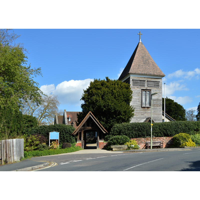
Copyright Statement: Image copyright © Lewis Hulbert, 2014
Image Source: digital photograph taken 14 April 2014 by Lewis Hulbert [http://commons.wikimedia.org/wiki/File:St_Peter's_Church,_Farnborough_from_the_road.JPG] [accessed 7 January 2015]
Copyright Instructions: CC-BY-SA-2.0
view of church interior - nave - looking west
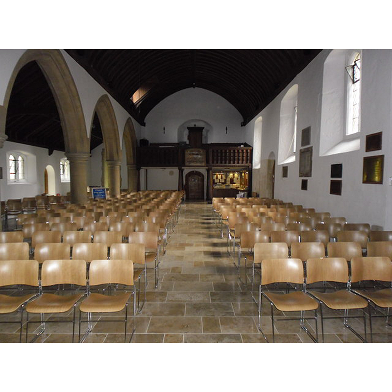
Copyright Statement: Image copyright © Basher Eyre, 2012
Image Source: digital photograph taken 4 May 2012 by Basher Eyre [www.geograph.org.uk/photo/2931370] [accessed 7 January 2015]
Copyright Instructions: CC-BY-SA-2.0
INFORMATION
Font ID: 17446FAR
Object Type: Baptismal Font1
Font Century and Period/Style: 11th century, Pre-Conquest? / Norman?
Church / Chapel Name: Parish Church of St. Peter
Font Location in Church: [cf. FontNotes]
Church Patron Saint(s): [dedication unknown -- St. Peter?]
Church Address: 60 Church Avenue, Farnborough, Hampshire GU14 8BX
Site Location: Hampshire, South East, England, United Kingdom
Directions to Site: Located by the M3 (junction 4), 4 km from Aldershot, 25 km E of Basingstoke
Ecclesiastic Region: Diocese of Guildford
Historical Region: Hundred of Crondall
Additional Comments: disappeared font? (the one from the Domesday-time church here)
Font Notes:
Click to view
There is an entry for Farnborough [variant spelling] in the Domesday survey [http://domesdaymap.co.uk/place/SU8755/farnborough/] [accessed 7 January 2015], in which a church is mentioned. The Victoria County History (Hampshire, vol. 4, 1911) notes: "The earliest parts of the church are the north and west walls of the nave, c. 1190–1200, and a south doorway of the same date is now in the wall of the new south aisle [...] The octagonal font is modern and of 15th-century design with a panelled bowl and shafted octagonal stem." [NB: we have no information on the font of the Domesday-time chuurch here].
COORDINATES
UTM: 30U 656887 5684479
Latitude & Longitude (Decimal): 51.292578, -0.750329
Latitude & Longitude (DMS): 51° 17′ 33.28″ N, 0° 45′ 1.18″ W
REFERENCES
- Victoria County History [online], University of London, 1993-. URL: https://www.british-history.ac.uk.