Freefolk / Freefolk Sifrewast / Freefolke / Frefolk / Frifhoc / Frigefolc / Fryfolk / Fryfolk Syfrewast / South Freefolk / South Fryfolk
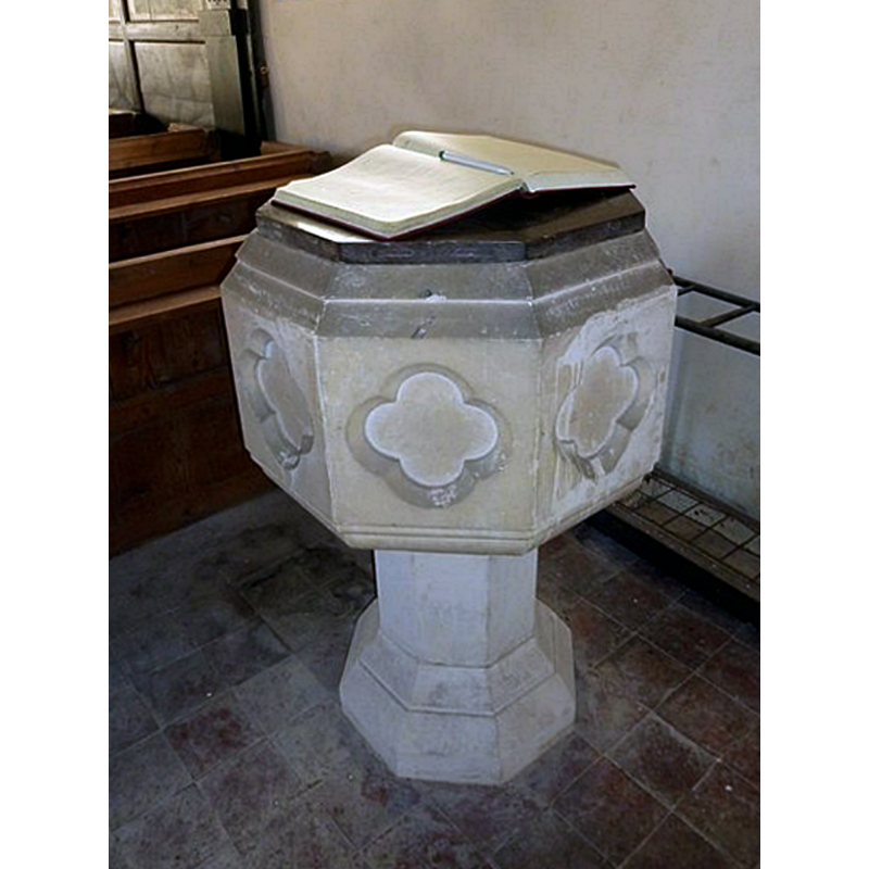
Image copyright © Basher Eyre, 2011
CC-BY-SA-2.0
Results: 4 records
view of font and cover
Scene Description: the font and cover are modern; the church is now redundant
Copyright Statement: Image copyright © Basher Eyre, 2011
Image Source: edited detail of a digital photograph taken 3 December 2011 by Basher Eyre [www.geograph.org.uk/photo/2791373] [accessed 22 August 2018]
Copyright Instructions: CC-BY-SA-2.0
view of church exterior - south view
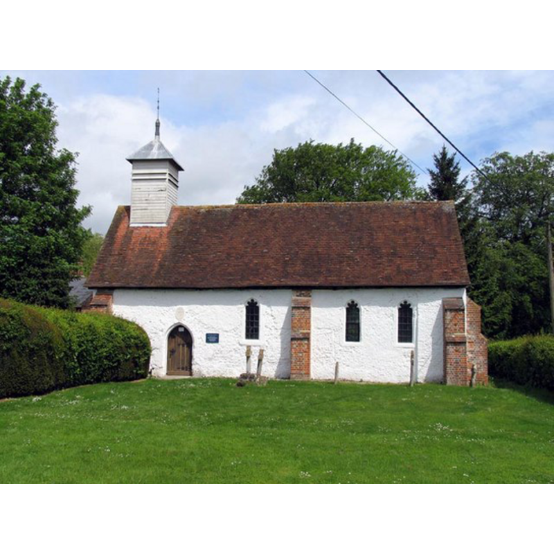
Scene Description: church originally 13thC; interior re-done in early 18thC; it is now redundant
Copyright Statement: Image copyright © John Salmon, 2006
Image Source: digital photograph taken 24 May 2006 by John Salmon [geograph.org.uk-343955.jpg]
Copyright Instructions: CC-BY-SA-2.0
view of church interior - nave - looking west
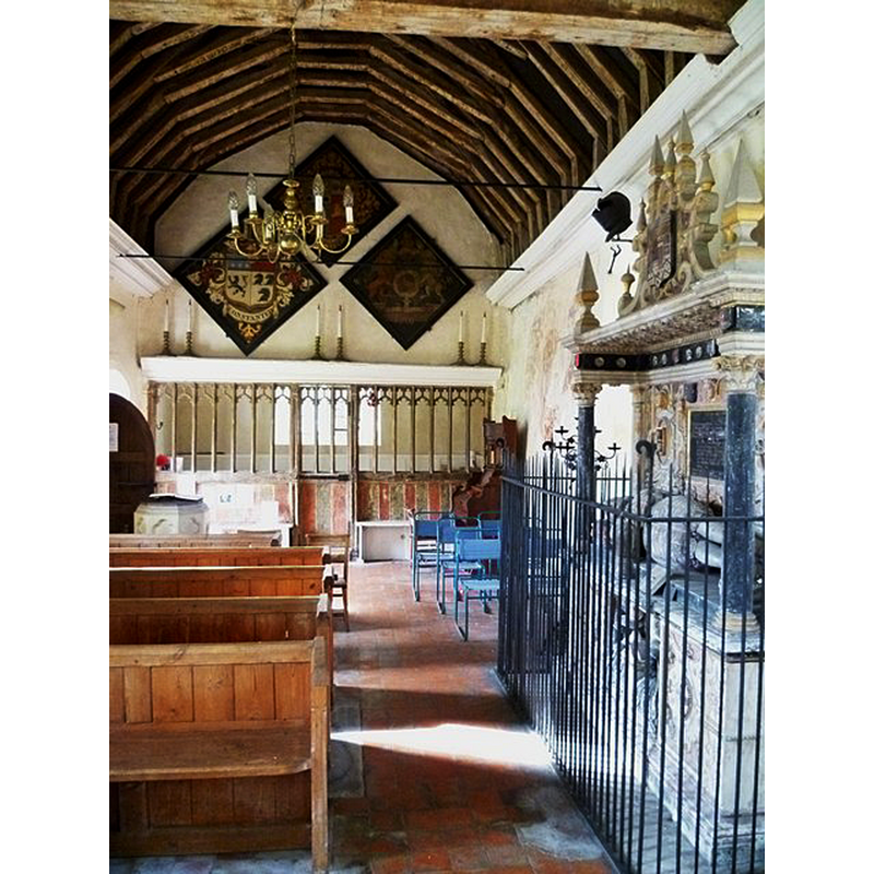
Scene Description: church originally 13thC; interior re-done in early 18thC; it is now redundant -- the modern font is partially visible at the back, left side, by the south entranceway
Copyright Statement: Image copyright © Shazz, 2011
Image Source: digital photograph taken 9 October 2011 by Shazz [www.geograph.org.uk/photo/2643706] [accessed 22 August 2018]
Copyright Instructions: CC-BY-SA-2.0
view of church interior - nave - looking east
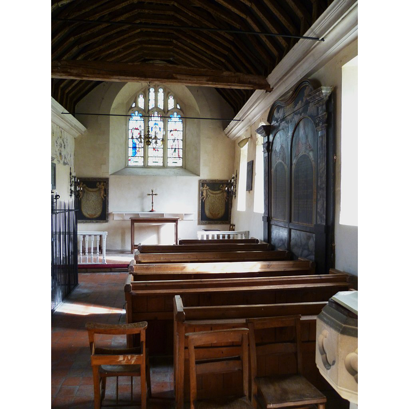
Scene Description: church originally 13thC; interior re-done in early 18thC; it is now redundant -- a part of the modern font is visible in the foreground, right side
Copyright Statement: Image copyright © Shazz, 2011
Image Source: digital photograph taken 9 October 2011 by Shazz [www.geograph.org.uk/photo/2643704] [accessed 22 August 2018]
Copyright Instructions: CC-BY-SA-2.0
INFORMATION
Font ID: 17444FRE
Object Type: Baptismal Font1
Font Century and Period/Style: 11th century, Pre-Conquest? / Norman
Church / Chapel Name: Church / Chapel of St. Nicholas
Font Location in Church: [cf. FontNotes]
Church Patron Saint(s): St. Nicholas of Myra
Church Notes: redundant church since 1974; in the care of the Churches Conservation Trust since 1976; a new church was built nearby
Church Address: Freefolk, Whitchurch, Laverstone RG28 7NW, United Kingdom
Site Location: Hampshire, South East, England, United Kingdom
Directions to Site: Located off (S) the B3400, near Laverstoke, 2 km W of Overton, 2-3 km E of Whitchurch
Ecclesiastic Region: Diocese of Winchester
Historical Region: Hundred of Evingar
Additional Comments: disappeared font? (the font from the Domesday-time church here)
Font Notes:
Click to view
There is an entry for Freefolk [variant spelling] in the Domesday survey [http://opendomesday.org/place/SU4848/freefolk/] [accessed 22 August 2018]; it reports "1 church. 1.0 church lands" in it. The Victoria County History (Hampshire, vol. 4, 1911) notes: "It appears by a bull of Pope Clement III, dated 1187, that he confirmed the church of Whitchurch with the chapel of Freefolk to the master and brethren of the Hospital of St. John of Jerusalem as guardians of the Hospital of St. Cross [...] The first church on this site of which there is now evidence seems to have been built in the 13th century, and the walls of the present building may be of this date, but all the details are of the 15th century or later. [...] The old church formerly the free chapel of ST. NICHOLAS is a small rectangular building 36 ft. by 15 ft. 3 in., and is now only occasionally used, as a new and larger parish church has been built on adjoining higher ground." No font is mentioned in the VCH entry. The Churches Conservation Trust [www.visitchurches.org.uk] entry for this church notes: "the Domesday Book mentions a church here, but the walls and roof of the current building are 13th-century and the windows and chancel screen are 15th. The interior was remodelled in 1703 and its character today comes largely from that period." The entry for this church in Historic England [Listing NGR: SU4884848619] reports "a Victorian font" in it. [NB: we have no information on the font from the original medieval church].
COORDINATES
UTM: 30U 618452 5677282
Latitude & Longitude (Decimal): 51.2346, -1.3033
Latitude & Longitude (DMS): 51° 14′ 4.56″ N, 1° 18′ 11.88″ W
REFERENCES
- Victoria County History [online], University of London, 1993-. URL: https://www.british-history.ac.uk.