West Derby nr. Liverpool / Derbei
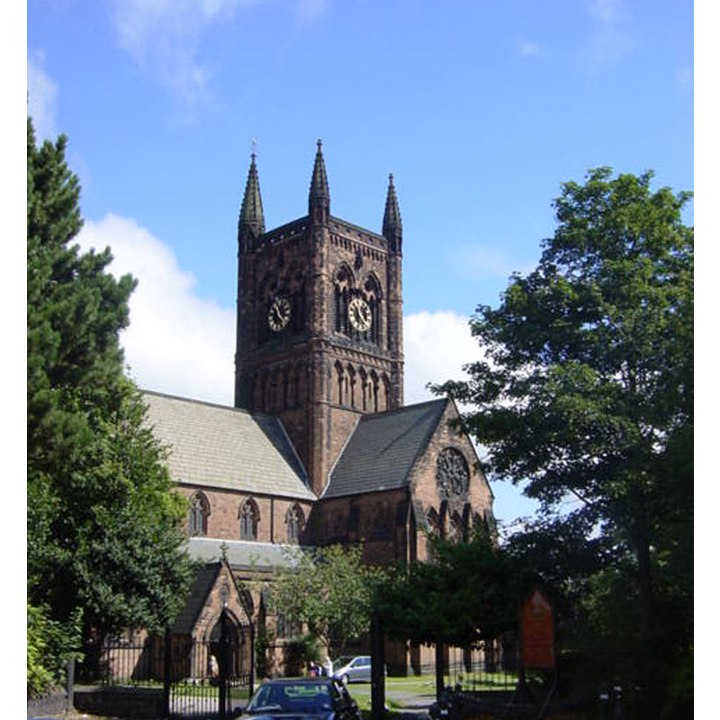
Image copyright © Sue Adair, 2005
CC-BY-SA-2.0
Results: 1 records
view of church exterior
Scene Description: the mid-19thC replacement church [cf. FontNotes]
Copyright Statement: Image copyright © Sue Adair, 2005
Image Source: digital photograph taken 14 August 2005 by Sue Adair [www.geograph.org.uk/photo/37445] [accessed 23 July 2014]
Copyright Instructions: CC-BY-SA-2.0
INFORMATION
Font ID: 17442DER
Object Type: Baptismal Font1?
Font Century and Period/Style: 14th century (mid?), Medieval
Church / Chapel Name: Parish Church of St. James [formerly a medieval chapel]
Font Location in Church: [cf. FontNotes]
Church Address: Mill Lane, Liverpool, Merseyside, L12 7JU
Site Location: Merseyside, North West, England, United Kingdom
Directions to Site: West Derby is now in the N suburbs of Liverpool
Ecclesiastic Region: Diocese of Liverpool
Historical Region: formerly in Lancashire -- Hundred of West Derby
Font Notes:
Click to view
There are twelve entries for West Derby [variant spelling] in the Domesday survey [http://domesdaymap.co.uk/place/SJ3994/west-derby/] [accessed 23 July 2014], but there is no mention of a church or cleric in any of them. The entry for this parish in the Victoria County History (Lancaster, vol. 3, 1907) notes: "The first distinct allusion to the chapel of West Derby occurs in the middle of the fourteenth century [...] The ancient structure [...] was pulled down after the building of the new church, 1853–6", but there is no mentin of a font in it [NB: nor is it clear whether the chapel had baptismal rights originally].
COORDINATES
UTM: 30U 505748 5919832
Latitude & Longitude (Decimal): 53.4275, -2.9135
Latitude & Longitude (DMS): 53° 25′ 39″ N, 2° 54′ 48.6″ W
REFERENCES
- Victoria County History [online], University of London, 1993-. URL: https://www.british-history.ac.uk.