Medmenham / Mebbenham / Medeham / Medemeham / Medinham / Medmenham
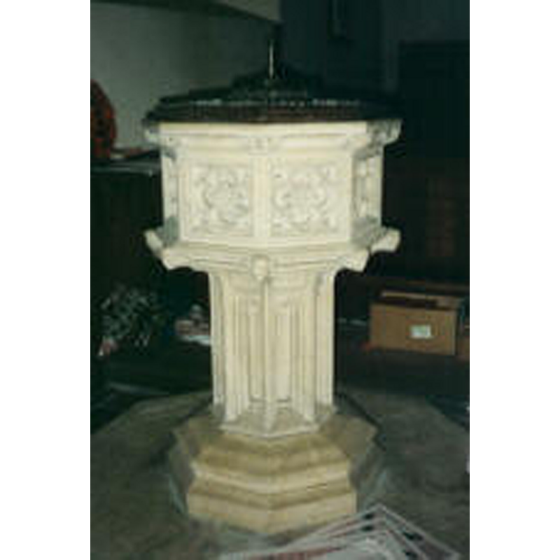
Image copyright © Hambleden Valley Churches, 2011
No known copyright restriction / Fair Dealing
Results: 3 records
view of font and cover
Scene Description: the modern font
Copyright Statement: Image copyright © Hambleden Valley Churches, 2011
Image Source: digital photograph in the Hambleden Valley Churches [www.hambleden-valley-churches.org.uk/MEDpictures.htm]
Copyright Instructions: No known copyright restriction / Fair Dealing
view of church exterior - southeast view
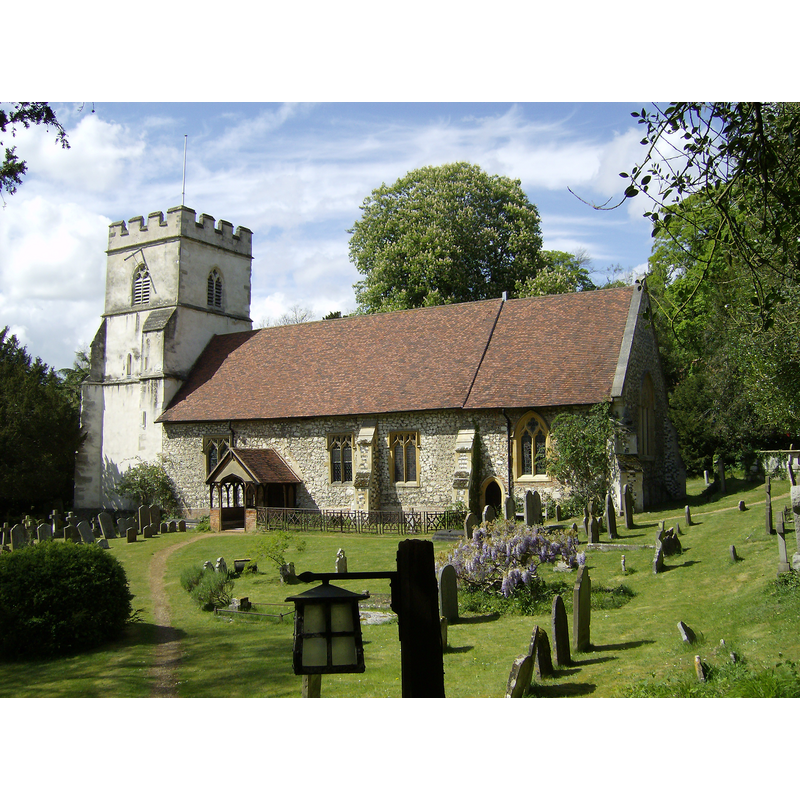
Copyright Statement: Image copyright © [in the public domain]
Image Source: digital photograph taken 6 May 2007 by Sealman [http://en.wikipedia.org/wiki/File:Medmenham_Church.JPG]
Copyright Instructions: Image released by the author into the public domain
view of church interior - looking east
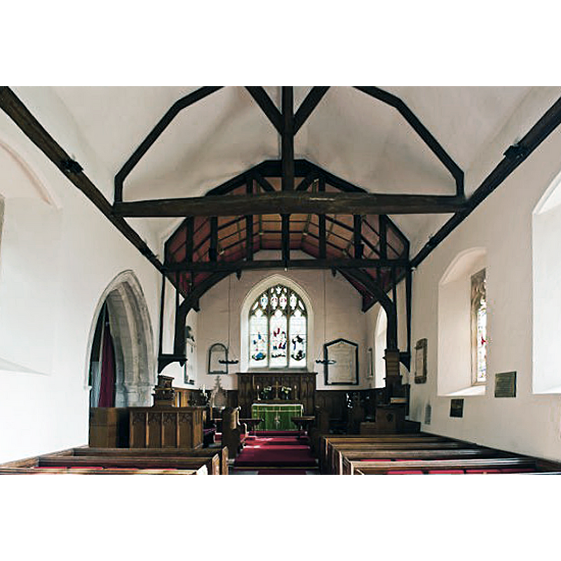
Copyright Statement: Image copyright © David Ross & Britain Express Ltd, 2015
Image Source: digital photograph taken by David Ross, in Britain Express [www.britainexpress.com/attractions.htm?attraction=5056] [accessed 16 October 2015]
Copyright Instructions: Standing permission
INFORMATION
Font ID: 17433MED
Object Type: Baptismal Font1
Font Century and Period/Style: 12th - 13th century, Transitional / Early English
Church / Chapel Name: Parish Church of St. Peter and St. Paul
Font Location in Church: [cf. FontNotes]
Church Patron Saint(s): St. Peter & St. Paul
Church Address: Medmenham, Buckinghamshire SL7 2HF
Site Location: Buckinghamshire, South East, England, United Kingdom
Directions to Site: Located off the A4155, 5 km E of Henley, 6 km SW of Marlow
Ecclesiastic Region: Diocese of Oxford
Historical Region: Hundred of Desborough
Additional Comments: disappeared font? (the medieval one)
Font Notes:
Click to view
There is an entry for Medmenham [variant spelling] in the Domesday survey [http://opendomesday.org/place/SU8084/medmenham/] [accessed 16 October 2015], but it mentions neither cleric nor church in it. Sheahan (1862) notes as Norman the inner doorway of the south porch, and mentions a font: "octagonal and sculptured" in the church. The Victoria County History (Buckingham, vol. 3, 1925) notes: "The building dates from the late 12th or early 13th century [...] To the east of the doorway internally there is a recess for a stoup", but does not mention the stoup or a font in it. The present font is octagonal, the basin with carved panels; it is probably from the Victorian renovation of this church [NB: we have no information on the original font of this church; the building underwent major renovations in 1702 and 1839, according to Sheahan (ibid.)]
COORDINATES
UTM: 30U 649656 5713556
Latitude & Longitude (Decimal): 51.553214, -0.841338
Latitude & Longitude (DMS): 51° 33′ 11.57″ N, 0° 50′ 28.82″ W
REFERENCES
- Victoria County History [online], University of London, 1993-. URL: https://www.british-history.ac.uk.
- Sheahan, James Joseph, History and topography of Buckinghamshire, comprising a general survey of the county, preceded by an epitome of the early history of Great Britain, London; Pontefract: Longman, Green, Longman, and Roberts; William Edward Bonas [...], 1862, p. 908