Medstead / Medsted / Medstyd
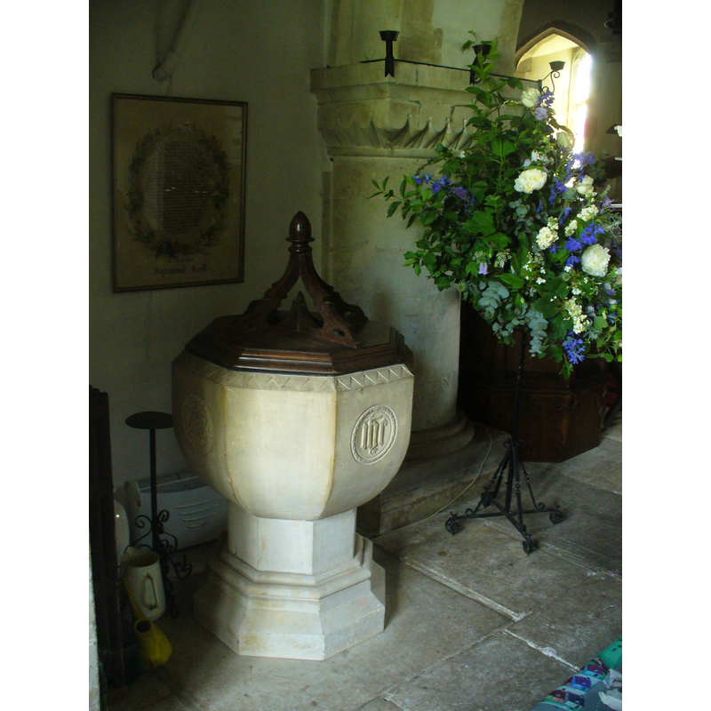
Image copyright © Colin Smith, 2011
Standing permission
Results: 2 records
view of font and cover
Scene Description: the 19th-century font and cover
Copyright Statement: Image copyright © Colin Smith, 2011
Image Source: digital photograph taken 21 May 2011 by Colin Smith
Copyright Instructions: Standing permission
view of church exterior - southeast view
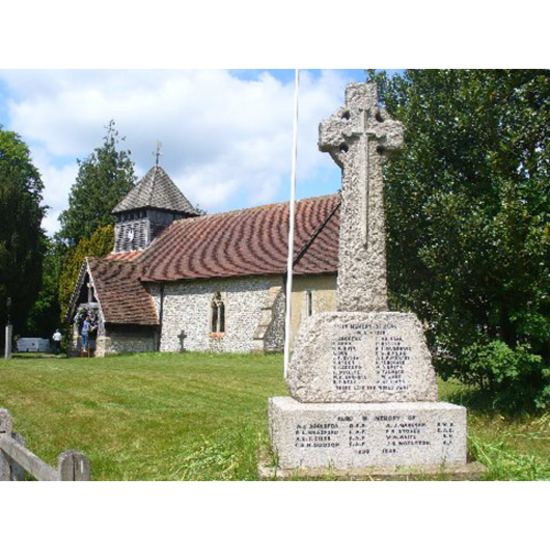
Copyright Statement: Image copyright © Colin Smith, 2011
Image Source: digital photograph taken 21 May 2011 by Colin Smith
Copyright Instructions: Standing permission
INFORMATION
Font ID: 17426MED
Object Type: Baptismal Font1?
Font Century and Period/Style: 12th century (mid?), Late Norman
Church / Chapel Name: Parish Church of St. Andrew [formerly a Chapel-of-ease to St. Mary the Virgin, Old Alresford]
Church Patron Saint(s): St. Andrew
Church Address: 17 Normandy St, at Wield Rd, Medstead, Alton GU34 1DD, UK -- Tel.: +44 1420 561154
Site Location: Hampshire, South East, England, United Kingdom
Directions to Site: Located off (N) the A31, 7 km WSW of Alton
Ecclesiastic Region: Diocese of Winchester
Historical Region: Hundred of Fawley
Additional Comments: disappeared font?
Font Notes:
Click to view
No entry found for Medstead / Medsted in the Domesday survey [cf. infra about a church in in Alresford being the one for Medstead]. The Victoria County History (Hampshire, vol. 3, 1908) notes: "Though so completely modernized the building probably preserves the dimensions of its twelfthcentury nave and chancel (the lengthening of the nave excepted), the oldest work now existing being the north arcade of the nave, c. 1160, of two bays with semicircular arches of a single order chamfered on the angles, square scalloped capitals, and round columns with moulded bases, the whole liberally whitewashed over [...] The font, near the south door [cf. infra], which is to the west of the older blocked doorway, is also modern". According to the Parish web site [www.standrews.hampshire.org.uk/church.htm] the Domesday Book (1086) mentions three churches in Alresford, one of which is likely to have been in Medstead, perhaps a chapel-of-ease to St. Mary the Virgin, the mother church in Alresford [now Old Alresford] since early times: "At the time of the Norman Conquest in 1066, it is likely St. Andrew's was a small, two-celled chapel built of either flint or wood. The siting of the chapel, close to two burial mounds dating from 1000 BC and an Iron Age ring fort, suggests it may have been built on an existing ritual site. It appears likely the Church was substantially enlarged or replaced around 1160, to which the oldest work now existing, the North Arcade of the Nave, has been dated. At this time the church was widened by 5 feet 7 inches by the addition of a north aisle. [...] In 1850 the church ceased to be a chapelry of Old Alresford [...] and Medstead became an independent parish with its own incumbent." That appears to be the date of the modern baptismal font in this church, located in the north aisle [NB: the font was moved in the 20th century from its original position near the south entranceway]. The font consists of an octagonal basin decorated with symbols on alternate faces of the rounded sides, raised on a moulded octagonal pedestal base. The wooden cover of oak, four scroll ribs meeting at an acorn finial; probably of similar date. [NB: we have no knowledge of separate baptismal registers for this church, so there may not have been a font in it until 1850].
Credit and Acknowledgements: We are grateful to Colin Smith for his photographs of church and font
COORDINATES
UTM: 30U 635289 5666118
Latitude & Longitude (Decimal): 51.13053, -1.06646
Latitude & Longitude (DMS): 51° 7′ 49.91″ N, 1° 3′ 59.26″ W
LID INFORMATION
Date: 19th-century?
Material: wood, oak?
Apparatus: no
Notes: [cf. FontNotes]
REFERENCES
- Victoria County History [online], University of London, 1993-. URL: https://www.british-history.ac.uk.