Burnham nr. Maidenhead / Burnaham / Burneham
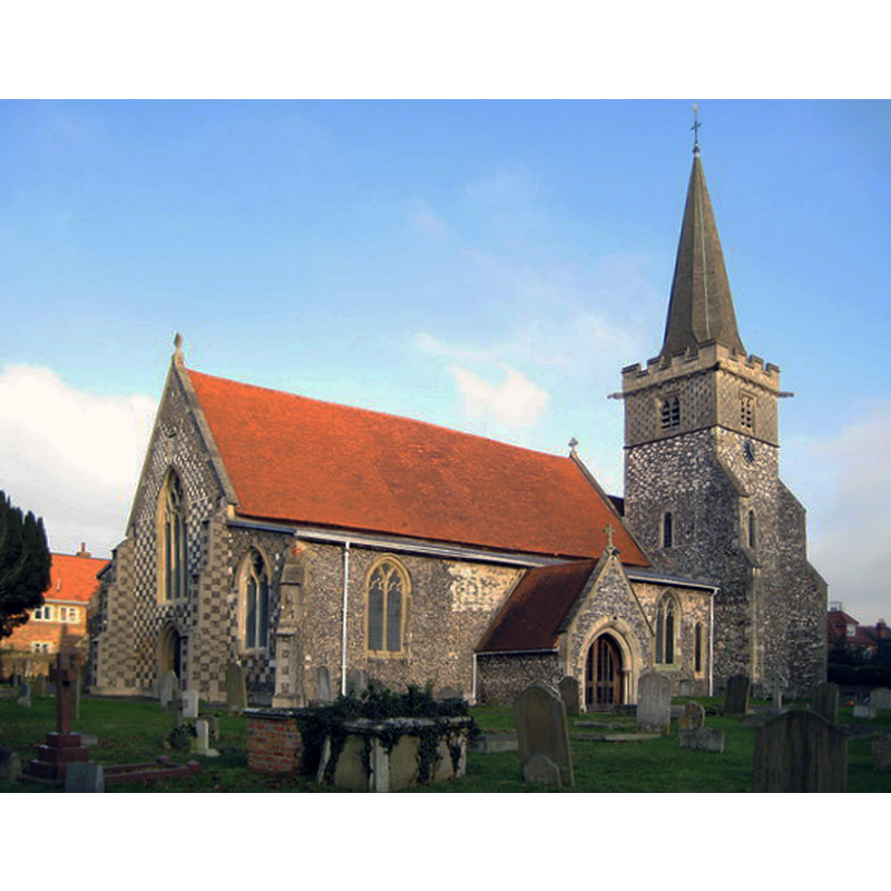
Image copyright © Nigel Cox, 2009
CC-BY-SA-2.0
Results: 1 records
view of church exterior - northeast view
Scene Description: Source caption: "Burnham: St Peter's Church. The church with its distinctive chequer-patterned west end dates in parts from the 12th century."
Copyright Statement: Image copyright © Nigel Cox, 2009
Image Source: digital photograph taken 9 January 2009 by Nigel Cox [www.geograph.org.uk/photo/1118895] [accessed 27 October 2015]
Copyright Instructions: CC-BY-SA-2.0
INFORMATION
Font ID: 17423BUR
Object Type: Baptismal Font1?
Font Century and Period/Style: 12th - 13th century, Medieval
Church / Chapel Name: Parish Church of St. Peter
Font Location in Church: [cf. FontNotes]
Church Patron Saint(s): St. Peter
Church Address: Church Street, Burnham, Buckinghamshire SL1 7EW -- Tel.: +44 1628 664338
Site Location: Buckinghamshire, South East, England, United Kingdom
Directions to Site: Located off the M4, 5 km NW of Slough, 5 km ENE of Maidenhead -- the church is located on Church St, off High St
Ecclesiastic Region: Diocese of Oxford
Historical Region: Hundred of Burnham
Additional Comments: disappeared font? (the one from the 12thC church here)
Font Notes:
Click to view
There is an entry for this Burnham [variant spelling] in the Domesday survey [http://opendomesday.org/place/SU9382/burnham/] [accessed 27 October 2015], but it mentions neither cleric nor church in it. Sheahan (1862) reports a church that goes back to the Early English period, but mentions no font in it. The Victoria County History (Buckingham, vol. 3, 1925) notes: "The church dates from the 12th century [...] The whole fabric was considerably restored during the 19th century [...] the bell-chamber of the tower, which had been destroyed by fire in the 18th century and rebuilt in timber, was again rebuilt in flint and stone, and a timber spire added in 1892"; there is no mention of its font in the VCH either.
COORDINATES
UTM: 30U 662306 5711673
Latitude & Longitude (Decimal): 51.5328, -0.6599
Latitude & Longitude (DMS): 51° 31′ 58.08″ N, 0° 39′ 35.64″ W
REFERENCES
- Victoria County History [online], University of London, 1993-. URL: https://www.british-history.ac.uk.
- Sheahan, James Joseph, History and topography of Buckinghamshire, comprising a general survey of the county, preceded by an epitome of the early history of Great Britain, London; Pontefract: Longman, Green, Longman, and Roberts; William Edward Bonas [...], 1862, p. 820