Soulbury / Soleberie
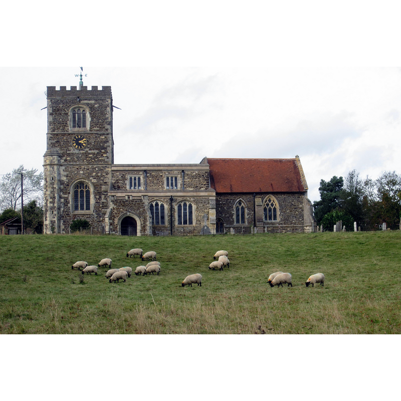
Image copyright © Philip Jeffrey, 2012
CC-BY-SA-2.0
Results: 3 records
view of church exterior - south view
Copyright Statement: Image copyright © Philip Jeffrey, 2012
Image Source: digital photograph taken 18 October 2012 by Philip Jeffrey [www.geograph.org.uk/photo/3184216] [accessed 23 November 2015]
Copyright Instructions: CC-BY-SA-2.0
symbol - shield - in a quatrefoil - 4
![[cf. FontNotes]](/static-50478a99ec6f36a15d6234548c59f63da52304e5/others/image_not_available.jpg)
Scene Description: [cf. FontNotes]
![[cf. FontNotes]](/static-50478a99ec6f36a15d6234548c59f63da52304e5/bsi-testing-site/others/image_not_available.jpg)
design element - motifs - lozenge - in a quatrefoil - 4
Scene Description: [cf. FontNotes]
INFORMATION
Font ID: 17415SOU
Object Type: Baptismal Font1
Font Century and Period/Style: 15th century [restored], Perpendicular [altered?]
Workshop/Group/Artisan: heraldic font
Church / Chapel Name: Parish Church of All Saints
Font Location in Church: Inside the church
Church Patron Saint(s): All Saints
Church Address: High Road, Soulbury, Buckinghamshire LU7 0BT, United Kingdom
Site Location: Buckinghamshire, South East, England, United Kingdom
Directions to Site: Located 5 km NW of Leighton Buzzard, 5 km S of Milton Keynes, 5 km N of Wing
Ecclesiastic Region: Diocese of Oxford
Historical Region: Hundred of Cottesloe
Additional Comments: disappeared font? (the one from the 1231 church here)
Font Notes:
Click to view
There are six entries for Soulbury [variant spelling] in the Domesday survey [http://opendomesday.org/place/SP8827/soulbury/] [accessed 23 November 2015], none of which mentions cleric or church in it. Sheahan (1862) describes a font in this church: "The font is octagon, with a shield and a lozenge alternately in the middle of each compartment enclosed by a quatrefoil; and the cover is of wood, rising from an octagon base, as a pyramid". The Victoria County History (Buckingham, vol. 3, 1925) notes: "The earliest mention of the church of Soulbury occurs in 1231 [...] The original church consisted of a chancel with an aisleless nave. About the middle of the 14th century the chancel was rebuilt and aisles were added to the old nave. In the next century new windows were inserted in the south aisle and the south porch was built. Early in the 16th century, probably soon after the grant of the church to Woburn Abbey, the arcades of the nave were rebuilt and the north aisle was extended westward, the west tower and the clearstory were built, and new roofs were given to the nave and aisles [...] In 1863 the church was restored [...] The 15th-century font, which has been much restored, is octagonal with quatrefoiled panels."
COORDINATES
UTM: 30U 656883 5756236
Latitude & Longitude (Decimal): 51.934704, -0.717936
Latitude & Longitude (DMS): 51° 56′ 4.93″ N, 0° 43′ 4.57″ W
MEDIUM AND MEASUREMENTS
Material: stone
Font Shape: octagonal, mounted
Basin Interior Shape: round
Basin Exterior Shape: octagonal
REFERENCES
- Victoria County History [online], University of London, 1993-. URL: https://www.british-history.ac.uk.
- Sheahan, James Joseph, History and topography of Buckinghamshire, comprising a general survey of the county, preceded by an epitome of the early history of Great Britain, London; Pontefract: Longman, Green, Longman, and Roberts; William Edward Bonas [...], 1862, p. 745