Nettleden / Netledon / Netteleyden / Netylden / Notleden
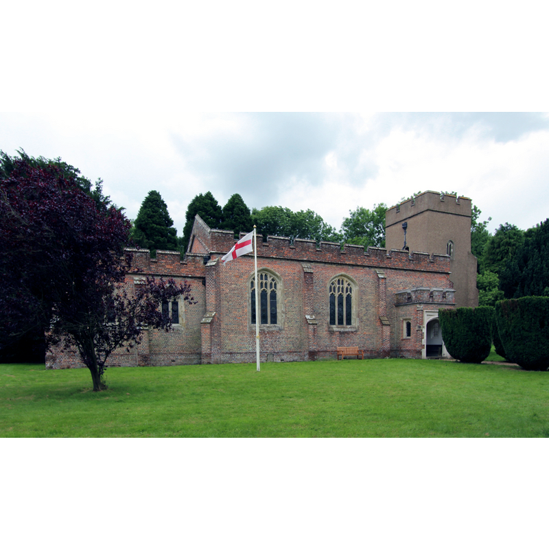
Image copyright © John Salmon, 2016
CC-BY-SA-2.0
Results: 1 records
view of church exterior - northeast view
Copyright Statement: Image copyright © John Salmon, 2016
Image Source: digital photograph taken 13 July 2016 by John Salmon [www.geograph.org.uk/photo/5054904] [accessed 21 September 2016]
Copyright Instructions: CC-BY-SA-2.0
INFORMATION
Font ID: 17412NET
Object Type: Baptismal Font1?
Font Century and Period/Style: 14th century, Decorated
Church / Chapel Name: Parish Church of St. Lawrence
Font Location in Church: [cf. FontNotes]
Church Patron Saint(s): St. Lawrence [aka Laurence]
Church Address: Nettleden Road, Nettleden, Hertfordshire HP1 3DQ
Site Location: Buckinghamshire, South East, England, United Kingdom
Directions to Site: Located 6 km NW of Hemel Hempstead [NB: although surrounded on most sides by Hertfordshire, Nettleden is now part of Buckinghamshire]
Ecclesiastic Region: Diocese of St. Albans
Historical Region: Hundred of Dacorum -- in Hertfordshire until 1895
Additional Comments: disappeared font? (the one from the 14thC church/chapel here)
Font Notes:
Click to view
No entry for Nettleden found in the Domesday survey. Sheahan (1862) includes Nettleden in Buckinghamshire: "It occupies an extreme point of Buckinghamshire, and is surrounded on three sides by Hertfordshire [...] The Church (St. Lawrence) is a neat edifice, built before 1470 [...] and nearly rebuilt in 1811 [...] the font is modern and small". The Victoria County History (Hertfordshire, vol. 2, 1908): "As there is no mention of the church or chapel of Nettleden in the taxation of churches under Pope Nicholas in 1291 it is probable that it was built after this date. In 1381 it is mentioned as annexed to the church of Pitstone […] originally a chapelry in the parish of Pylesthorne or Pitstone in Buckinghamshire, but was formed into a parish in 1895 from parts of the parishes of Ivinghoe and Pitstone, and at the same time transferred from the county of Buckinghamshire to that of Hertfordshire"; the VCH (ibid.) notes the modern church, "having been almost wholly rebuilt in brick by John earl of Bridgewater in 1811 [...] The small octagonal font is also modern." [NB: we have no information on the font of the previous church; the earliest register for baptisms, burials, and marriages here starts in 1784, more than a hundred years before Nettleden was set as a separate parish].
COORDINATES
UTM: 30U 670873 5739804
Latitude & Longitude (Decimal): 51.78298, -0.52276
Latitude & Longitude (DMS): 51° 46′ 58.73″ N, 0° 31′ 21.94″ W
REFERENCES
- Victoria County History [online], University of London, 1993-. URL: https://www.british-history.ac.uk.
- Sheahan, James Joseph, History and topography of Buckinghamshire, comprising a general survey of the county, preceded by an epitome of the early history of Great Britain, London; Pontefract: Longman, Green, Longman, and Roberts; William Edward Bonas [...], 1862, p. 702