Wolverton nr. Stony Stratford / Wlregton / Wlverintone / Wolfrington / Wolverington / Wlueruntone / Wulvrinton
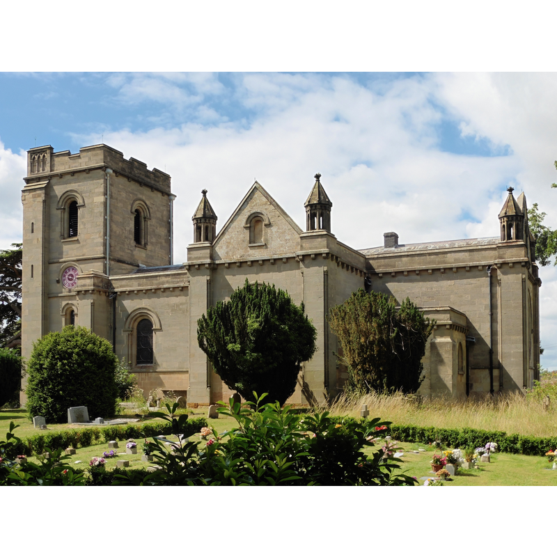
Image copyright © Dave Kelly, 2015
CC-BY-SA-2.0
Results: 2 records
view of church exterior - southeast view
Scene Description: EXT SE digital photograph taken 1 August 2015 by Dave Kelly [www.geograph.org.uk/photo/4594963] [accessed 8 March 2016]
INT E digital photograph taken 10 September 2001 by John Salmon [www.geograph.org.uk/photo/333039] [accessed 8 March 2016]
Copyright Statement: Image copyright © Dave Kelly, 2015
Image Source: digital photograph taken 1 August 2015 by Dave Kelly [www.geograph.org.uk/photo/4594963] [accessed 8 March 2016]
Copyright Instructions: CC-BY-SA-2.0
view of church interior - nave - looking east
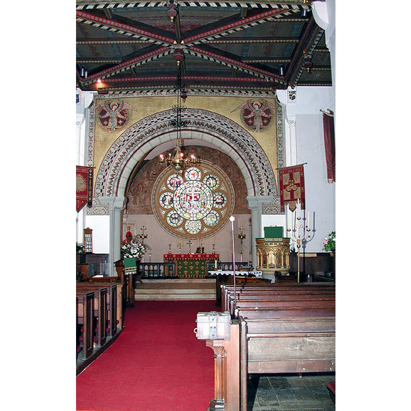
Copyright Statement: Image copyright © John Salmon, 2007
Image Source: digital photograph taken 10 September 2001 by John Salmon [www.geograph.org.uk/photo/333039] [accessed 8 March 2016]
Copyright Instructions: CC-BY-SA-2.0
INFORMATION
Font ID: 17389WOL
Object Type: Baptismal Font1
Font Century and Period/Style: 12th century, Late Norman
Church / Chapel Name: Parish Church of the Holy Trinity
Font Location in Church: [cf. FontNotes]
Church Patron Saint(s): The Holy Trinity
Church Address: Old Wolverton Road, Stony Stratford, Milton Keynes MK12 5NH
Site Location: Buckinghamshire, South East, England, United Kingdom
Directions to Site: Located between Stony Stratford (2 km ENE) and Newport Pagnell; the church is located off Old Wolverton Rd.
Ecclesiastic Region: Diocese of Oxford
Historical Region: Hundred of Seckley [in Domesday] -- Hundred of Newport
Additional Comments: disappeared font? (the one from the 12thC church here)
Font Notes:
Click to view
There is an entry for this Wolvertone [variant spelling] in the Domesday survey [http://opendomesday.org/place/SP8141/wolverton/] [accessed 8 March 2016], but it mentions no church in it. Sheahan (1862) notes that the fabric of the church "was completed in 1815", but uses the term "re-erected", without mention of the earlier church; a font is noted, "of Bath stone [...] upon a clustered column". The Victoria County History (Buckingham, vol. 4, 1927) notes: "The ancient church [Holy Trinity] dated from the 12th century [...] The tower dates from the 14th century and the rest of the structure from 1815." [there is no mention of a font in the VCH]. The Wolverton's Ecclesiastical History - IX Wolverton St Mary page [http://wolvertonpast.blogspot.com/2011/02/wolvertons-ecclesiastical-history-ix.html] notes: "When looking at the west wall it should be borne in mind that the font originally stood nearby, to the left as you enter, on a square of decorative floor tiles which still exists below the present boarded floor [...] he font is in the Gothic style. It is mid 19th century and of Bath stone. Faint stencil patterns can still be made out on the stonework which was damaged when it was moved to its present position at the re-ordering. The towering font canopy is later and designed by Edward Swinfen Harris. The body of the gilded dove from which it is suspended hides a rise-and-fall mechanism." [NB: we have no information on the whereabouts of the medieval font]. [NB: the other two churches in Wolverton, St. George the Martyr's -circular and sculpted font, according th Sheahan (ibid.)- and St. Mary the Virgin's are both mid-19th century].
COORDINATES
UTM: 30U 648806 5770409
Latitude & Longitude (Decimal): 52.064256, -0.829182
Latitude & Longitude (DMS): 52° 3′ 51.32″ N, 0° 49′ 45.05″ W
REFERENCES
- Victoria County History [online], University of London, 1993-. URL: https://www.british-history.ac.uk.
- Sheahan, James Joseph, History and topography of Buckinghamshire, comprising a general survey of the county, preceded by an epitome of the early history of Great Britain, London; Pontefract: Longman, Green, Longman, and Roberts; William Edward Bonas [...], 1862, p. 646, 649