Wavendon / Wafanduninga / Wandon / Warnden / Wauenden / Wauendene / Wauendone / Wavyngdon
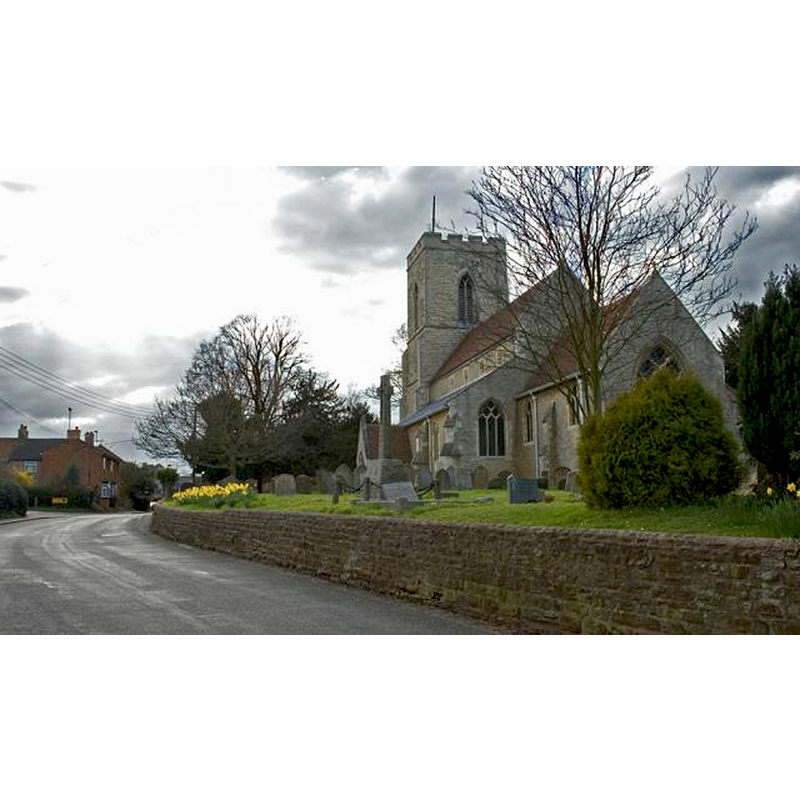
Image copyright © Peter Roberts, 2005
CC-BY-SA-2.0
Results: 3 records
view of church exterior - southeast view
Copyright Statement: Image copyright © Peter Roberts, 2005
Image Source: digital photograph taken 25 March 2005 by Peter Roberts [www.geograph.org.uk/photo/747] [accessed 7 March 2016]
Copyright Instructions: CC-BY-SA-2.0
view of font and cover

Scene Description: the modern font and cover
Copyright Statement: Image copyright © clutch.open.ac.uk, 2011
Image Source: digital photograph in http://clutch.open.ac.uk/schools/heronsgate99/church_life/font/font.html
Copyright Instructions: PERMISSION NOT AVAILABLE -- IMAGE NOT FOR PUBLIC USE
view of font cover
Scene Description: the modern font and cover
Copyright Statement: Image copyright © clutch.open.ac.uk, 2011
Image Source: digital photograph in http://clutch.open.ac.uk/schools/heronsgate99/church_life/font/font.html
Copyright Instructions: PERMISSION NOT AVAILABLE -- IMAGE NOT FOR PUBLIC USE
INFORMATION
Font ID: 17388WAV
Object Type: Baptismal Font1
Font Century and Period/Style: 12th - 13th century, Medieval
Church / Chapel Name: Parish Church of the Assumption of the Blessed Virgin [aka St. Mary's]
Font Location in Church: [cf. FontNotes]
Church Patron Saint(s): The Assumption of St. Mary
Church Address: 52 Walton Road, Wavendon, Milton Keynes MK17 8LW
Site Location: Buckinghamshire, South East, England, United Kingdom
Directions to Site: Located 6 km NW of Woburn, 8 km SSE of Newport Pagnell
Ecclesiastic Region: Diocese of Oxford
Historical Region: Hundred of Moulsoe [in Domesday] -- Hundred of Newport
Additional Comments: disappeared font? (the one from the medieval church here)
Font Notes:
Click to view
There are seven entries for Wavendon [variant spelling] in the Domesday survey [http://opendomesday.org/place/SP9137/wavendon/] [accessed 7 March 2016], neither of which mention cleric or church in it [NB: the part in Leofwin (of Nuneham)'s lordship was held in tenancy in 1086 by Godwin the priest]. Sheahan (1862) reports that this church "was entirely restored under the direction of Mr. Butterfield, architect, in 1848-9", and describes the new font: "The large font, of Tottenhoe stone, is eloborately sculptured, and has a finely carved cover of oak, suspendd from above by chains, and a gilt dove." Sheahan (ibid.) mentions also "the old holy-water stoupe"[sic] located on the right-hand side of the doorway. The Victoria County History (Buckingham, vol. 4, 1927) notes: "The advowson of the church is mentioned in 1199 [...] The nave and chancel show no detail earlier than the 13th century [...] In 1848–9 there was a complete restoration of the church, and much of the walling was refaced and in places possibly rebuilt [...] The font is modern. This modern font is located in the south aisle, just west of the south door. The Victorian wooden cover is quite interesting: although it base design is the common octagonal pyramid, it incorporates a church building as part of it.
COORDINATES
UTM: 30U 659396 5766389
Latitude & Longitude (Decimal): 52.0252, -0.6767
Latitude & Longitude (DMS): 52° 1′ 30.72″ N, 0° 40′ 36.12″ W
LID INFORMATION
Date: 19th century (mid)
Material: wood, oak
Apparatus: yes
Notes: [cf. FontNotes]
REFERENCES
- Victoria County History [online], University of London, 1993-. URL: https://www.british-history.ac.uk.
- Sheahan, James Joseph, History and topography of Buckinghamshire, comprising a general survey of the county, preceded by an epitome of the early history of Great Britain, London; Pontefract: Longman, Green, Longman, and Roberts; William Edward Bonas [...], 1862, p. 632