Shenley nr. Milton Keynes / Sanleia / Senelai / Shendeley / Shenle / Shenlegh / Shenley Church End
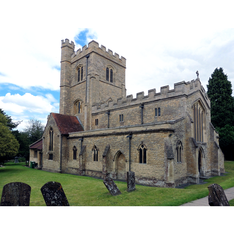
Image copyright © Dave Kelly, 2015
CC-BY-SA-2.0
Results: 2 records
view of church exterior - southeast view
Copyright Statement: Image copyright © Dave Kelly, 2015
Image Source: digital photograph taken 1 August 2015 by Dave Kelly [www.geograph.org.uk/photo/4594966] [accessed 25 February 2016]
Copyright Instructions: CC-BY-SA-2.0
design element - motifs - panel
![[cf. FontNotes]](/static-50478a99ec6f36a15d6234548c59f63da52304e5/others/image_not_available.jpg)
Scene Description: [cf. FontNotes]
![[cf. FontNotes]](/static-50478a99ec6f36a15d6234548c59f63da52304e5/bsi-testing-site/others/image_not_available.jpg)
INFORMATION
Font ID: 17368SHE
Object Type: Baptismal Font1
Font Century and Period/Style: 15th century, Perpendicular
Church / Chapel Name: Parish Church of St. Mary
Font Location in Church: Inside the church
Church Address: Dudley Hill, Shenley Church End, Milton Keynes MK5 6AB
Site Location: Buckinghamshire, South East, England, United Kingdom
Directions to Site: Located 6 km NW of Fenny Stratford, in the Milton Keynes district and civil parish
Ecclesiastic Region: Diocese of Oxford
Historical Region: Hundred of Seckley [in Domesday] -- Hundred of Newport
Additional Comments: disappeared font? (the one from the original late-12thC (?) church here)
Font Notes:
Click to view
There are two entries for Shenley [Church End] [variant spelling] in the Domesday survey [http://opendomesday.org/place/SP8336/shenley-church-end/] [accessed 25 February 2016], neither of which mentions cleric or church in it. Sheahan (1862) comments: "the earliest part of the chancel is Transition from Norman to Early English [...] and the font is of stone, and is sculptured". The Victoria County History (Buckingham, vol. 4, 1927) notes: "The church dates from about 1150 [...] the whole fabric was restored in 1888–90 [...] The font, which has an octagonal panelled bowl, dates from the 15th century."
COORDINATES
UTM: 30U 651709 5765848
Latitude & Longitude (Decimal): 52.02249, -0.78888
Latitude & Longitude (DMS): 52° 1′ 20.96″ N, 0° 47′ 19.97″ W
MEDIUM AND MEASUREMENTS
Material: stone
Font Shape: octagonal, mounted
Basin Interior Shape: round
Basin Exterior Shape: octagonal
REFERENCES
- Victoria County History [online], University of London, 1993-. URL: https://www.british-history.ac.uk.
- Sheahan, James Joseph, History and topography of Buckinghamshire, comprising a general survey of the county, preceded by an epitome of the early history of Great Britain, London; Pontefract: Longman, Green, Longman, and Roberts; William Edward Bonas [...], 1862, p. 599