Olney / Alney / Ollaneg / Ollanege / Olnea / Olnei / Olneye / Oulney / Ouneia / Ouneya
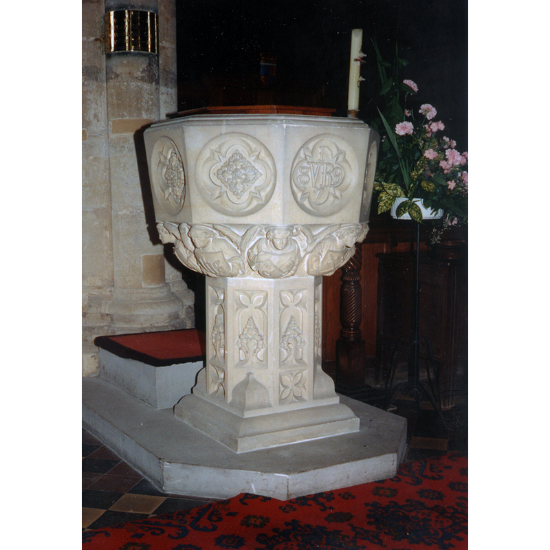
Image copyright © John Salmon, 2012
CC-BY-SA-2.0
Results: 6 records
view of font and cover
Scene Description: the modern font
Copyright Statement: Image copyright © John Salmon, 2012
Image Source: photograph in 1995 by John Salmon [www.geograph.org.uk/photo/3265956] [accessed 24 February 2016]
Copyright Instructions: CC-BY-SA-2.0
view of church exterior - northwest end
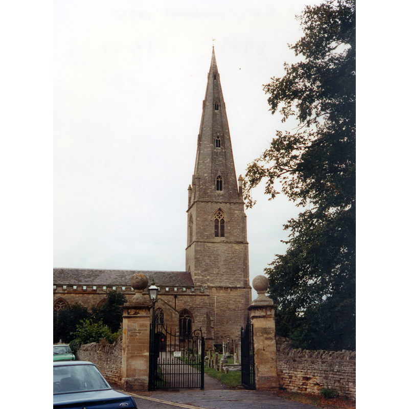
Copyright Statement: Image copyright © John Salmon, 2012
Image Source: photograph taken in 1995 by John Salmon [www.geograph.org.uk/photo/3265935] [accessed 24 February 2016]
Copyright Instructions: CC-BY-SA-2.0
view of church exterior in context
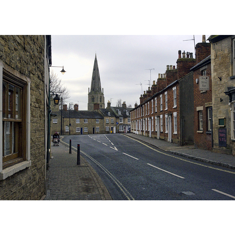
Scene Description: Source caption: "The Main Road. With the spire of St. Peter & St. Paul rising in the background."
Copyright Statement: Image copyright © Cameraman, 2011
Image Source: digital photograph taken 20 January 2011 by Cameraman [www.geograph.org.uk/photo/2288129] [accessed 24 February 2016]
Copyright Instructions: CC-BY-SA-2.0
view of church interior - nave - looking east
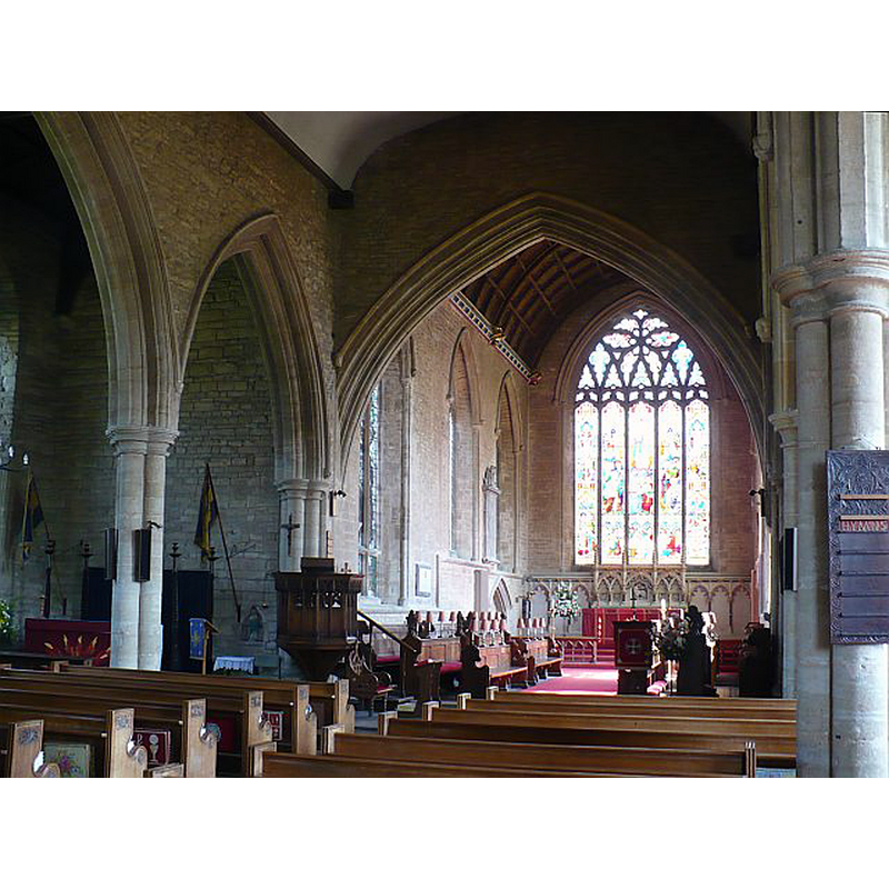
Copyright Statement: Image copyright © Robin Drayton, 2008
Image Source: igital photograph taken 13 May 2008 by Robin Drayton [www.geograph.org.uk/photo/814629] [accessed 24 February 2016]
Copyright Instructions: CC-BY-SA-2.0
view of font
![the image shows the two fonts at the west end of the church; in the foreground the Victorian font; in the background the late 16thC font [cf. FontNotes]](/static-50478a99ec6f36a15d6234548c59f63da52304e5/others/permission_not_available.jpg)
Scene Description: the image shows the two fonts at the west end of the church; in the foreground the Victorian font; in the background the late 16thC font [cf. FontNotes]
Copyright Statement: Image copyright © [N/A]
Image Source: [information missing / not recorded]
Copyright Instructions: PERMISSION NOT AVAILABLE -- IMAGE NOT FOR PUBLIC USE
design element - motifs - panel
Scene Description: on the sides of the basin of the old font, which is seen here in the background [cf. FontNotes]
Copyright Statement: Image copyright © [N/A]
Image Source: [information missing / not recorded]
Copyright Instructions: PERMISSION NOT AVAILABLE -- IMAGE NOT FOR PUBLIC USE
INFORMATION
Font ID: 17366OLN
Object Type: Baptismal Font1
Font Century and Period/Style: 16th century(late?), Reformation
Church / Chapel Name: Parish Church of St. Peter and St. Paul
Font Location in Church: [cf. FontNotes]
Church Patron Saint(s): St. Peter & St. Paul
Church Address: Church Street, Olney, Milton Keynes MK46 4AD
Site Location: Buckinghamshire, South East, England, United Kingdom
Directions to Site: Located off (W) the A509, just N of Emberton, W of Clifton Reynes and Newton Blossomville, 12 km from Bedford, Milton Keynes and Northampton
Ecclesiastic Region: Diocese of Oxford
Historical Region: Hundred of Bunsty [in Domesday] -- Hundred of Newport
Additional Comments: disappeared font? (the font(s) from the medieval church) -- altered and disused font (the late-16thC font in the N aisle)
Font Notes:
Click to view
There is en entry for Olney [variant spelling] in the Domesday survey [http://opendomesday.org/place/SP8851/olney/] [accessed 24 February 2016], but it mentions neither cleric nor church in it. Sheahan (1862) writes: "The Church [...] is a venerable structure of the 13th century, and was a beautiful building, but the alterations of the last century have destroyed much of its beauty, at least in the interior. It is in the Early Decorated, or middle pointed style of architecture [...] the font is octagonal and plain". The Victoria County History (Buckingham, vol. 4, 1927) notes: "A church existed in the parish from a very early period, probably long before 1273, the date of the first known reference [...] but the present structure was built during the middle of the 14th century [...] The font in use is modern, but there is an octagonal font in the north aisle which probably dates from the late 16th century and has a plain stem and base, and a panelled bowl, the upper portion of which appears to have been cut away." The present font is noted in the history of the church [www.mkheritage.co.uk/odhs/ratcliff/olneyparishchurch.html]: "Entering the building by the west door will be noticed the imposing font of Caën stone with oak canopy, recently placed near the west column of the south aisle, upon which is a brass plate inscribed: 'This font was given by the Vicar the Rev J P Langley, June 20, 1897, on the completion of the 60th year of Queen Victoria’s reign'. " [NB: we have no information on the font from the medieval church]
COORDINATES
UTM: 30U 657217 5780123
Latitude & Longitude (Decimal): 52.1492, -0.7021
Latitude & Longitude (DMS): 52° 8′ 57.12″ N, 0° 42′ 7.56″ W
MEDIUM AND MEASUREMENTS
Material: stone
Font Shape: octagonal, mounted
Basin Interior Shape: round
Basin Exterior Shape: octagonal
REFERENCES
- Victoria County History [online], University of London, 1993-. URL: https://www.british-history.ac.uk.
- Sheahan, James Joseph, History and topography of Buckinghamshire, comprising a general survey of the county, preceded by an epitome of the early history of Great Britain, London; Pontefract: Longman, Green, Longman, and Roberts; William Edward Bonas [...], 1862, p. 587