Chicheley / Cicelai / Chechele / Chichele
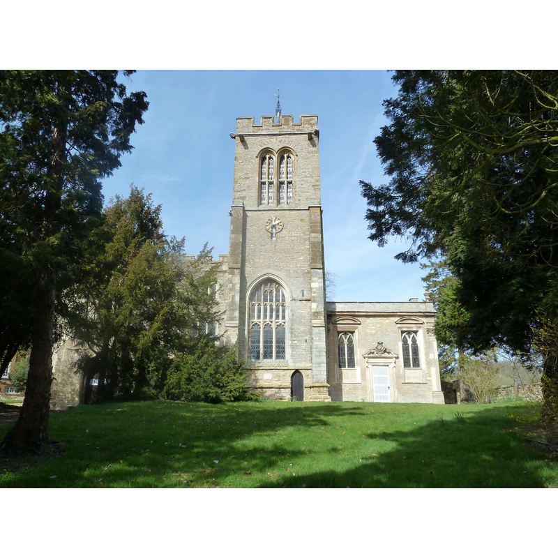
Image copyright © Mr Biz, 2012
CC-BY-SA-2.0
Results: 2 records
view of church exterior - southeast end
Scene Description: [NB: what appears to be an odd addition to the side of the tower is the chancel]
Copyright Statement: Image copyright © Mr Biz, 2012
Image Source: digital photograph taken 25 March 2012 by Mr Biz [www.geograph.org.uk/photo/2868615] [accessed 17 February 2016]
Copyright Instructions: CC-BY-SA-2.0
view of church exterior in context - northeast end
![EXT SE END digital photograph taken 25 March 2012 by Mr Biz [www.geograph.org.uk/photo/2868615] [accessed 17 February 2016] [NB: what appears to be an odd little addition to the tower side is the chancel]](/static-50478a99ec6f36a15d6234548c59f63da52304e5/compressed/1160217016_compressed.png)
Scene Description: EXT SE END digital photograph taken 25 March 2012 by Mr Biz [www.geograph.org.uk/photo/2868615] [accessed 17 February 2016] [NB: what appears to be an odd little addition to the tower side is the chancel]
Copyright Statement: Image copyright © Philip Jeffrey, 2013
Image Source: digital photograph taken 14 August 2013 by Philip Jeffrey [www.geograph.org.uk/photo/3599711] [accessed 17 February 2016]
Copyright Instructions: CC-BY-SA-2.0
INFORMATION
Font ID: 17353CHI
Object Type: Baptismal Font1
Font Century and Period/Style: Medieval
Church / Chapel Name: Parish Church of St. Lawrence
Font Location in Church: [cf. FontNotes]
Church Patron Saint(s): St. Lawrence [aka Laurence]
Church Address: Hall Lane, Chicheley, Milton Keynes MK16 9JH
Site Location: Buckinghamshire, South East, England, United Kingdom
Directions to Site: Located off (W) the A509, 4 km NE of Newport Pagnell
Ecclesiastic Region: Diocese of Oxford
Historical Region: Hundred of Mulsoe [in Domesday] -- Hundred of Newport
Additional Comments: disappeared font?
Font Notes:
Click to view
There are three entries for Chicheley [variant spelling] in the Domesday survey [http://opendomesday.org/place/SP9045/chicheley/] [accessed 17 February 2016], neither of which mentions cleric or church in it. Sheahan (1862) notes: "the octagonal font is large and ancient". The Victoria County History (Buckingham, vol. 4, 1927) notes: "The plan of the present building appears to be the result of successive additions to a 12th-century church [...] The aisle and tower have been recently restored." [NB: there is no mention of a font in the VCH; did the old font reported in Sheahan get replaced in the restoration noted in the VCH?]
COORDINATES
UTM: 30U 658873 5775149
Latitude & Longitude (Decimal): 52.10404, -0.68023
Latitude & Longitude (DMS): 52° 6′ 14.54″ N, 0° 40′ 48.83″ W
MEDIUM AND MEASUREMENTS
Material: stone
Font Shape: octagonal, mounted
Basin Exterior Shape: octagonal
REFERENCES
- Victoria County History [online], University of London, 1993-. URL: https://www.british-history.ac.uk.
- Sheahan, James Joseph, History and topography of Buckinghamshire, comprising a general survey of the county, preceded by an epitome of the early history of Great Britain, London; Pontefract: Longman, Green, Longman, and Roberts; William Edward Bonas [...], 1862, p. 518