Broughton nr. Milton Keynes / Brotone / Bruchton / Bruhtone / Bruttone / Burwton
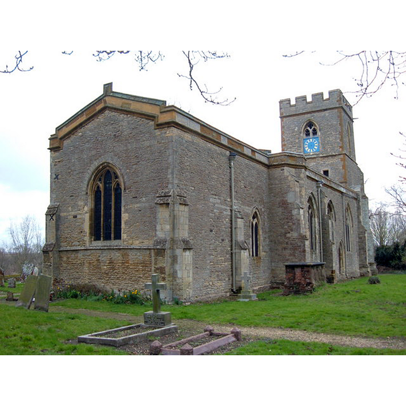
Image copyright © Mr Biz, 2008
CC-BY-SA-2.0
Results: 3 records
view of church exterior - northeast view
Scene Description: Source caption: "St. Lawrence Church, Broughton. Located towards the top of the old village on what was once the A50 London - Leicester road. The church is no longer used and maintained by the Churches Conservation Trust."
Copyright Statement: Image copyright © Mr Biz, 2008
Image Source: digital photograph taken 18 March 2008 by Mr Biz [www.geograph.org.uk/photo/728856] [accessed 17 February 2016]
Copyright Instructions: CC-BY-SA-2.0
view of church exterior - southeast view
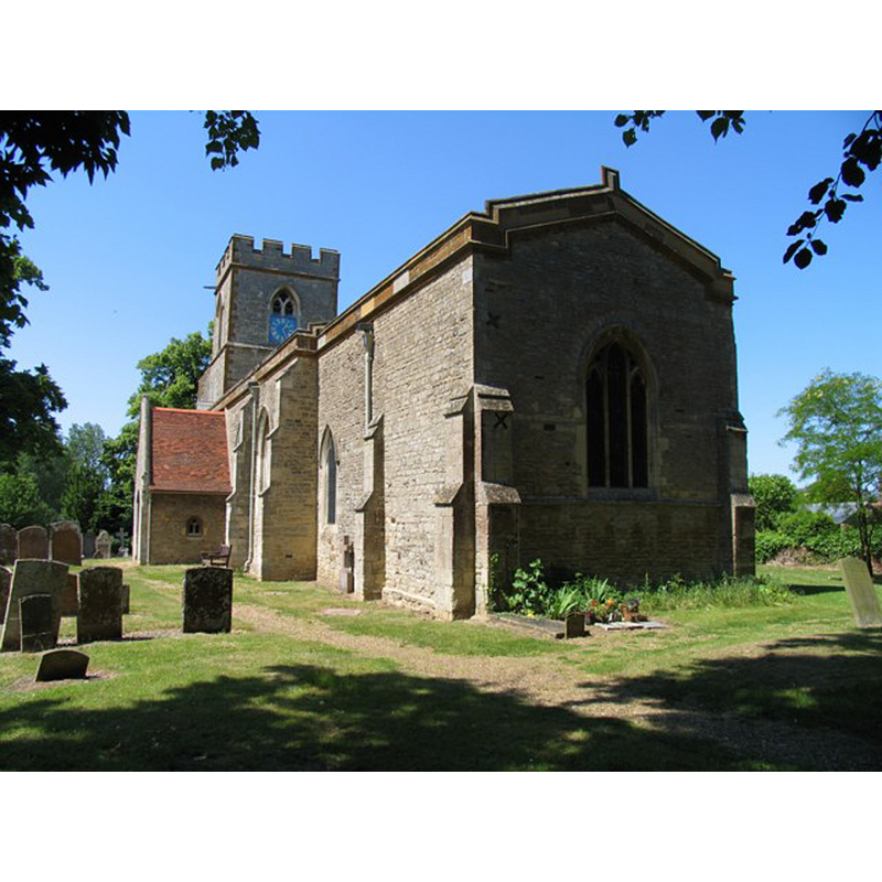
Scene Description: Source caption: "St Lawrence Broughton. The parish church of the former village of Broughton in the Milton Keynes area has now been taken into the care of the Churches Conservation Trust."
Copyright Statement: Image copyright © Andrew Tatlow, 2009
Image Source: digital photograph taken 1 June 2009 by Andrew Tatlow [www.geograph.org.uk/photo/1692240] [accessed 17 February 2016]
Copyright Instructions: CC-BY-SA-2.0
symbol - shield - coat of arms - unidentified
![on the former basin, now upturned and serving as lower base under the modern basin [cf. FontNotes]](/static-50478a99ec6f36a15d6234548c59f63da52304e5/others/image_not_available.jpg)
Scene Description: on the former basin, now upturned and serving as lower base under the modern basin [cf. FontNotes]
![on the former basin, now upturned and serving as lower base under the modern basin [cf. FontNotes]](/static-50478a99ec6f36a15d6234548c59f63da52304e5/bsi-testing-site/others/image_not_available.jpg)
INFORMATION
Font ID: 17351BRO
Object Type: Baptismal Font1
Font Century and Period/Style: 14th - 15th century [base only] [composite font], Medieval [composite]
Workshop/Group/Artisan: heraldic font
Church / Chapel Name: Parish Church of St. Lawrence [redundant
Font Location in Church: Inside the church
Church Patron Saint(s): St. Lawrence [aka Laurence]
Church Notes: "remarkable series of paintings upon the walls of the nave. The earliest of these is the late 14th-century painting between the two eastern windows in the north wall which represents the dismemberment of the body of Christ." [source: VCH , Bucks., vol. 4, 1927] -- redundant now and under the care of the Churches Conservation Trust
Church Address: 22 Oxenhope Way, Broughton MK10 9AA
Site Location: Buckinghamshire, South East, England, United Kingdom
Directions to Site: Located near Milton Keynes, and now a suburb of it; near the Bedfordshire border [NB: not to be mistaken with 'Broughton' nr. Aylesbury, also in Bucks.]
Ecclesiastic Region: Diocese of Oxford
Historical Region: Houndred of Moulsoe [in Domesday] -- Hundred of Newport
Additional Comments: re-cycled font? (the present base is the former basin, now inverted) -- disappeared font? (the one from the 12thC church here)
Font Notes:
Click to view
There are two entries for this Broughton [variant spelling] in the Domesday survey [http://opendomesday.org/place/SP8940/broughton/] [accessed 17 February 2016], neither of which mention cleric or church in it. Sheahan (1862), who notes the church itself is "principally very Early Decorated", writes: "the font is a modern stone basin on a stone pedestal, supported by the old octagonal font inverted, having coats of arms remaining thereon." The Victoria County History (Buckingham, vol. 4, 1927) notes: "The church of Broughton, which is a rectory, was originally bestowed on Tickford Priory by Robert de Broughton and William his son, and the gift confirmed by Robert, Bishop of Lincoln 1151–4. [...] No detail now remains of an earlier date than the first quarter of the 14th century, when the chancel and nave appear to have been remodelled [...] In 1880–1 the church was drastically restored" [NB: no mention of the font in the VCH]. [NB: an object resembling a small font has been recorded in the churchyard at Broughton, now turned into a sundial [source: http://www.country-eye.co.uk/gallery/imagelibrary/showphotodetail.php?id=566]
COORDINATES
UTM: 30U 657846 5769345
Latitude & Longitude (Decimal): 52.0522, -0.6979
Latitude & Longitude (DMS): 52° 3′ 7.92″ N, 0° 41′ 52.44″ W
MEDIUM AND MEASUREMENTS
Material: stone
REFERENCES
- Victoria County History [online], University of London, 1993-. URL: https://www.british-history.ac.uk.
- Sheahan, James Joseph, History and topography of Buckinghamshire, comprising a general survey of the county, preceded by an epitome of the early history of Great Britain, London; Pontefract: Longman, Green, Longman, and Roberts; William Edward Bonas [...], 1862, p. 507