Little Brickhill / Brichel / Brichella / Brichellae / Brickhill Parva / Brikull / Little Brikehill / Parva Brychull
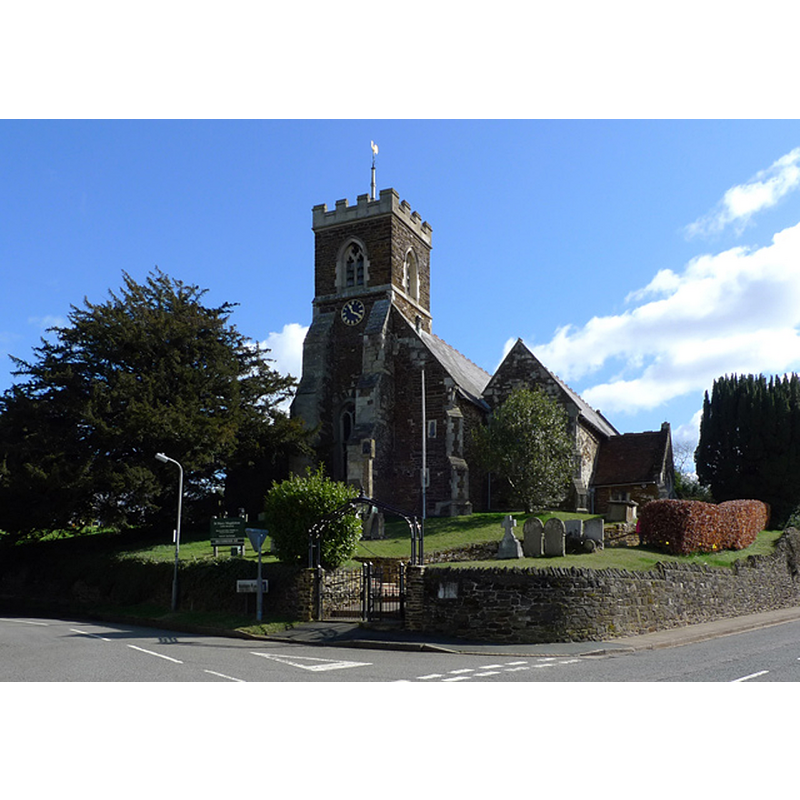
Image copyright © Cameraman, 2010
CC-BY-SA-2.0
Results: 1 records
view of church exterior - southwest view
Copyright Statement: Image copyright © Cameraman, 2010
Image Source: digital photograph taken 1 April 2010 by Cameraman [www.geograph.org.uk/photo/1781976] [accessed 17 February 2016]
Copyright Instructions: CC-BY-SA-2.0
INFORMATION
Font ID: 17350BRI
Object Type: Baptismal Font1
Font Century and Period/Style: 13th century [basin only?] [composite font], Medieval [composite]
Church / Chapel Name: Parish Church of St. Mary Magdalene
Font Location in Church: Inside the church
Church Patron Saint(s): St. Mary Magdalene
Church Address: Woburn Road, Little Brickhill, Milton Keynes MK17 9LU
Site Location: Buckinghamshire, South East, England, United Kingdom
Directions to Site: Located 3 km SE of Fenny Stratford, 10 km N of Leighton Buzzard
Ecclesiastic Region: Diocese of Oxford
Historical Region: Hundred of Moulsoe [in Domesday] -- Hundred of Newport
Additional Comments: altered font: re-cut stem, or a modern one? -- disappeared font? (the one from the 12thC church here)
Font Notes:
Click to view
There are two entries for [Great and Little] Brickhill [variant spelling] in the Domesday survey [http://opendomesday.org/place/XX0000/great-and-little-brickhill/] [accessed 2 February 2016], neither of which mentions cleric or church in it. Sheahan (1862) reports a plain font in this church. The Victoria County History (Buckingham, vol. 4, 2011) notes: "The church, which has probably always been dedicated in honour of St. Mary Magdalene, [...] was given by Robert de Turnham to the priory of Combwell, which he founded in the reign of Henry II [i.e., 1154-1189] [...] A church, probably built a little before the middle of the 12th century [...] In 1703 [...] The fabric of the church was at this time repaired, and a second restoration was undertaken in 1864 [...] The font has a plain circular bowl dating probably from the 13th century, and a modern, or possibly recut, stem and base."
COORDINATES
UTM: 30U 659569 5761655
Latitude & Longitude (Decimal): 51.982617, -0.67638
Latitude & Longitude (DMS): 51° 58′ 57.42″ N, 0° 40′ 34.97″ W
MEDIUM AND MEASUREMENTS
Material: stone
Font Shape: round, mounted
Basin Interior Shape: round
Basin Exterior Shape: round
REFERENCES
- Victoria County History [online], University of London, 1993-. URL: https://www.british-history.ac.uk.
- Sheahan, James Joseph, History and topography of Buckinghamshire, comprising a general survey of the county, preceded by an epitome of the early history of Great Britain, London; Pontefract: Longman, Green, Longman, and Roberts; William Edward Bonas [...], 1862, p. 505