Great Brickhill / Brichella / Brickhill Magna / Magna Brichull / Magna Brikehille
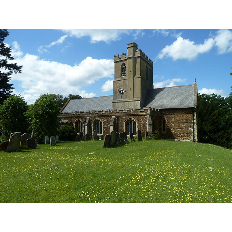
Image copyright © Robin Webster, 2014
CC-BY-SA-2.0
Results: 3 records
view of church exterior - south view
Copyright Statement: Image copyright © Robin Webster, 2014
Image Source: digitlal photograph taken 25 May 2014 by Robin Webster [www.geograph.org.uk/photo/3994912] [accessed 17 February 2016]
Copyright Instructions: CC-BY-SA-2.0
view of church interior - nave - looking southwest

Scene Description: with the top of the font and cover visible at the far end, in the south aisle, right of the south door
Copyright Statement: Image copyright © Basher Eyre, 2011
Image Source: digital photograph taken 6 September 2011 by Basher Eyre [www.geograph.org.uk/photo/2600018] [accessed 17 February 2016]
Copyright Instructions: CC-BY-SA-2.0
view of font and cover

Scene Description: the modern font and cover
Copyright Statement: Image copyright © Ewart White, 2011
Image Source: digital photograph taken 7 March 2010 by Ewart White
Copyright Instructions: PERMISSION NOT AVAILABLE -- IMAGE NOT FOR PUBLIC USE
INFORMATION
Font ID: 17349BRI
Object Type: Baptismal Font1
Font Century and Period/Style: 13th century, Medieval
Church / Chapel Name: Parish Church of the Nativity of the Blessed Virgin [aka St Mary's]
Font Location in Church: [cf. FontNotes]
Church Patron Saint(s): The Nativity of St. Mary
Church Address: Lower Way, Great Brickhill, Milton Keynes, MK17 9AG
Site Location: Buckinghamshire, South East, England, United Kingdom
Directions to Site: Located 5 km SE of Fenny Stratford
Ecclesiastic Region: Diocese of Oxford
Historical Region: Hundred of Moulsoe [in Domesday] -- Hundred of Newport
Additional Comments: disappeared font?
Font Notes:
Click to view
There are two entries for [Great and Little] Brickhill [variant spelling] in the Domesday survey [http://opendomesday.org/place/XX0000/great-and-little-brickhill/] [accessed 2 February 2016], neither of which mentions cleric or church in it. Sheahan (1862) mentions an octagonal font in this church, probably modern, but he also notes: "The chapel on the north side of the chancel contains the former font, much mutilated". The Victoria County History (Buckingham, vol. 4, 1927) notes: "The chancel, tower, and probably the nave date from the 13th century, but all the original details of the nave have been obliterated by subsequent alterations [...] the south porch was added in 1867, when the whole fabric was restored [...] The font is modern." [NB: the present font is octagonal with alternate basin sides carved; raised on brightly-coloured Victorian colonnettes; it may date from the 1867 re-building of this church; we have no information on the whereabouts of the old font noted in Sheahan [cf. supra] inside the north chapel]
COORDINATES
UTM: 30U 658711 5760022
Latitude & Longitude (Decimal): 51.968199, -0.689614
Latitude & Longitude (DMS): 51° 58′ 5.51″ N, 0° 41′ 22.61″ W
MEDIUM AND MEASUREMENTS
Material: stone
REFERENCES
- Victoria County History [online], University of London, 1993-. URL: https://www.british-history.ac.uk.
- Sheahan, James Joseph, History and topography of Buckinghamshire, comprising a general survey of the county, preceded by an epitome of the early history of Great Britain, London; Pontefract: Longman, Green, Longman, and Roberts; William Edward Bonas [...], 1862, p. 503