Cold Brayfield / Brafeld / Brafield / Brafield Cold / Bragenfelda / Bramfeld / Branefield / Brauefeld / Braufend / Braumfeld / Braunfeld / Brauufeld / Brawefeld / Brayfield / Brayfield Cold / Britfeld / Cold Brafield
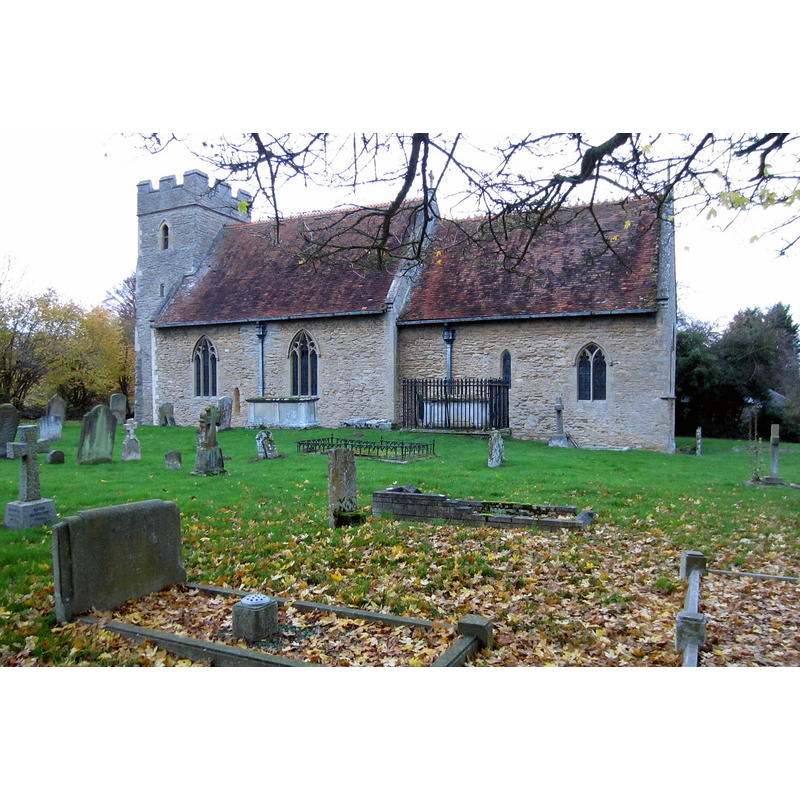
Image copyright © Philip Jeffrey, 2012
CC-BY-SA-2.0
Results: 1 records
view of church exterior - south view
Copyright Statement: Image copyright © Philip Jeffrey, 2012
Image Source: digital photograph taken 17 November 2012 by Philip Jeffrey [www.geograph.org.uk/photo/3227410] [accessed 18 February 2016]
Copyright Instructions: CC-BY-SA-2.0
INFORMATION
Font ID: 17348BRA
Object Type: Baptismal Font1
Font Century and Period/Style: 12th century, Late Norman
Church / Chapel Name: Parish Church of St. Mary the Virgin
Church Patron Saint(s): St. Mary the Virgin
Church Address: 15 Bedford Road, Cold Brayfield, Milton Keynes MK46 4HS
Site Location: Buckinghamshire, South East, England, United Kingdom
Directions to Site: Located on the A428 [aka Bedford Rd.], near Lavendon, 6 km E of Olney, 8 km N of Newport, 13 km W of Bedford, by the border with Beds.
Ecclesiastic Region: Diocese of Ocford
Historical Region: Hundred of Newport
Additional Comments: disappeared fonts? [cf. FontNotes]
Font Notes:
Click to view
No entry found for Cold Brayfield in the Domesday survey. Sheahan (1862) notes: "the font, which is small and plain, is supported by a fluted circular column placed on an octagonal basement." The Victoria County History (Buckingham, vol. 4, 1927) notes: "The church appears to have been built shortly before it was granted to Harrold Priory a little before the middle of the 12th century [...] The font is octagonal, but preserves no detail to indicate its date." Pevsner & Williamson (1994: 258) describe the font here as "Small, post-Reformation". [NB: the description of the font in the VCH does not appear to match those in Sheahan or Pevsner & Williamson -- we have no information on the font of the original church here].
COORDINATES
UTM: 30U 661216 5781523
Latitude & Longitude (Decimal): 52.160623, -0.643036
Latitude & Longitude (DMS): 52° 9′ 38.24″ N, 0° 38′ 34.93″ W
REFERENCES
- Victoria County History [online], University of London, 1993-. URL: https://www.british-history.ac.uk.
- Sheahan, James Joseph, History and topography of Buckinghamshire, comprising a general survey of the county, preceded by an epitome of the early history of Great Britain, London; Pontefract: Longman, Green, Longman, and Roberts; William Edward Bonas [...], 1862, p. 497