Middle Claydon / Claindone / Claydon Middle / Cliandone / Little Claydon
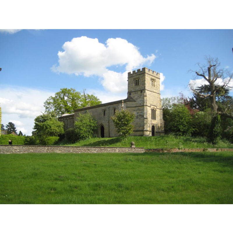
Image copyright © Nigel Cox, 2009
Reproduce under the provisions of the Creative Commons Licence
Results: 2 records
view of church exterior - northwest view
Copyright Statement: Image copyright © Nigel Cox, 2009
Image Source: digital photograph taken 3 May 2009 by Nigel Cox [http://www.geograph.org.uk/photo/1286081]
Copyright Instructions: Reproduce under the provisions of the Creative Commons Licence
view of font and cover

Scene Description: the modern font and cover
Copyright Statement: Image copyright © robertfrost1960, 2010
Image Source: digital photograph taken 2 May 2010 by robertfrost1960 [http://www.flickr.com/photos/32157648@N08/4586536456/]
Copyright Instructions: PERMISSION NOT AVAILABLE -- IMAGE NOT FOR PUBLIC VIEW
INFORMATION
Font ID: 17333CLA
Object Type: Baptismal Font1
Font Date: ca. 1306?
Font Century and Period/Style: 14th century (early?), Decorated
Church / Chapel Name: Parish Church of All Saints
Font Location in Church: [cf. FontNotes]
Church Patron Saint(s): All Saints
Church Address: Middle Claydon, Buckinghamshire MK18 2EY
Site Location: Buckinghamshire, South East, England, United Kingdom
Directions to Site: Located between East Botolph and Steeple Claydon, 6 WSW of Winslow, 10 km E of Buckingham, 13 NNE of Aylesbury
Ecclesiastic Region: Diocese of Oxford
Historical Region: Hundred of Waddesdon [in Domesday] -- Hundred of Ashendon
Additional Comments: disappeared font? (the one from the ca. 1306 church here)
Font Notes:
Click to view
There is an entry for [Middle] Claydon [variant spelling] in the Domesday survey [http://opendomesday.org/place/SP7225/middle-claydon/] [accessed 3 December 2015], but it mentions neither cleric nor church in it. Lipscomb (1831- ) writes: "The font under the gallery at the west end is of Coade's artificial stone, vase-shaped, on a pedestal modelled from a Grecian altar, inscribed: "The gift of the Rector, 1809." and with the arms of Wright impaling Calvert." Sheahan (1862) writes: "The nave of the church is in the very Early Decorated style", but does not mention a font in it. The Victoria County History (Buckingham, vol. 4, 1927) notes that the earliest parts of the church date to ca. 1300, but much of the rest is 15th- and 16th-century. The VCH does not mention the font either. The medieval font must have been lost (?) by Sheahan's time. The present marble font is modern. [NB: we have no information on the whereabouts of the font from the original church]
COORDINATES
UTM: 30U 640565 5754281
Latitude & Longitude (Decimal): 51.9215, -0.955919
Latitude & Longitude (DMS): 51° 55′ 17.4″ N, 0° 57′ 21.31″ W
REFERENCES
- Victoria County History [online], University of London, 1993-. URL: https://www.british-history.ac.uk.
- Lipscomb, George, The History and Antiquities of the County of Buckingham, London: J.B. Nichols, 1831-1843, vol. 1: 191
- Sheahan, James Joseph, History and topography of Buckinghamshire, comprising a general survey of the county, preceded by an epitome of the early history of Great Britain, London; Pontefract: Longman, Green, Longman, and Roberts; William Edward Bonas [...], 1862, p. 362