Turweston / Tereweston / Thurneston / Tower Weston / Turnestone / Turson / Turston / Turveston / Turvestone
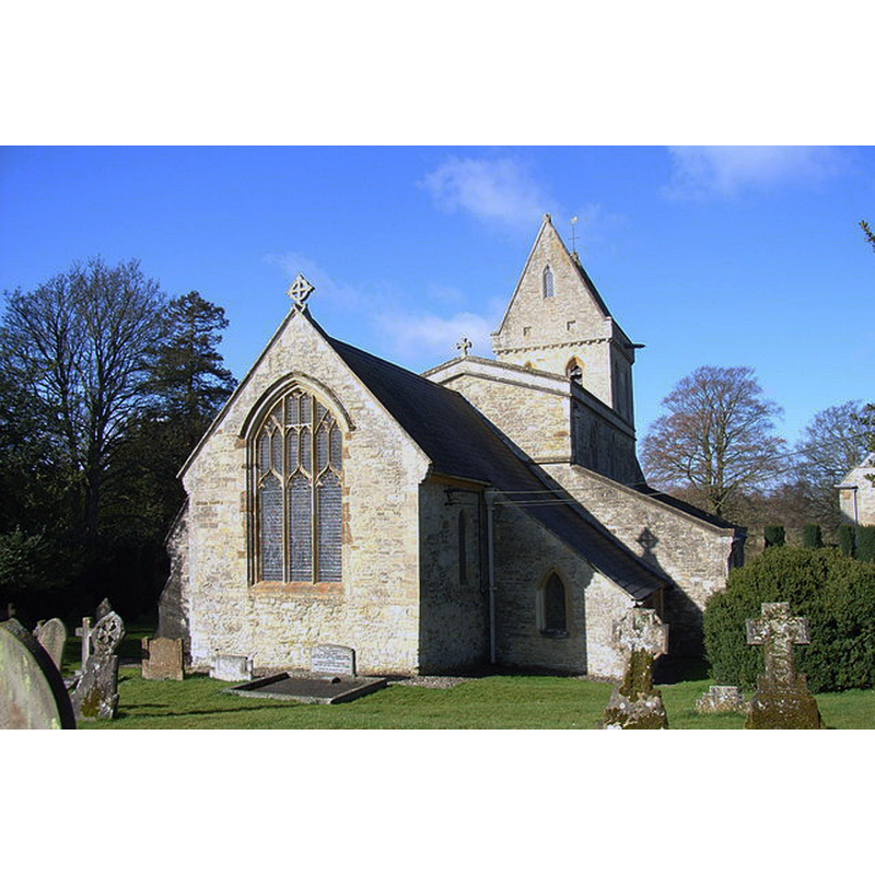
Image copyright © Andrew Smith, 2006
CC-BY-SA-2.0
Results: 4 records
view of church exterior - northeast view
Scene Description: Source caption: "St Mary's, Turweston. A tower with a triangular cap is a feature of many North Buckinghamshire and, particularly, Northamptonshire churches."
Copyright Statement: Image copyright © Andrew Smith, 2006
Image Source: digital photograph taken 27 March 2006 by Andrew Smith [www.geograph.org.uk/photo/143152] [accessed 28 January 2016]
Copyright Instructions: CC-BY-SA-2.0
view of church exterior - southeast view
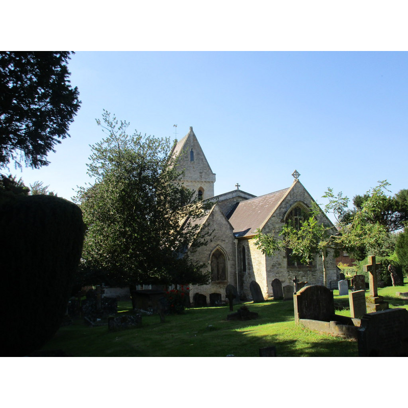
Scene Description: Source caption: "St. Mary's church, Turweston. A largely Victorian exterior hides a much older interior."
Copyright Statement: Image copyright © Jonathan Thacker, 2015
Image Source: digital photograph taken 10 September 2015 by Jonathan Thacker [www.geograph.org.uk/photo/4686784] [accessed 28 January 2016]
Copyright Instructions: CC-BY-SA-2.0
view of font and cover

Scene Description: the modern font
Copyright Statement: Image copyright © Colin Underhill / Alamy Stock Photo, 2013
Image Source: digital photograph taken 5 January 2013 by Colin Underhill [www.alamy.com/stock-photo-st-mary`s-church-turweston-buckinghamshire-england-uk-52809166.html] [accessed 28 January, 2016]
Copyright Instructions: PERMISSION NOT AVAILABLE -- IMAGE NOT FOR PUBLIC USE
design element - motifs - rope moulding
![around the upper rim of the disappeared 12thC font here [cf. FontNotes]](/static-50478a99ec6f36a15d6234548c59f63da52304e5/others/image_not_available.jpg)
Scene Description: around the upper rim of the disappeared 12thC font here [cf. FontNotes]
![around the upper rim of the disappeared 12thC font here [cf. FontNotes]](/static-50478a99ec6f36a15d6234548c59f63da52304e5/bsi-testing-site/others/image_not_available.jpg)
INFORMATION
Font ID: 17329TUR
Object Type: Baptismal Font1
Font Century and Period/Style: 12th century, Late Norman
Church / Chapel Name: Parish Church of the Assumption of the Blessed Virgin
Font Location in Church: [cf. FontNotes]
Church Patron Saint(s): The Assumption of St. Mary
Church Address: 1 Main Street, Turweston, Buckinghamshire NN13 5JU
Site Location: Buckinghamshire, South East, England, United Kingdom
Directions to Site: Located just E of Brackley, near the borders with Nhants and Oxon.
Ecclesiastic Region: Diocese of Oxford
Historical Region: Hundred of Stotfold [in Domesday] -- Hundred of Buckingham]
Additional Comments: moved font (the one from the 12thC church here is reported in Historic England as being in the parish church at Syresham, Nhants)
Font Notes:
Click to view
There is an entry for Turweston [variant spelling] in the Domesday survey [http://opendomesday.org/place/SP6037/turweston/] [accessed 28 January 2016], but it mentions neither cleric nor church in it. Sheahan (1862) describes the font at the time: "The font is plain, except that it has a band of cable moulding round the upper rim." The Victoria County History (Buckingham, vol. 4, 1927) notes: "This church dates from the 12th century", but a modern font in it, which it shows located in the south aisle, just west of the south entranceway. [NB: the earlier font, the one reported in Sheahan, is reported now in the parish church at Syresham, Nhants [source: Historic England Listing NGR: SP6309041964] [cf. BSI entry for Syresham]
COORDINATES
UTM: 30U 628492 5766520
Latitude & Longitude (Decimal): 52.0344, -1.1268
Latitude & Longitude (DMS): 52° 2′ 3.84″ N, 1° 7′ 36.48″ W
MEDIUM AND MEASUREMENTS
Material: stone
Font Shape: round
Basin Exterior Shape: round
REFERENCES
- Victoria County History [online], University of London, 1993-. URL: https://www.british-history.ac.uk.
- Sheahan, James Joseph, History and topography of Buckinghamshire, comprising a general survey of the county, preceded by an epitome of the early history of Great Britain, London; Pontefract: Longman, Green, Longman, and Roberts; William Edward Bonas [...], 1862, p. 318