Marsh Gibbon / Gibbemers / Mersa / Merse / Mersee / Mershe Gybewine / Mershe Gibwen / Mersh Gibwyne / Mershe-juxta-Twyford
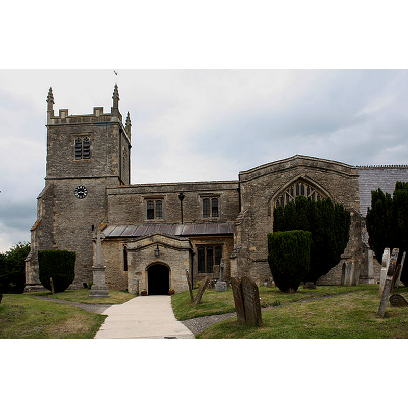
Image copyright © Mike Baldwin, 2009
CC-BY-SA-2.0
Results: 1 records
view of church exterior - south view
Copyright Statement: Image copyright © Mike Baldwin, 2009
Image Source: digital photograph taken 8 June 2009 by Mike Baldwin [www.geograph.org.uk/photo/1643092] [accessed 20 January 2016]
Copyright Instructions: CC-BY-SA-2.0
INFORMATION
Font ID: 17324MAR
Object Type: Baptismal Font1
Font Century and Period/Style: Medieval? / Victorian?
Church / Chapel Name: Parish Church of St. Mary the Virgin
Font Location in Church: Inside the church
Church Patron Saint(s): St. Mary the Virgin
Church Address: Church Street, Marsh Gibbon, Buckinghamshire OX27 0HW
Site Location: Buckinghamshire, South East, England, United Kingdom
Directions to Site: Located off (N) the A41, 7 km ENE of Bicester, , 15 km SW of Buckingham, by the Oxon. Border
Ecclesiastic Region: Diocese of Oxford
Historical Region: Hundred of Mow [in Domesday] -- Hundred of Buckingham
Additional Comments: composite / altered font?
Font Notes:
Click to view
There are two entries for Marsh [Gibbon] [variant spelling] in the Domesday survey [http://opendomesday.org/place/SP6423/marsh-gibbon/] [accessed 20 January 2016], neither of which mentions cleric or church in it. Sheahan (1862) notes "the font large, plain, and octagonal" and reports the 1860 renovation of this church by A. Bloomfield. Sheahan (ibid.) dates the earlier fabric of the church to the Early English period. The Victoria County History (Buckingham, vol. 4, 1927) notes: "An aisleless cruciform church, probably without any tower, was built here in the middle of the 13th century", but does not mention a font in it. The present font consists of a large octagonal basin with vertical sides, plain but for a large moulding at the upper rim; chamfered underbowl that is plain at the top, then graded moulded; plain short octagonal stam and splaying lower base also octagonal. Wooden cover, octagonal with pyramidal top; counterweight raised; modern?
COORDINATES
UTM: 30U 633454 5752128
Latitude & Longitude (Decimal): 51.9039, -1.0601
Latitude & Longitude (DMS): 51° 54′ 14.04″ N, 1° 3′ 36.36″ W
MEDIUM AND MEASUREMENTS
Material: stone
Font Shape: octagonal, mounted
Basin Exterior Shape: octagonal
LID INFORMATION
Material: wood, oak?
Apparatus: yes; counterweight
Notes: [cf. FontNotes]
REFERENCES
- Victoria County History [online], University of London, 1993-. URL: https://www.british-history.ac.uk.
- Sheahan, James Joseph, History and topography of Buckinghamshire, comprising a general survey of the county, preceded by an epitome of the early history of Great Britain, London; Pontefract: Longman, Green, Longman, and Roberts; William Edward Bonas [...], 1862, p. 294