Radnage / Radenach / Radenache / Radenai / Radeneach / Radenhach / Radenhag / Radenhech / Radnashe / Rodenache
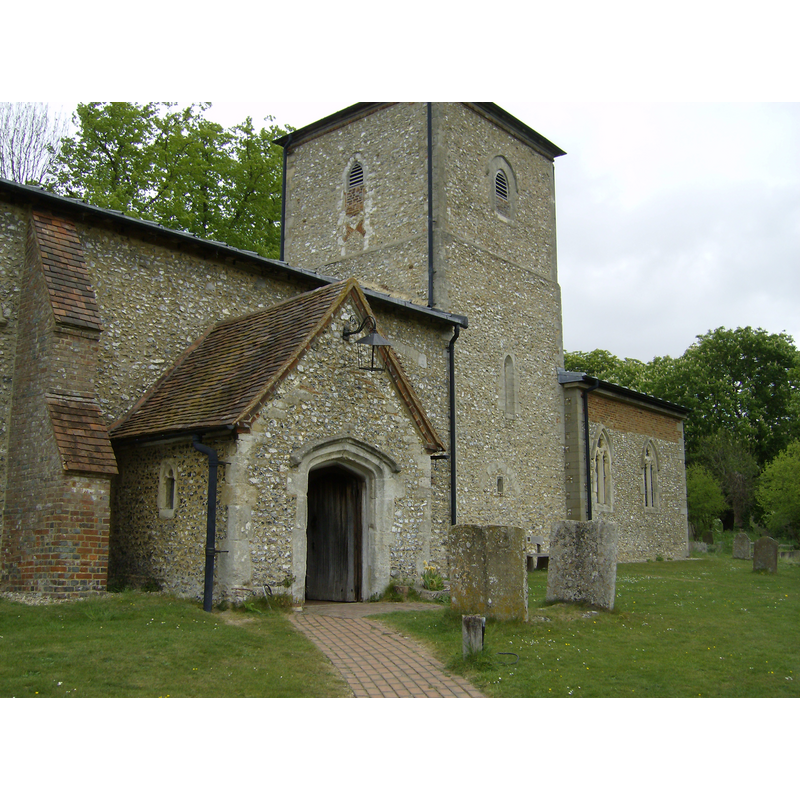
Image copyright © [in the public domain]
Released into the public domain by the author
Results: 4 records
view of church exterior - south porch and tower
Copyright Statement: Image copyright © [in the public domain]
Image Source: digital photograph taken 5 May 2007 by Sealman [http://en.wikipedia.org/wiki/File:St._Mary%27s_parish_Church_Radnage.jpg]
Copyright Instructions: Released into the public domain by the author
view of church exterior - southeast view
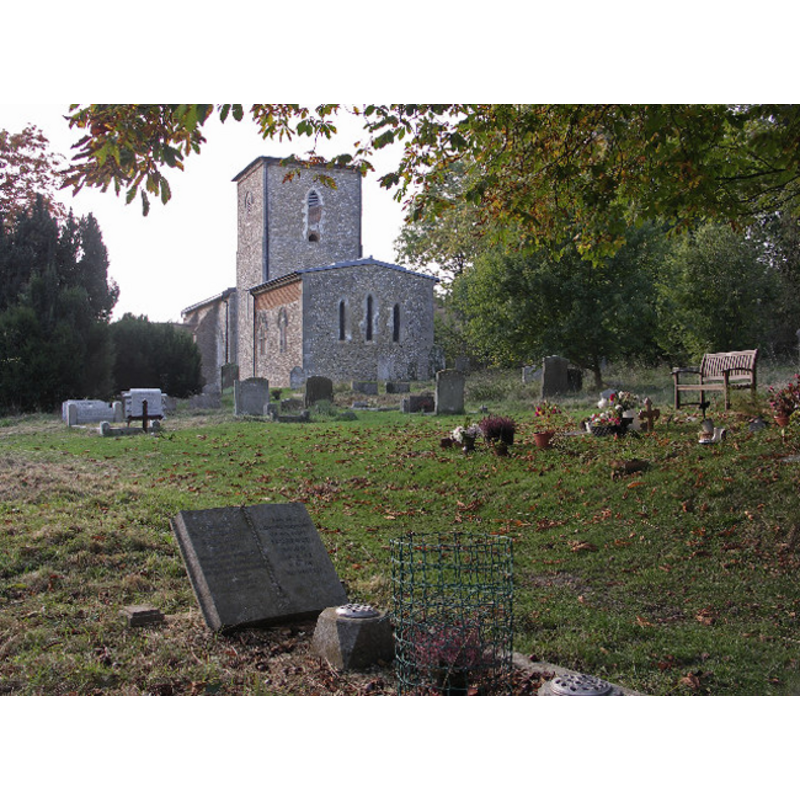
Copyright Statement: Image copyright © David Ellis, 2005
Image Source: digital photograph taken 17 October 2005 by David Ellis [geograph.org.uk - 104588.jpg]
Copyright Instructions: CC-BY-SA-2.0
view of font

Copyright Statement: Image copyright © Thorskegga, 2009
Image Source: digital photograph taken 8 October 2009 by Thorskegga [www.flickr.com/photos/thorskegga/4016971997/] [accessed 17 October 2011]
Copyright Instructions: PERMISSION NOT AVAILABLE -- IMAGE NOT FOR PUBLIC USE
view of font and cover
Copyright Statement: Image copyright © Eric Hardy, 2007
Image Source: digital photograph taken 19 February 2007 by Eric Hardy [www.flickr.com/photos/erichardyuk/407879564/]
Copyright Instructions: PERMISSION NOT AVAILABLE -- IMAGE NOT FOR PUBLIC USE
INFORMATION
Font ID: 17313RAD
Object Type: Baptismal Font1
Font Century and Period/Style: 10th - 11th century / 17th century, Pre-Conquest? / Restoration?
Church / Chapel Name: Parish Church of St. Mary the Virgin
Font Location in Church: Inside the church, at the W end of the nave
Church Patron Saint(s): St. Mary the Virgin
Church Notes: church said to have been built by the Templars -- it was used as a set in 'A month in the country'
Church Address: Radnage Lane, Radnage, Buckinghamshire, HP14 4DU
Site Location: Buckinghamshire, South East, England, United Kingdom
Directions to Site: Located 9 km WNW of High Wycombe
Ecclesiastic Region: Diocese of Oxford
Historical Region: Hundred of Desborough
Additional Comments: disappeared font? (the one from the ca. 1231 church here) -- altered font (the present one: whitewashed? / plastered?)
Font Notes:
Click to view
No entry for Radnage found in the Domesday survey. There is no mention of a font in this church in Sheahan (1862). The Victoria County History (Buckingham, vol. 3, 1925) notes: "The building, which is of unusual plan, the central tower being narrower than either the chancel or nave, dates from the opening years of the 13th century [...] The font is probably of the 17th century; it is now covered with plaster and paint and has a cover with a strap hinge." The British Listed Buildings database entry [www.britishlistedbuildings.co.uk/en-46611-church-of-st-mary-radnage] [accessed 17 October 2011], however, reports: "Rough medieval font". [NB: the font here is of an old design, examples of which have been attributed to the pre-Conquest period; it is doubtful that this font be of that period; there is no record in Domesday of such an early church here [NB: although that is not evidence of the church not being there]. Is it 17th-century font as claimed in the VCH? -- we have no information on the medieval font of this curch].
COORDINATES
UTM: 30U 647642 5726982
Latitude & Longitude (Decimal): 51.674381, -0.864715
Latitude & Longitude (DMS): 51° 40′ 27.77″ N, 0° 51′ 52.97″ W
MEDIUM AND MEASUREMENTS
Material: stone
Font Shape: round, mounted
Basin Interior Shape: round
Basin Exterior Shape: round
Drainage Notes: lead-lined
LID INFORMATION
Material: wood, oak?
Apparatus: no
Notes: [cf. FontNotes]
REFERENCES
- Victoria County History [online], University of London, 1993-. URL: https://www.british-history.ac.uk.