Tingewick / Tedinwiche / Tengewicha / Tingewic / Tyngwyk
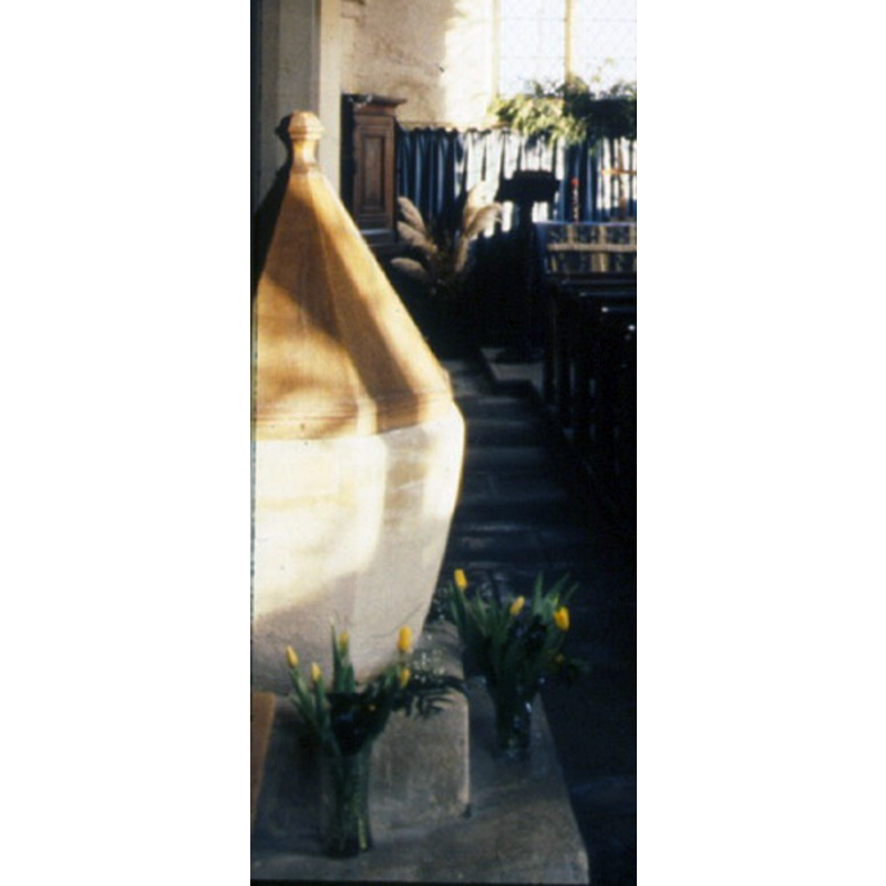
Image copyright © Su Floyd, 2016
No known copyright restriction / Fair Dealing
Results: 2 records
view of font and cover
Scene Description: Source caption: "Font: octagonal basin of shelly oolite, with staple marks, probably mediaeval."
Copyright Statement: Image copyright © Su Floyd, 2016
Image Source: digital photograph taken by Su Floyd [http://freepages.genealogy.rootsweb.ancestry.com/~tingewick/335-church-font_w.jpg] [accessed 28 January 2016]
Copyright Instructions: No known copyright restriction / Fair Dealing
view of church exterior - south view
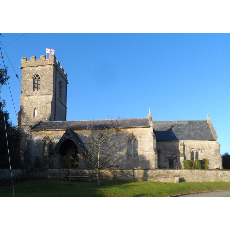
Scene Description: Source caption: "St Mary Magdalen, Tingewick. The nave is the oldest part of the church and dates from C12. The chancel and tower are C15. Other additions were made in C19."
Copyright Statement: Image copyright © Bikeboy, 2015
Image Source: digital photograph taken 2 January 2015 by Bikeboy [www.geograph.org.uk/photo/4306178] [accessed 28 January 2016]
Copyright Instructions: CC-BY-SA-2.0
INFORMATION
Font ID: 17306TIN
Object Type: Baptismal Font1
Font Century and Period/Style: 12th - 13th century, Medieval
Church / Chapel Name: Parish Church of St. Mary Magdalene
Font Location in Church: [cf. FontNotes]
Church Patron Saint(s): St. Mary Magdalene
Church Address: Church Lane, Tingewick, Buckinghamshire MK18 4RD
Site Location: Buckinghamshire, South East, England, United Kingdom
Directions to Site: Located on the A421, 4 km WSW of Buckingham
Ecclesiastic Region: Diocese of Oxford
Historical Region: Hundred of Rowley [in Domesday] -- Hundred of Buckingham
Additional Comments: altered font? / re-tooled font? (is this font a re-tooled version of the one from the medieval church here)
Font Notes:
Click to view
There is an entry for Tingewick [variant spelling] in the Domesday survey [http://opendomesday.org/place/SP6532/tingewick/] [accessed 28 January 2016], but it mentions neither cleric nor church in it. Lipscomb (1831- ) writes: "The old Font, which stood near the north door, on a square base, about two feet high, is octagonal, contracted towards the bottom." Sheahan (1862) reports a plain octagonal font in this church. The Victoria County History (Buckinghamshire, vol. 4, 1927) notes: "The three eastern bays of the north arcade of the nave are probably pierced in the wall of a 12thcentury church [...] The font is modern." [NB: the plain font shown in the image area might be medieval, but much re-tooled].
COORDINATES
UTM: 30U 634258 5761909
Latitude & Longitude (Decimal): 51.9916, -1.0446
Latitude & Longitude (DMS): 51° 59′ 29.76″ N, 1° 2′ 40.56″ W
MEDIUM AND MEASUREMENTS
Material: stone
Font Shape: octagonal, mounted
Basin Interior Shape: round
Basin Exterior Shape: octagonal
LID INFORMATION
Material: wood
Apparatus: no
Notes: octagonal pyramid with knob finial; appears modern
REFERENCES
- Victoria County History [online], University of London, 1993-. URL: https://www.british-history.ac.uk.
- Lipscomb, George, The History and Antiquities of the County of Buckingham, London: J.B. Nichols, 1831-1843, vol. 3: 126
- Sheahan, James Joseph, History and topography of Buckinghamshire, comprising a general survey of the county, preceded by an epitome of the early history of Great Britain, London; Pontefract: Longman, Green, Longman, and Roberts; William Edward Bonas [...], 1862, p. 316