Halton nr. Aylesbury / Haltone
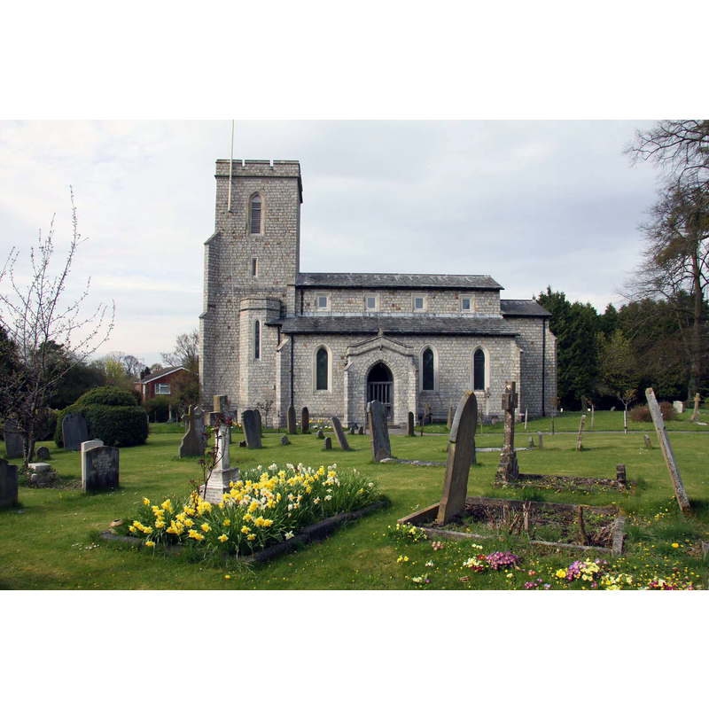
Image copyright © Steve Daniels, 2013
CC-BY-SA-2.0
Results: 1 records
view of church exterior - south view
Scene Description: the modern church
Copyright Statement: Image copyright © Steve Daniels, 2013
Image Source: digital photograph taken 24 April 2013 by Steve Daniels [www.geograph.org.uk/photo/3457632] [accessed 30 September 2015]
Copyright Instructions: CC-BY-SA-2.0
INFORMATION
Font ID: 17295HAL
Object Type: Baptismal Font1?
Font Century and Period/Style: 13th century, Early English
Church / Chapel Name: Parish Church of St. Michael and All Angels
Font Location in Church: [cf. FontNotes]
Church Patron Saint(s): St. Michael & All Angels
Church Notes: original church here first documented 13thC; present church is 19thC, on the site of the medieval one
Church Address: Church View, Halton, Buckinghamshire, HP22 5PQ
Site Location: Buckinghamshire, South East, England, United Kingdom
Directions to Site: Located 3 km from Wendover, 8 km SE of Aylesbury
Ecclesiastic Region: Diocese of Oxford
Historical Region: Hundred of Aylesbury
Additional Comments: disappeared font? (the one of the 13thC (?) church here)
Font Notes:
Click to view
There is an entry for this Halton [variant spelling] in the Domesday survey [http://opendomesday.org/place/SP8710/halton/] [accessed 30 September 2015], but it mentions neither cleric nor church in it. Sheahan (1862) notes that the church "was entirely rebuilt in 1813 [...] The font which is of white stone, is a large basin resting on a column placed on a plinth, correspondent with the pillars of the nave." The Victoria County History (Buckingham, vol. 2, 1908) notes: "The church of Halton presumably came into the possession of the monastery of Christchurch, Canterbury, as early as the manor, but it is not definitely mentioned till the 13th century. [...] The [present] church of ST. MICHAEL is a completely modern structure consisting of a shallow chancel, a nave of four bays with north and south aisles, and a western tower. It was built in 1813 [...] The only trace remaining of the old church, which occupied about the same site, is some stone curbing laid down to the east of the present church, marking the lines of the old chancel. [...] The seating, fittings, woodwork, &c., are all modern, except the font, which is of late 18th-century date. It is constructed of white marble inlaid with coloured marbles, and has a small square bowl, ornamented with grotesques, which is supported upon a twisted stem." [NB: we have no information on the font of the earlier church here].
COORDINATES
UTM: 30U 656275 5739303
Latitude & Longitude (Decimal): 51.782747, -0.734425
Latitude & Longitude (DMS): 51° 46′ 57.89″ N, 0° 44′ 3.93″ W
REFERENCES
- Victoria County History [online], University of London, 1993-. URL: https://www.british-history.ac.uk.
- Sheahan, James Joseph, History and topography of Buckinghamshire, comprising a general survey of the county, preceded by an epitome of the early history of Great Britain, London; Pontefract: Longman, Green, Longman, and Roberts; William Edward Bonas [...], 1862, p. 138