Marlow / Berlaue / Great Marlow / Chepping Marlow / Chipping Marlow / Merelafan / Merlaue / Merlawe
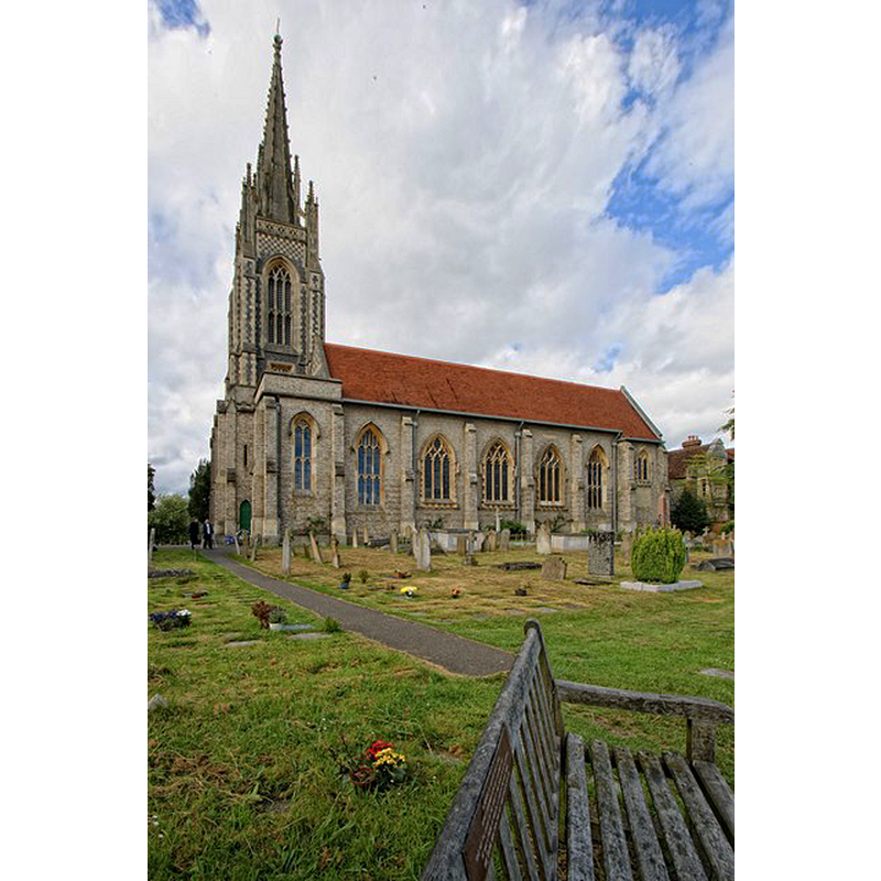
Image copyright © Dave Hitchborne, 2013
CC-BY-SA-2.0
Results: 4 records
view of church exterior - south view
Scene Description: Source caption: "The Church of All Saints, Marlow. All Saints church was built in 1831 on the site of a previous church that was demolished after its spire collapsed. The ancient church was built in 1070. The spire of the present church rises to 170 feet."
INT E WITH FONT digital photograph taken 13 June 2013 by Dave Hitchborne [www.geograph.org.uk/photo/3652652] [accessed 16 October 2015] Source caption: "The Church of All Saints, Marlow. The baptismal font and elaborate font cover."
INT W digital photograph taken 13 June 2013 by Dave Hitchborne [www.geograph.org.uk/photo/3651836] [accessed 16 October 2015]
Copyright Statement: Image copyright © Dave Hitchborne, 2013
Image Source: digital photograph taken 13 June 2013 by Dave Hitchborne [www.geograph.org.uk/photo/3652719] [accessed 16 October 2015]
Copyright Instructions: CC-BY-SA-2.0
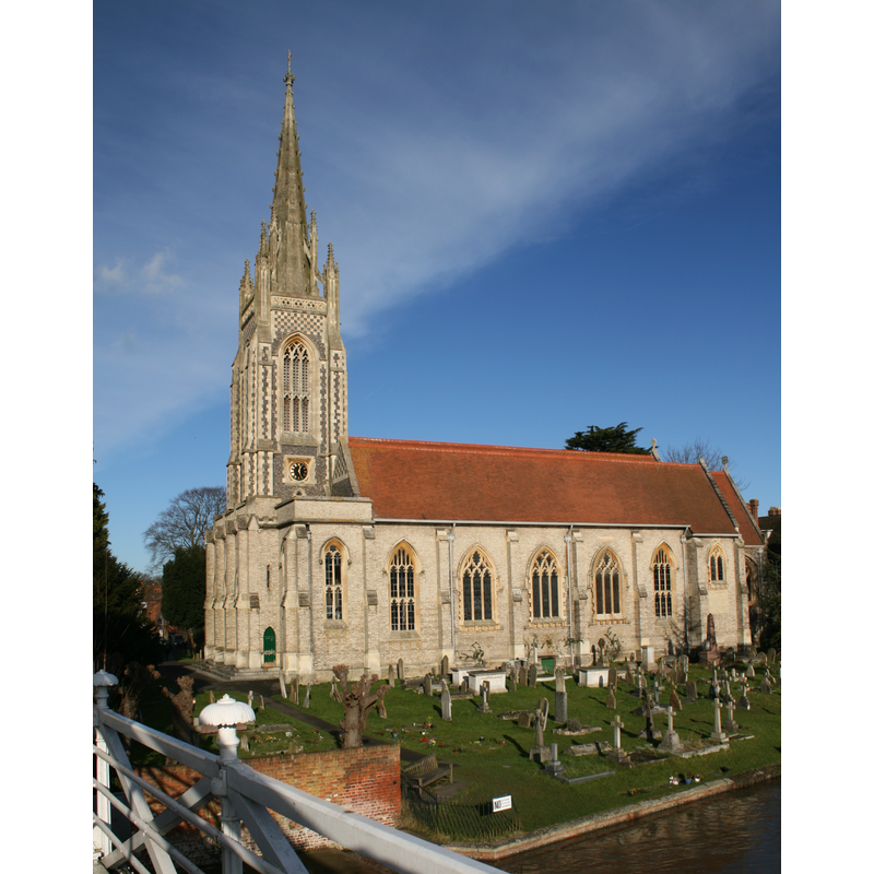
view of church exterior - southwest view
Copyright Statement: Image copyright © Hertzsprung, 2008
Image Source: digital photograph taken 12 January 2008 by Hertzsprung [http://en.wikipedia.org/wiki/File:MarlowAllSaintsChurch.jpeg] [accessed 9 December 2011]
Copyright Instructions: CC-BY-SA-3.0
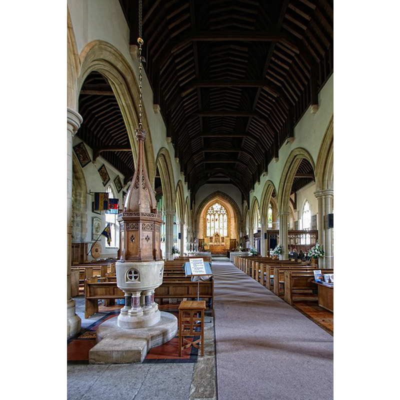
view of church interior - nave - looking west
![the modern font and cover are visible at the far [west] end, by the right [north] arcade](/static-50478a99ec6f36a15d6234548c59f63da52304e5/compressed/1151016011_compressed.png)
Scene Description: the modern font and cover are visible at the far [west] end, by the right [north] arcade
Copyright Statement: Image copyright © Dave Hitchborne, 2013
Image Source: digital photograph taken 13 June 2013 by Dave Hitchborne [www.geograph.org.uk/photo/3651836] [accessed 16 October 2015]
Copyright Instructions: CC-BY-SA-2.0
view of font and cover in context - west side
Scene Description: the modern font and cover at the west end of the nave, looking east
Copyright Statement: Image copyright © Dave Hitchborne, 2013
Image Source: digital photograph taken 13 June 2013 by Dave Hitchborne [www.geograph.org.uk/photo/3652652] [accessed 16 October 2015]
Copyright Instructions: CC-BY-SA-2.0
INFORMATION
Font ID: 17282MAR
Object Type: Baptismal Font1
Font Date: ca. 1100?
Font Century and Period/Style: 11th - 12th century, Norman
Church / Chapel Name: Parish Church of All Saints
Font Location in Church: [cf. FontNotes]
Church Patron Saint(s): All Saints
Church Address: The Causeway, Marlow, Buckinghamshire, SL7 2AA
Site Location: Buckinghamshire, South East, England, United Kingdom
Directions to Site: Located 6-7 km SSW of High Wycombe, 8 km NW of Maidenhead
Ecclesiastic Region: Diocese of Oxford
Historical Region: Hundred of Desborough
Additional Comments: disappeared font? (the one from the ca. 1100 church here)
Font Notes:
Click to view
There are four entries for [Great] Marlow and [Little] Malow [variant spelling] in the Domesday survey [http://opendomesday.org/place/XX0000/marlow-and-little-marlow/] [accessed 16 October 2015], none of which mentions cleric or church in it. Magna Britannia (1806) reported "A neat baptistry was fitted up, and a new marble font given by the late vicar, Dr. Cleobury" in this church [NB: it does not mention the whereabouts of the earlier font]. Sheahan (1862) notes that the "church was rebuilt in 1834, on the site of the old church", and reports a small marble font in it. The Victoria County History (Buckingham, vol. 3, 1925) notes: "Marlow Church was appurtenant to the manor and was bestowed by Robert Fitz Hamon on Tewkesbury Abbey, [...] Henry I confirming the gift after the death of Robert in 1107. [...] It [the modern church] was built in 1832 in place of an earlier church, of which the tower and spire fell on 21 December 1831", but does not mention a font in either of them. The All Saints Marlow site [www.allsaintsmarlow.org/history.asp] notes: "The Parish Church, dedicated to All Saints, was built on the site of an earlier one which was demolished in 1832. The date of erection of the old Church is obscure, but records show that a Church existed here at least as early as 1070 A.D. when Saint Wulfstan, Bishop of Worcester, visited the town." [NB: the present font is modern, probably of the 1832 re-building, the one noted in Magna Britannia and Sheahan above]. Sheahan (1862) notes the Church of the Holy Trinity, also in Marlow, as having been consecrated in 1852 and having an elegant Caen-stone font topped by a carved oak canopy. Holy Trinity's, adds Sheahan (ibid.), "is at present merely a Chapel of Ease to the parish church." Another modern font is noted by Sheahan (ibid.) in the Catholic Church of St. Peter, also of Caen stone and dating from ca. 1846.
COORDINATES
UTM: 30U 654330 5715270
Latitude & Longitude (Decimal): 51.567361, -0.773222
Latitude & Longitude (DMS): 51° 34′ 2.5″ N, 0° 46′ 23.6″ W
REFERENCES
- Victoria County History [online], University of London, 1993-. URL: https://www.british-history.ac.uk.
- Sheahan, James Joseph, History and topography of Buckinghamshire, comprising a general survey of the county, preceded by an epitome of the early history of Great Britain, London; Pontefract: Longman, Green, Longman, and Roberts; William Edward Bonas [...], 1862, p. 895