Little Marlow / Berlaue / Great Marlow / Chepping Marlow / Chipping Marlow / Merelafan / Merlaue / Merlawe
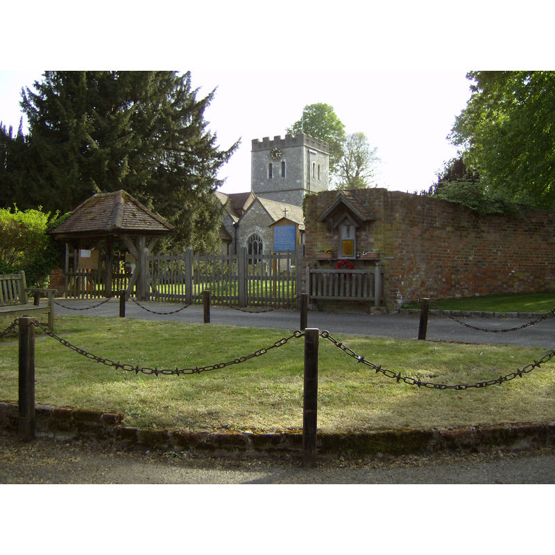
Image copyright © [in the public domain]
Released by its author into the public domain
Results: 3 records
view of church exterior
Copyright Statement: Image copyright © [in the public domain]
Image Source: digital photograph taken 4 May 2007 by Sealman [http://en.wikipedia.org/wiki/File:Little_Marlow_Church.JPG] [accessed 9 December 2011]
Copyright Instructions: Released by its author into the public domain
view of font

Copyright Statement: Image copyright © Ewart White, 2009
Image Source: digital photograph taken 20 June 2009 by Ewart White [http://www.flickr.com/photos/john_field/3645726237/] [accessed 9 December 2011]
Copyright Instructions: PERMISSION NOT AVAILABLE -- IMAGE NOT FOR PUBLIC USE
view of font in context
Copyright Statement: Image copyright © Guy Wynter, 2008
Image Source: digital photograph taken 5 April 2008 by Guy Wynter [http://www.flickr.com/photos/25174693@N02/2389649686/]
Copyright Instructions: PERMISSION NOT AVAILABLE -- IMAGE NOT FOR PUBLIC USE
INFORMATION
Font ID: 17281MAR
Object Type: Baptismal Font1
Font Century and Period/Style: 12th century [basin only], Medieval [composite]
Church / Chapel Name: Parish Church of St. John the Baptist
Font Location in Church: Inside the church
Church Patron Saint(s): St. John the Baptist
Church Address: Church Lane, Little Marlow, Buckinghamshire, SL7 3RT
Site Location: Buckinghamshire, South East, England, United Kingdom
Directions to Site: Located 2 km E of Marlow [i.e., Great Marlow]
Ecclesiastic Region: Diocese of Oxford
Historical Region: Hundred of Desborough
Additional Comments: altered font (only the basin is 12th-century; the base is modern)
Font Notes:
Click to view
There are four entries for [Great] Marlow and [Little] Malow [variant spelling] in the Domesday survey [http://opendomesday.org/place/XX0000/marlow-and-little-marlow/] [accessed 16 October 2015], none of which mentions cleric or church in it. Sheahan (1862) notes: "The font is large, ancient, circular, and plain, and has a handsome modern canopy cover." The RCAHM (1912) reports a font of the 12th century in this church. The Victoria County History (Buckingham, vol. 3, 1925) notes: "The south wall of the chancel and the chapel date from the end of the 12th century, which was probably the original date of the nave [...] Modern restorations were effected in 1866, when a gallery and high pews were taken out, and in 1902 [...] The lower part of the font is modern, but the circular bowl appears to be of the 12th century."
COORDINATES
UTM: 30U 656581 5717002
Latitude & Longitude (Decimal): 51.5823, -0.74
Latitude & Longitude (DMS): 51° 34′ 56.28″ N, 0° 44′ 24″ W
MEDIUM AND MEASUREMENTS
Material: stone
Font Shape: bucket-shaped, mounted
Basin Interior Shape: round
Basin Exterior Shape: round
Drainage Notes: lead-lined
LID INFORMATION
Date: modern
Material: wood
Apparatus: no
Notes: octagonal and flat, decorated with metal and ring handle
REFERENCES
- Victoria County History [online], University of London, 1993-. URL: https://www.british-history.ac.uk.
- Great Britain. Royal Commission on Historical Monuments (England), An inventory of the historical monuments in Buckinghamshire, London: H.M. Stationary Office, 1912-, vol. 1: 231
- Sheahan, James Joseph, History and topography of Buckinghamshire, comprising a general survey of the county, preceded by an epitome of the early history of Great Britain, London; Pontefract: Longman, Green, Longman, and Roberts; William Edward Bonas [...], 1862, p. 904