Chesterton nr. Cambridge / Cestretone / Cestretune
Results: 2 records
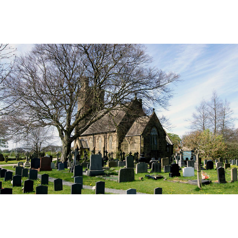
view of church exterior in context - southwest view
Scene Description: Source caption: "Chesterton: St Andrew. A view from the edge of the churchyard on a February afternoon of high cloud and intermittent sunshine. In 1954, Nikolaus Pevsner thought "the church is still a village church in a village setting, away from the main traffic and with various old houses around". The village setting has changed a lot in the sixty years since then."
design element - motifs - moulding


INFORMATION
Font ID: 17253CHE
Object Type: Baptismal Font1
Font Century and Period/Style: 13th century, Early English
Church / Chapel Name: Parish Church of St. Andrew
Font Location in Church: Inside the church
Church Patron Saint(s): St. Andrew
Church Address: St Andrew's Road, Cambridge CB4 1DT
Site Location: Cambridgeshire, East, England, United Kingdom
Directions to Site: Located just NE of Cambridge, N of the river Cam, E of Castle Hill, now a suburb
Ecclesiastic Region: Diocese of Ely
Historical Region: Hundred of Chesterton
Additional Comments: disappeared font? (the one from the Domesday-time church here)
Font Notes:
Click to view
There is an entry for this Chesterton [variant spelling] in the Domesday survey [http://opendomesday.org/place/TL4659/chesterton/] [accessed 28 June 2016]; it mentions a priest and 0.25 church lands in it, but not a church, thogh there must have been one there at the time. The RCHM (Cambridge, 1959) notes a medieval church of the mid 13th-century here, and a font "plain octagonal stone bowl with moulded underedge, octagonal stem and octagonal to square base, on modern step, 13th-century." The Victoria County History (Cambridge…, vol. 9, 1989) notes: "The patronage of the parish church at first belonged with the manor to the king, who still presented in the 1190s […] From a possibly cruciform 13th-century predecessor it has retained the wide chancel arch, the splays, later built up, of the east windows of the aisles, and the east and west responds of an earlier nave south arcade, apparently as long as the present one. There also survives the plain octagonal font". [NB: the churches of St. Luke, St. George and the Good Shepherd are modern].
COORDINATES
UTM: 31U 304626 5788868
Latitude & Longitude (Decimal): 52.215555, 0.140025
Latitude & Longitude (DMS): 52° 12′ 56″ N, 0° 8′ 24.09″ E
MEDIUM AND MEASUREMENTS
Material: stone
Font Shape: octagonal, mounted
Basin Interior Shape: round
Basin Exterior Shape: octagonal
REFERENCES
- Victoria County History [online], University of London, 1993-. URL: https://www.british-history.ac.uk.
- Great Britain. Royal Commission on Historical Monuments (England), An Inventory of the Historical Monuments in the city of Cambridge, London: H.M. Stationary Office, 1959, vol. 2: 293