Cambridge No. 15 / Grentebrige
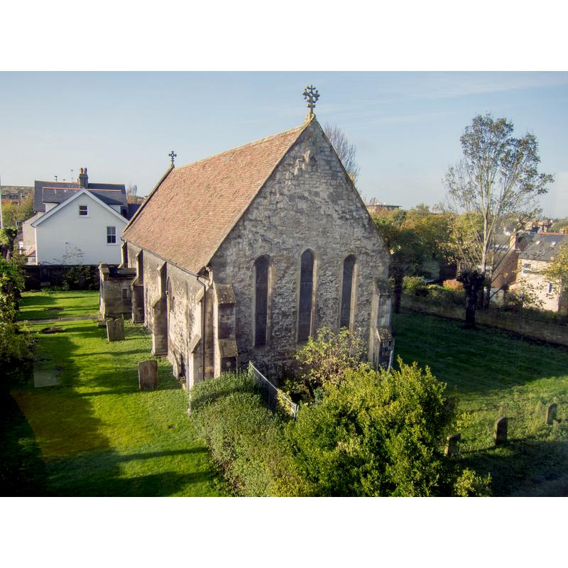
Image copyright © Kim Fyson, 2013
CC-BY-SA-2.0
Results: 2 records
view of church exterior - southeast view
Copyright Statement: Image copyright © Kim Fyson, 2013
Image Source: digital photograph taken 12 November 2013 by Kim Fyson [www.geograph.org.uk/photo/3971277] [accessed 30 March 2016]
Copyright Instructions: CC-BY-SA-2.0
view of church exterior - southwest view
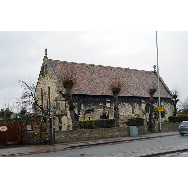
Scene Description: Source caption: "Church of St Andrew the Less. The church is originally associated with Barnwell Priory and was built in the 11/12 th century. The present small building dates from the 13th century."
Copyright Statement: Image copyright © N Chadwick, 2015
Image Source: digital photograph taken 16 February 2015 by N Chadwick [www.geograph.org.uk/photo/4378395] [accessed 30 March 2016]
Copyright Instructions: CC-BY-SA-2.0
INFORMATION
Font ID: 17251CAM
Object Type: Baptismal Font1
Font Century and Period/Style: 13th century, Early English
Church / Chapel Name: Parish Church of St. Andrew the Less
Font Location in Church: Inside the church
Church Patron Saint(s): St. Andrew
Church Notes: original church may have been 11thC; present church 13thC with 19thC renovation
Church Address: 153 Newmarket Road, Cambridge CB5 8JE
Site Location: Cambridgeshire, East, England, United Kingdom
Directions to Site: Located on the N side of Newmarket Road
Ecclesiastic Region: Diocese of Ely
Historical Region: Hundred of Cambridge
Font Notes:
Click to view
Noted in the RCHM (Cambridge, 1959): "Font: of limestone, plain octagonal bowl and stem with moulded base, 13th-century." The Victoria County History (Cambridge..., vol. 3, 1959) notes: "ST. ANDREW THE LESS is not mentioned in the survey of 1279. It belonged to the Austin Canons of Barnwell, and has long been known as 'the Abbey Church', but it appears to have served as parish church to the straggling suburb along the Newmarket Road even before the Dissolution. The present building belongs to the early 13th century; it may have been erected for the use of the parishioners so that the canons could have the exclusive use of their own church. [...] It is probably the 'chapel of St. Andrew' mentioned in 1274 as giving sanctuary to a fugitive"; no font mentioned in the VCH entry.
COORDINATES
UTM: 31U 304575 5788130
Latitude & Longitude (Decimal): 52.208906, 0.139706
Latitude & Longitude (DMS): 52° 12′ 32.06″ N, 0° 8′ 22.94″ E
MEDIUM AND MEASUREMENTS
Material: stone, limestone
Font Shape: octagonal, mounted
Basin Interior Shape: round
Basin Exterior Shape: octagonal
REFERENCES
- Victoria County History [online], University of London, 1993-. URL: https://www.british-history.ac.uk.
- Great Britain. Royal Commission on Historical Monuments (England), An Inventory of the Historical Monuments in the city of Cambridge, London: H.M. Stationary Office, 1959, vol. 2: 263