Cambridge No. 13 / Grentebrige
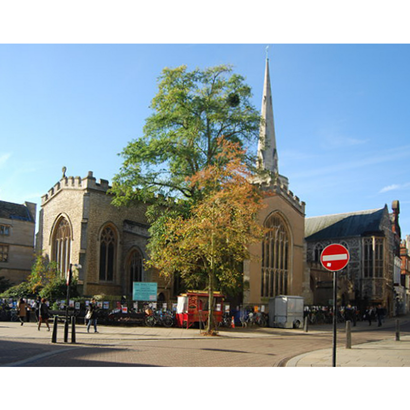
Image copyright © N Chadwick, 2014
CC-BY-SA-2.0
Results: 2 records
view of church exterior - northeast view
Copyright Statement: Image copyright © N Chadwick, 2014
Image Source: digital photograph taken 5 October 2014 by N Chadwick [www.geograph.org.uk/photo/4243208] [accessed 29 March 2016]
Copyright Instructions: CC-BY-SA-2.0
view of church interior - nave - looking east
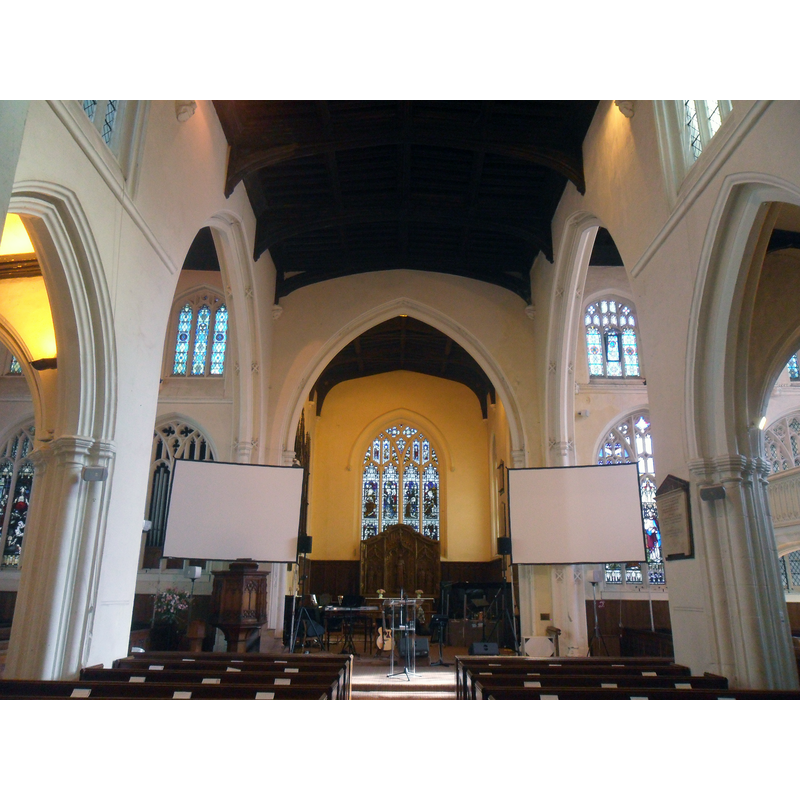
Copyright Statement: Image copyright © Ben, 2012
Image Source: digital photograph taken 4 October 2012 by Ben [www.geograph.org.uk/photo/3166202] [accessed 29 March 2016]
Copyright Instructions: CC-BY-SA-2.0
INFORMATION
Font ID: 17249YOR
Object Type: Baptismal Font1
Font Century and Period/Style: 14th - 15th century, Medieval
Church / Chapel Name: Parish Church of the Holy Trinity
Font Location in Church: [cf. FontNotes]
Church Patron Saint(s): The Holy Trinity
Church Address: Market Street, Cambridge CB2 3PA -- Tel.: +44 1223 355397
Site Location: Cambridgeshire, East, England, United Kingdom
Directions to Site: Located on the W side of Sidney Street, Cambridge city centre
Additional Comments: disappeared font?: the one from the 12th-century church? -- disused font: in the churchyard in 1959
Font Notes:
Click to view
There are five entries for Cambridge [variant spelling] in the Domesday survey [http://opendomesday.org/place/TL4458/cambridge/] [accessed 29 March 2016], none of which mentions cleric or church in it. The RCHM (Cambridge, 1959) notes the old church here may have been destroyed in the fire of 1174, and mentions a font in the churchyard, "octagonal bowl with moulded underedge, plain stem and chamfered base, 14th or 15th-century, worn and patched". The Victoria County History (Cambridge..., vol. 3, 1959) notes: "This church is first mentioned in 1174 when it is said to have been burnt down, but no part of the present fabric goes back to the 12th century. Parts of the tower and chancel are late 13thcentury work; large-scale rebuilding took place in the 14th century"; no font mentioned in the VCH entry.
COORDINATES
UTM: 31U 303232 5787852
Latitude & Longitude (Decimal): 52.205931, 0.120243
Latitude & Longitude (DMS): 52° 12′ 21.35″ N, 0° 7′ 12.88″ E
MEDIUM AND MEASUREMENTS
Material: stone
Font Shape: octagonal, mounted
Basin Interior Shape: round
Basin Exterior Shape: octagonal
REFERENCES
- Victoria County History [online], University of London, 1993-. URL: https://www.british-history.ac.uk.
- Great Britain. Royal Commission on Historical Monuments (England), An Inventory of the Historical Monuments in the city of Cambridge, London: H.M. Stationary Office, 1959, vo. 2: 259