Amport / Andeporte / Anne / Anne de Port / Aneport
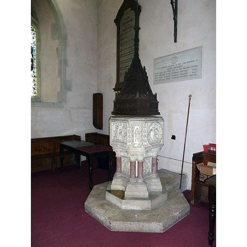
Image copyright © Basher Eyre, 2011
CC-BY-SA-2.0
Results: 2 records
view of font and cover
Scene Description: the modern font
Copyright Statement: Image copyright © Basher Eyre, 2011
Image Source: digital photograph taken 9 August 2011 by Basher Eyre [www.geograph.org.uk/photo/2547932] [accessed 28 August 2018]
Copyright Instructions: CC-BY-SA-2.0
view of church exterior - south view
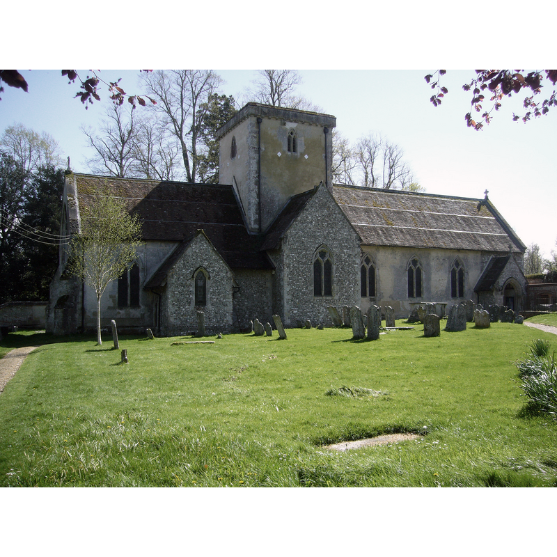
Copyright Statement: Image copyright © Cuthbert Pullar, 2014
Image Source: digital photograph taken 26 April 2014 by Cuthbert Pullar [https://commons.wikimedia.org/wiki/File:Amport_Parish_Church_April_2014.JPG] [accessed 28 August 2018]
Copyright Instructions: CC-BY-SA-3.0
INFORMATION
Font ID: 17215AMP
Object Type: Baptismal Font1?
Font Century and Period/Style: 14th century, Medieval
Church / Chapel Name: Parish Church of St. Mary
Font Location in Church: [cf. FontNotes]
Church Patron Saint(s): St. Mary the Virgin
Church Address: Amport, Andover SP11 8BW, UK
Site Location: Hampshire, South East, England, United Kingdom
Directions to Site: Located off (S) the A303, 7 km W of Andover
Ecclesiastic Region: Diocese of Winchester
Historical Region: Hundred of Andover
Additional Comments: disappeared font? (the one from the medieval church here)
Font Notes:
Click to view
There are two entries for Amport [variant spelling] in the Domesday survey [http://opendomesday.org/place/SU2944/amport/] [accessed 28 August 2018], neither of which mentions cleric or church in it. White (1878) reports "a very handsome carved stone font with elaborate cover", and appears to indicate that it was introduced in the 1870 restoration of this church. The Victoria County History (Hampshire, vol. 4, 1911) notes: "Richard le Poor, Bishop of Chichester (1215–17), acquired the church of Amport, [...] no doubt from Adam de Port, in whose gift it was, in 1209 [...] The history of the [present] building is confined to the 14th century and modern rebuilding. The chancel, tower and south transept are the only complete parts of the old church, and these date from about 1320–30." There is no mention of a font in the VCH. The British Listed Buildings database entry [http://www.britishlistedbuildings.co.uk/en-140013-church-of-st-mary-amport] notes: "Parish church. c1320, restoration of 1866 by Slater & Carpenter [...] The font is an elaborate 'Perpendicular' design of 1865 with a wood cover." Plans for modifications of this church which include moving the font were being considered in 2009 [cf. www.amportvillage.co.uk/church_ext/church_extensions0506.htm]. The modern font is located at the west end of the nave [NB: we have no information on the earlier font(s) of this church]
COORDINATES
UTM: 30U 599706 5672667
Latitude & Longitude (Decimal): 51.1967, -1.573
Latitude & Longitude (DMS): 51° 11′ 48.12″ N, 1° 34′ 22.8″ W
MEDIUM AND MEASUREMENTS
Material: stone
LID INFORMATION
Date: 19th-century?
Material: wood
Notes: [cf. FontNotes]
REFERENCES
- Victoria County History [online], University of London, 1993-. URL: https://www.british-history.ac.uk.
- White, William, History, gazetteer and directory of the County of Hampshire including the Isle of Wight, and [...], Sheffield: William White, 1878, p. 112