Hinton Ampner / Henton / Hentune / Hinton Amner
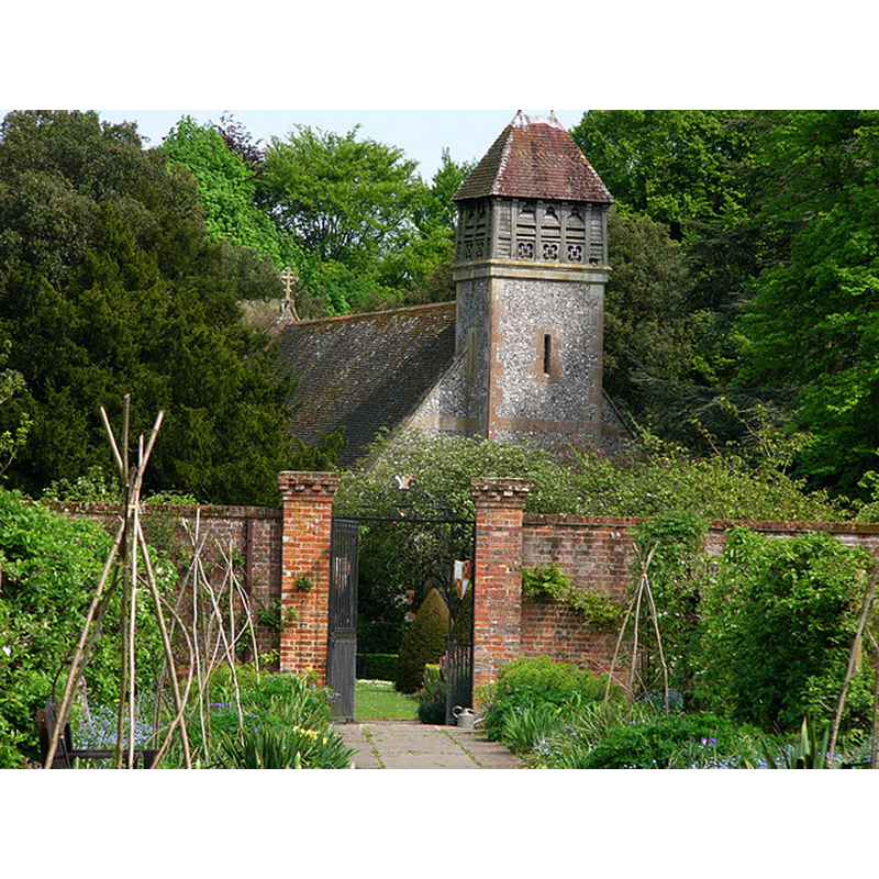
Image copyright © Chris Gunns, 2008
CC-BY-SA-2.0
Results: 4 records
view of church exterior - northwest view
Copyright Statement: Image copyright © Chris Gunns, 2008
Image Source: digital photograph taken 10 May 2008 by Chris Gunns [www.geograph.org.uk/photo/796187] [accessed 16 September 2016]
Copyright Instructions: CC-BY-SA-2.0
view of church exterior - southeast view
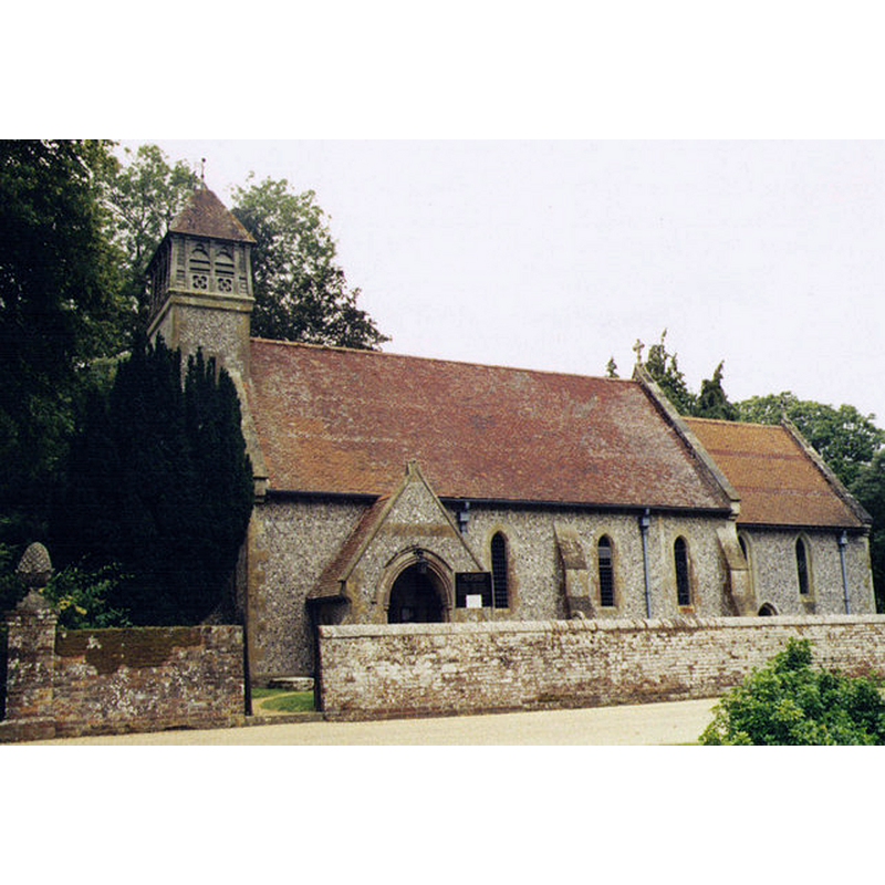
Copyright Statement: Image copyright © Michael Ford, 2009
Image Source: digital photograph taken in 2006 by Michael Ford [www.geograph.org.uk/photo/1503272] [accessed 16 September 2016]
Copyright Instructions: CC-BY-SA-2.0
view of church interior - nave - looking east
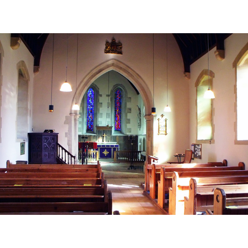
Copyright Statement: Image copyright © Nick Macneill, 2012
Image Source: digital photograph taken 1 March 2012 by nick macneill [www.geograph.org.uk/photo/2850482] [accessed 16 September 2016]
Copyright Instructions: CC-BY-SA-2.0
view of font in context
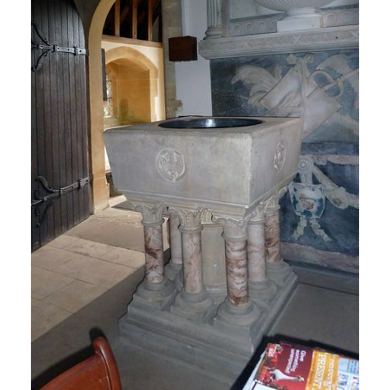
Scene Description: the modern font
Copyright Statement: Image copyright © Basher Eyre, 2010
Image Source: digital photograph taken 13 November 2010 by Basher Eyre [www.geograph.org.uk/photo/2160093] [accessed 16 September 2016]
Copyright Instructions: CC-BY-SA-2.0
INFORMATION
Font ID: 17214HIN
Object Type: Baptismal Font1, base only?
Font Century and Period/Style: 11th century, Pre-Conquest? / Norman
Church / Chapel Name: Parish Church of All Saints
Font Location in Church: [cf. FontNotes]
Church Patron Saint(s): All Saints
Church Address: Hinton Hill, Bramdean, Hampshire SO24 0LA
Site Location: Hampshire, South East, England, United Kingdom
Directions to Site: Located off (S) the A272. just W of Bramdean, ESE of Winchester
Ecclesiastic Region: Diocese of Winchester
Historical Region: Hundred of Fawley -- Hundred of Mansbridge [in Domesday]
Additional Comments: disused font: only the base remains -- disappeared font? (the one from the Domesday-time church here?)
Font Notes:
Click to view
There is an entry for Hinton [Ampner] [variant spelling] in the Domesday survey [http://domesdaymap.co.uk/place/] [accessed 16 August 2017]; it mentions a church in it. The Victoria County History (Hampshire, vol. 3, 1908) notes: "The church of All Saints has suffered from 'restoration' more severely than many of its neighbours [...] but is still of great interest as preserving its pre-Conquest plan and a few details of that date [...] the font, near the south door of the nave, is modern. The English Heritage entry for Hinton Ampner [Listing NGR: SU6172227506] (1955) notes: "In vestry base of old font."
COORDINATES
UTM: 30U 629711 5656360
Latitude & Longitude (Decimal): 51.044119, -1.149648
Latitude & Longitude (DMS): 51° 2′ 38.83″ N, 1° 8′ 58.73″ W
REFERENCES
- Victoria County History [online], University of London, 1993-. URL: https://www.british-history.ac.uk.