Bullington / Bolende / Bolendon / Bolyndene / Bulandun / Bulendun / Bullington nr. Andover
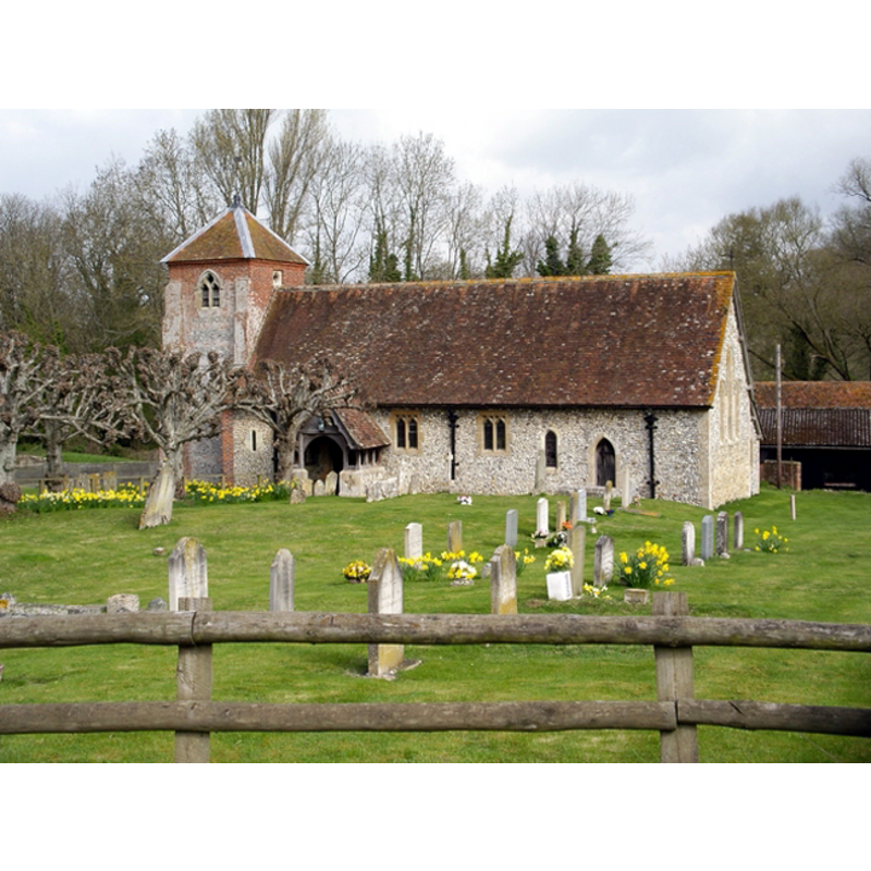
Image copyright © Peter Jordan, 2006
CC-BY-SA-3.0
Results: 2 records
view of church exterior - south view
Copyright Statement: Image copyright © Peter Jordan, 2006
Image Source: digital photograph taken 18 April 2006 by Peter Jordan [www.geograph.org.uk/photo/155273] [accessed 2 August 2011]
Copyright Instructions: CC-BY-SA-3.0
view of font in context

Scene Description: the font in the space beneath the tower
Copyright Statement: Image copyright © K. Kousseff, 2011
Image Source: digital photograph by K Kousseff (?) [www.achurchnearyou.com/album.php?V=18358] and [http://www.achurchnearyou.com/photo_gallery/kkousseff_18358_1304677458_750.jpg]
Copyright Instructions: PERMISSION NOT AVAILABLE -- IMAGE NOT FOR PUBLIC USE
INFORMATION
Font ID: 17211BUL
Object Type: Baptismal Font1
Font Century and Period/Style: 13th century [basin only] [composite font], Medieval [composite]
Church / Chapel Name: Parish Church of St. Michael and All Angels
Font Location in Church: Inside the church, at the W end, beneath the tower
Church Patron Saint(s): St. Michael & All Angels
Church Address: Bullington Lane, Bullington, Winchester SO21 3RE, UK
Site Location: Hampshire, South East, England, United Kingdom
Directions to Site: Located off (W) the A34, 15 km ESE of Andover
Ecclesiastic Region: Diocese of Winchester
Historical Region: Hundred of Wherwell
Additional Comments: disused font (found in a farmyard) / restored font / altered font: stem and base are modern
Font Notes:
Click to view
No individual entry found for this Bullington in the Domesday survey. White (1878) notes: "The ancient font-bowl, rescued by the vicar from a farmyard, stands in the tower on a new stone base." The Victoria County History (Hampshire, vol. 4, 1911) has: "The nave [...] dates from the latter part of the 12th century, two small windows near the west end and the north doorway being of that date; the chancel was rebuilt about 1220 [...] The font, which stands in the tower, has an old round bowl probably of 13th-century date on a modern stem and base." The entry for this church in Historic England [Listing NGR: SP3767439287] mentions no font in it. The wooden cover is round and flat; appears modern. The entry for this church in the CRSBI (2018) notes: "Bullington was held by the Benedictine nunnery of Wherwell before and after the Conquest. It was assessed at 10 hides and the 1086 entry notes a mill but does not record a church."
COORDINATES
UTM: 30U 615349 5669862
Latitude & Longitude (Decimal): 51.16855, -1.3501
Latitude & Longitude (DMS): 51° 10′ 6.78″ N, 1° 21′ 0.36″ W
MEDIUM AND MEASUREMENTS
Material: stone
Font Shape: tub-shaped, mounted
Basin Interior Shape: round
Basin Exterior Shape: round
LID INFORMATION
Date: modern?
Material: wood, oak?
Apparatus: no
Notes: [cf. FontNotes]
REFERENCES
- Castilla y León: paisaje, arte, historia y tradición, León: Edilesa, 1999, [http://www.british-history.ac.uk/report.aspx?compid=56841] [accessed 18 January 2011]
- White, William, History, gazetteer and directory of the County of Hampshire including the Isle of Wight, and [...], Sheffield: William White, 1878, p. 179