Easton nr. Winchester / Estune
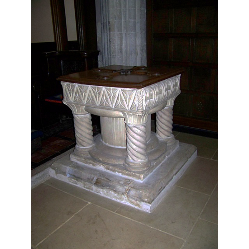
Image copyright © Trish Steel, 2009
CC-BY-SA-3.0
Results: 4 records
view of font and cover
Scene Description: the 19th-century font and cover [cf. FontNotes]
Copyright Statement: Image copyright © Trish Steel, 2009
Image Source: digital photograph taken 30 May 2009 by Trish Steel [www.geograph.org.uk/photo/1327870] [accessed 18 August 2011]
Copyright Instructions: CC-BY-SA-3.0
view of church exterior - south door
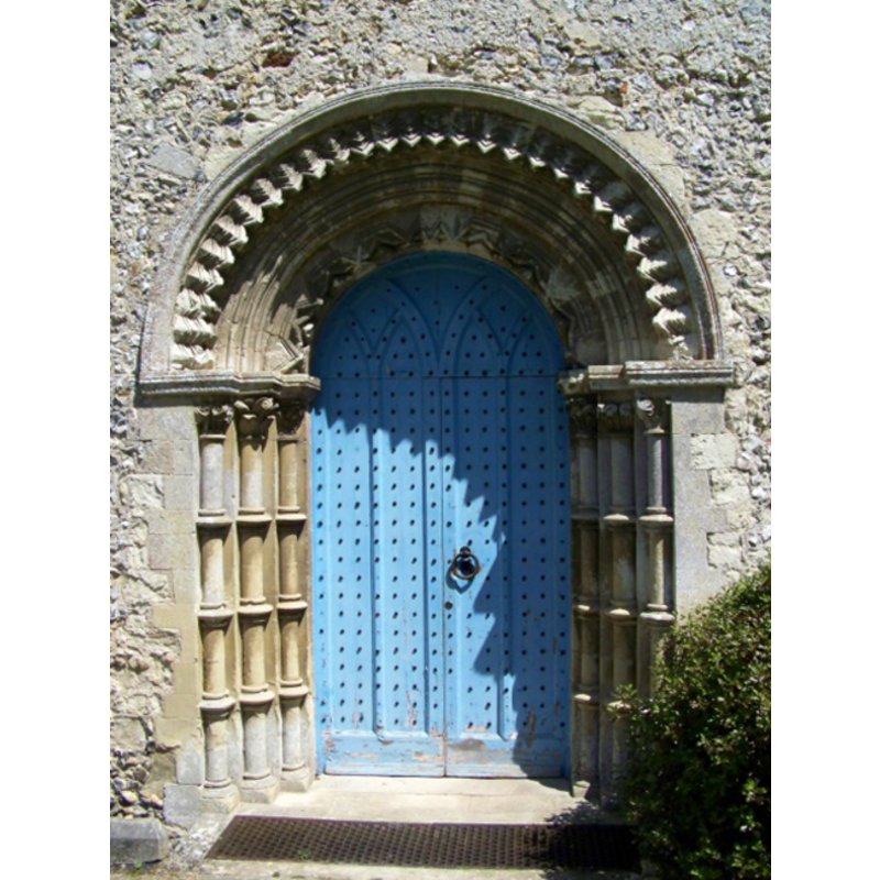
Copyright Statement: Image copyright © Trish Steel, 2009
Image Source: digital photograph taken 30 May 2009 by Trish Steel [www.geograph.org.uk/photo/1327854] [accessed 18 August 2011]
Copyright Instructions: CC-BY-SA-3.0
view of church exterior - south view
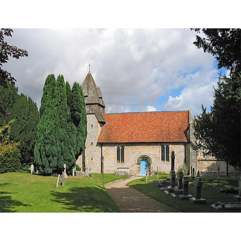
Copyright Statement: Image copyright © Peter Facey, 2006
Image Source: digital photograph taken 28 August 2006 by Peter Facey [www.geograph.org.uk/photo/227700] [accessed 18 August 2011]
Copyright Instructions: CC-BY-SA-3.0
view of church interior - nave - looking east
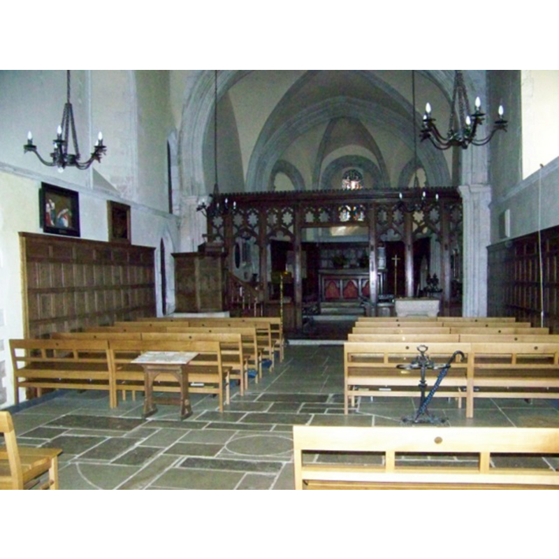
Scene Description: the top of the modern font is visible on the right (south) side, at the back (east), this side of the chancel screen
Copyright Statement: Image copyright © Trish Steel, 2009
Image Source: digital photograph taken 30 May 2009 by Trish Steel [www.geograph.org.uk/photo/1327947] [accessed 18 August 2011]
Copyright Instructions: CC-BY-SA-3.0
INFORMATION
Font ID: 17207EAS
Object Type: Baptismal Font1
Font Century and Period/Style: 12th - 13th century, Medieval
Church / Chapel Name: Parish Church of St. Mary
Font Location in Church: Reported ca. 1878 inside the curch, beneath the tower arch [cf. FontNotes]
Church Patron Saint(s): St. Mary the Virgin
Church Address: Easton, Winchester SO21 1EH, UK
Site Location: Hampshire, South East, England, United Kingdom
Directions to Site: Located off (SE) the M3-B3047 crossroads, 4-5 km NNE of Winchester
Ecclesiastic Region: Diocese of Winchester
Historical Region: Hundred of Fawley
Additional Comments: disappeared font? (from the two Domesday-time church here?)
Font Notes:
Click to view
There is an entry for this Easton [variant spelling] in the Domesday survey [http://opendomesday.org/place/SU5132/easton/] [accessed 3 July 2018]; it reports two churches in it. The National Gazetteer of 1868 reports "a curiously carved font" here. White (1878) notes: "The Norman font has been placed under the tower arch." [NB: the church itself is described in White (ibid.) as a curious blend of Norman and Early English architecture]. The Victoria County History (Hampshire, vol. 3, 1908) notes: "At the time of the Domesday Survey there were two chapels at Easton in the possession of the bishop (fn. 30) The advowson of Easton was in the hands of the bishop of Winchester until the year 1885. [...] The church of Our Lady is a very valuable example of a small parish church of c. 1170"; a modern font is noted inside the church, but there is no mention in the VCH entry of a medieval font. The modern font is based on a popular font type of the 12th century, the 'table-top' design on five supports, the basic desing of most of the Tournai fonts as well; it is a decent rendition of the classic design, although the motifs on the basin sides are modern in character. [NB: we have not been able to find recent sources of information on the old font, claimed by Whte [cf. supra] to be located under the tower arch. The modern font is located towards the centre of the nave].
COORDINATES
UTM: 30U 620882 5660947
Latitude & Longitude (Decimal): 51.08727, -1.274
Latitude & Longitude (DMS): 51° 5′ 14.17″ N, 1° 16′ 26.4″ W
MEDIUM AND MEASUREMENTS
Material: stone
REFERENCES
- The National Gazetteer: a Topographical Dictionary of the British Isles, London: Virtue & Co., 1868
- Victoria County History [online], University of London, 1993-. URL: https://www.british-history.ac.uk.
- White, William, History, gazetteer and directory of the County of Hampshire including the Isle of Wight, and [...], Sheffield: William White, 1878, p. 216