Forton
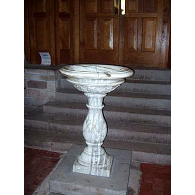
Image copyright © Craig Thornber, 2005
Standing permission
Results: 2 records
view of font
Scene Description: the 18th-century font
Copyright Statement: Image copyright © Craig Thornber, 2005
Image Source: digital photograph taken 28 May 2005 by Craig Thornber [http://www.thornber.net/staffs/html/forton.html] [standing permission]
Copyright Instructions: Standing permission
view of church exterior - southeast view
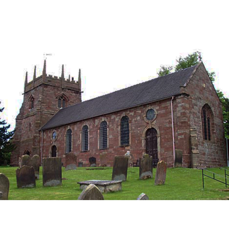
Copyright Statement: Image copyright © Craig Thornber, 2005
Image Source: digital photograph taken 28 May 2005 by Craig Thornber [http://www.thornber.net/staffs/html/forton.html] [standing permission]
Copyright Instructions: Standing permission
INFORMATION
Font ID: 17205FOR
Object Type: Baptismal Font1
Font Century and Period/Style: 10th - 11th century, Pre-Conquest
Church / Chapel Name: Parish Church of All Saints
Font Location in Church: [cf. FontNotes]
Church Patron Saint(s): All Saints
Church Address: Forton, Newport TF10 8BY, UK -- Tel.: +44 1952 820080
Site Location: Staffordshire, West Midlands, England, United Kingdom
Directions to Site: Located off the A519, 2-3 km NNE of Newport and the Shropshire border
Ecclesiastic Region: Diocese of Lichfield
Additional Comments: broken font? fragment? Disappeared font? (the one reported in SNAP [cf. FontNotes] as Saxon)
Font Notes:
Click to view
No entry for this Forton found in the Domesday survey. The SNAP Newport History Society entry for Forton Hall and All Saints Church reports "remains of a Saxon font" in the church [http://www.discovershropshire.org.uk/html/search/verb/GetRecord/resource:20081127081008]. The Staffordshire Past-Track site [http://www.search.staffspasttrack.org.uk/engine/resource/default.asp?resource=3711], however, mentions only "a white marble font, dated 1723" in this church.
COORDINATES
UTM: 30U 542837 5848841
Latitude & Longitude (Decimal): 52.78768, -2.3648
Latitude & Longitude (DMS): 52° 47′ 15.65″ N, 2° 21′ 53.28″ W
MEDIUM AND MEASUREMENTS
Material: stone
Number of Pieces: fragment?