Houghton nr. Stockbridge / Holstune / Houetun
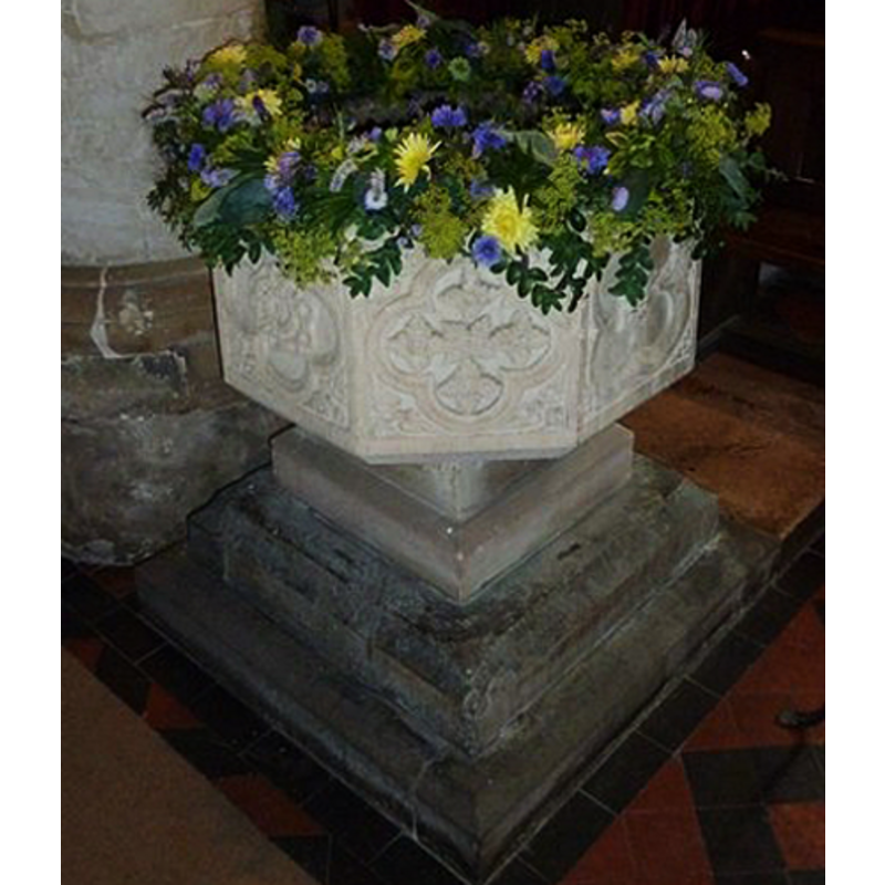
Image copyright © Basher Eyre, 2011
CC-BY-SA-2.0
Results: 3 records
view of font
Scene Description: the re-cut font
Copyright Statement: Image copyright © Basher Eyre, 2011
Image Source: detail of a digital photograph taken 30 June 2011 by Basher Eyre [www.geograph.org.uk/photo/2519773] [accessed 4 August 2011]
Copyright Instructions: CC-BY-SA-2.0
view of font in context
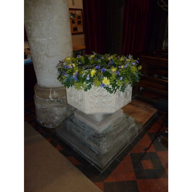
Scene Description: the re-cut font
Copyright Statement: Image copyright © Basher Eyre, 2011
Image Source: digital photograph taken 30 June 2011 by Basher Eyre [www.geograph.org.uk/photo/2519773] [accessed 4 August 2011]
Copyright Instructions: CC-BY-SA-2.0
view of church exterior - southwest end
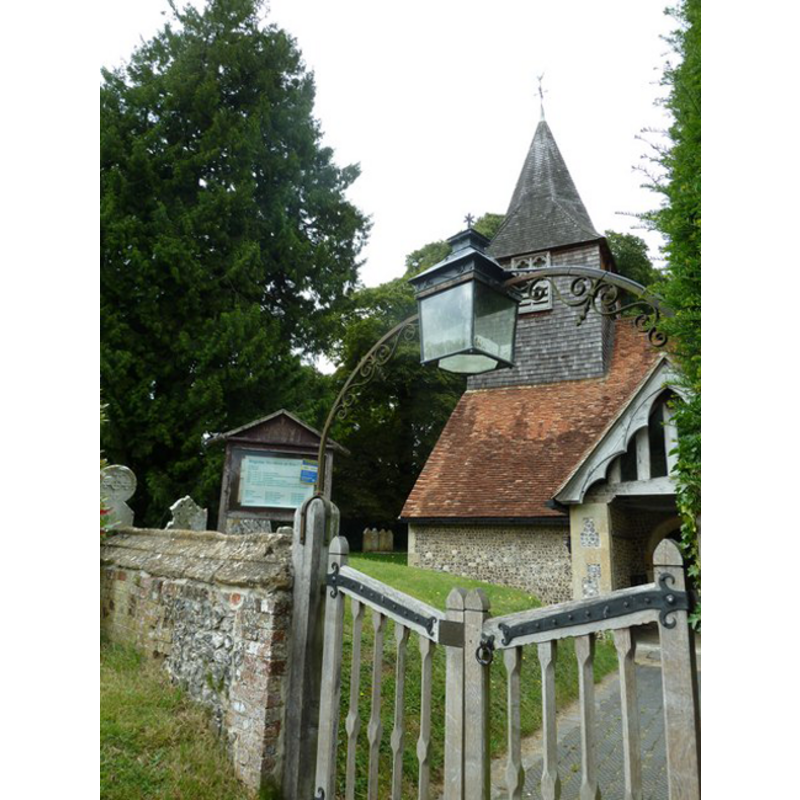
Copyright Statement: Image copyright © Basher Eyre, 2011
Image Source: digital photograph taken 30 June 2011 by Basher Eyre [www.geograph.org.uk/photo/2519771] [accessed 4 August 2011]
Copyright Instructions: CC-BY-SA-2.0
INFORMATION
Font ID: 17202HOU
Object Type: Baptismal Font1
Font Century and Period/Style: 12th century [re-cut], Medieval [altered]
Church / Chapel Name: Parish Church of All Saints
Font Location in Church: Inside the church
Church Patron Saint(s): All Saints
Church Address: Church Road, Houghton, Stockbridge SO20 6LJ , UK
Site Location: Hampshire, South East, England, United Kingdom
Directions to Site: Located off (W) the A3057, 3 km SW of Stockbridge
Ecclesiastic Region: Diocese of Winchester
Historical Region: Hundred of Buddlesgate -- Hundred of Somborne [in Domeday]
Additional Comments: altered font (re-cut font; the present font here) -- disappeared fonts (two, from the two Domesday-time churches here)
Font Notes:
Click to view
There are five entries for this Houghton [variant spellings] in the Domesday survey [http://opendomesday.org/place/SU3432/houghton/] [accessed 17 July 2018], one of which reports "2 churches. 1.75 church lands" in it. White (1878) reports: "The font is as old as the 12th century." The Victoria County History (Hampshire, vol. 3, 1908) notes: "Some pieces of twelfth-century detail, belonging to the first half of the century, and including the head of a small window, are built into the east wall of the south aisle, and there is other evidence that a church was on this site at the time [...] The font is old but reworked, with a panelled bowl and a square base of Purbeck marble". The entry for this church in Historic England [Listing NGR: SU3418432646] [accessed 17 July 2018] reports: "Font C15 recut octagonal carved bowl on square 4 step base."
COORDINATES
UTM: 30U 604061 5661217
Latitude & Longitude (Decimal): 51.093, -1.514
Latitude & Longitude (DMS): 51° 5′ 34.8″ N, 1° 30′ 50.4″ W
MEDIUM AND MEASUREMENTS
Material: stone, limestone (Purbeck marble)
Font Shape: octagonal, mounted
Basin Interior Shape: round
Basin Exterior Shape: octagonal
REFERENCES
- Victoria County History [online], University of London, 1993-. URL: https://www.british-history.ac.uk.
- White, William, History, gazetteer and directory of the County of Hampshire including the Isle of Wight, and [...], Sheffield: William White, 1878, p. 291