Nately Scures / Nateley Scures / Scures / Skewers
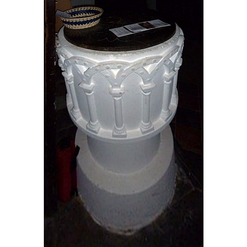
Image copyright © Basher Eyre, 2011
CC-BY-SA-2.0
Results: 5 records
view of font and cover - upper view
Scene Description: according to the VCH entry, "The font is circular and of late date and a poor imitation of 12th-century work."
Copyright Statement: Image copyright © Basher Eyre, 2011
Image Source: digital photograph taken 30 November 2011 by Basher Eyre [www.geograph.org.uk/photo/2715854] [accessed 8 August 2018]
Copyright Instructions: CC-BY-SA-2.0
view of church exterior - north view
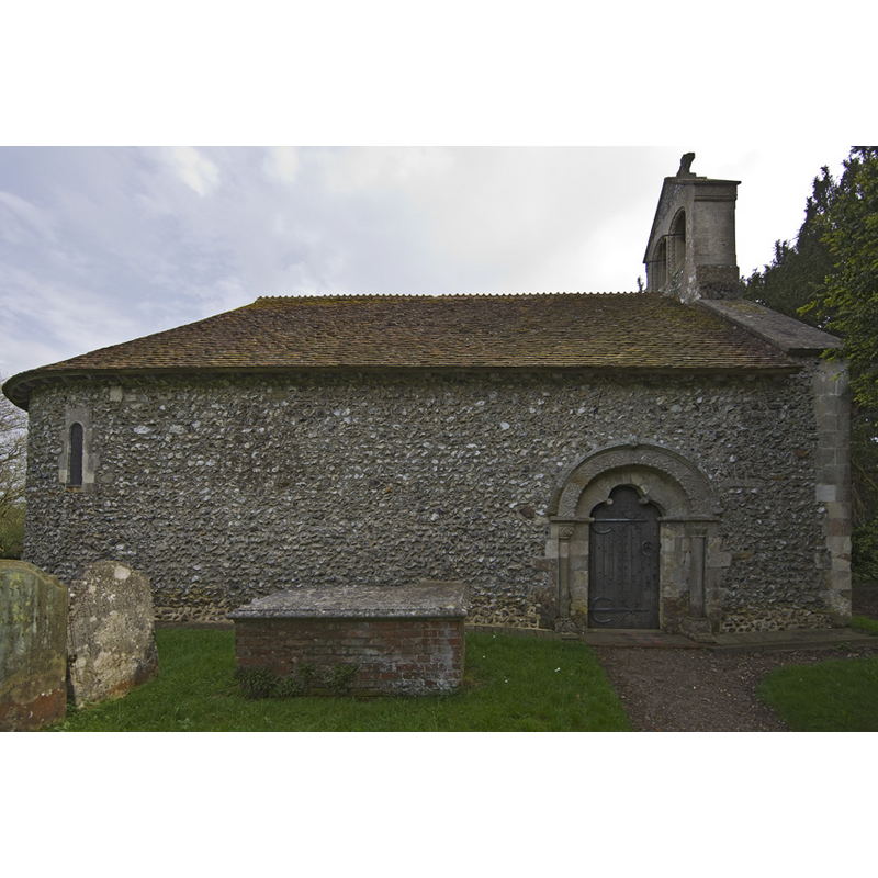
Scene Description: notice the north entrance, the only access to the interior of this church
Copyright Statement: Image copyright © Anthony McCallum, 2008
Image Source: digital photograph taken 3 May 2008 by Antony McCallum [www.wydlight.com]
Copyright Instructions: CC-BY-SA-3.0
view of church exterior - southeast view
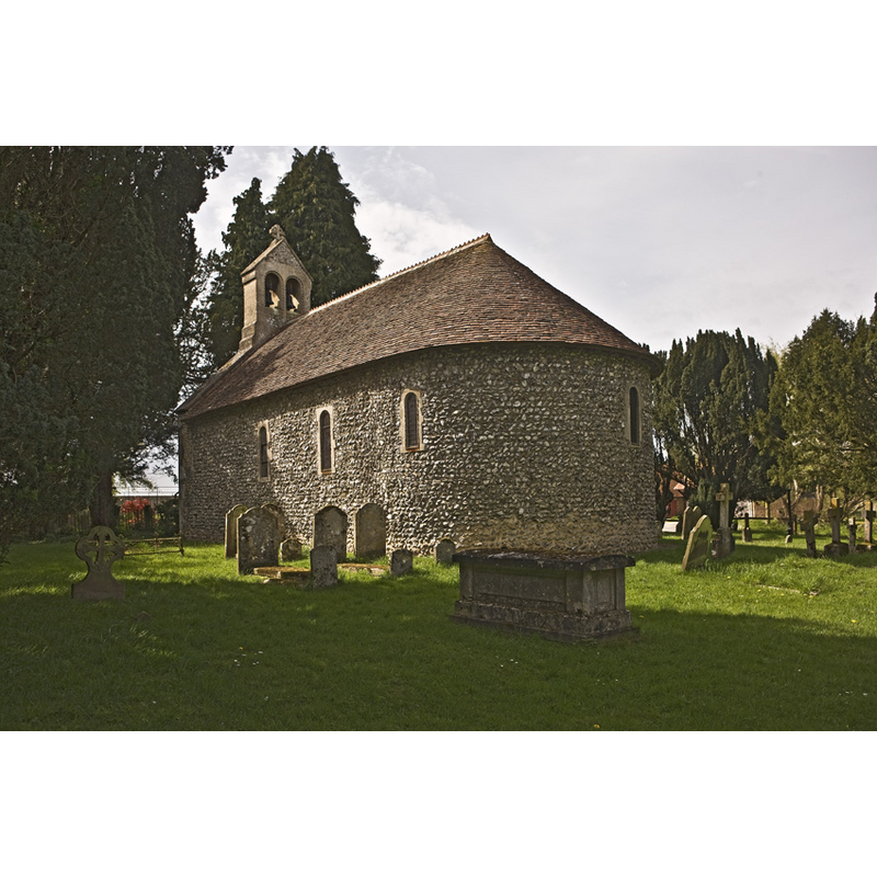
Copyright Statement: Image copyright © Anthony McCallum, 2008
Image Source: digital photograph taken 3 May 2008 by Antony McCallum [www.wydlight.com]
Copyright Instructions: CC-BY-SA-3.0
view of church interior - nave - looking east
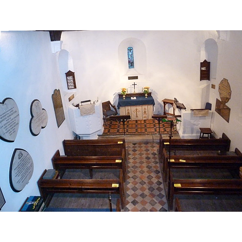
Copyright Statement: Image copyright © Basher Eyre, 2011
Image Source: digital photograph taken 30 November 2011 by Basher Eyre [www.geograph.org.uk/photo/2715837] [accessed 8 August 2018]
Copyright Instructions: CC-BY-SA-2.0
information
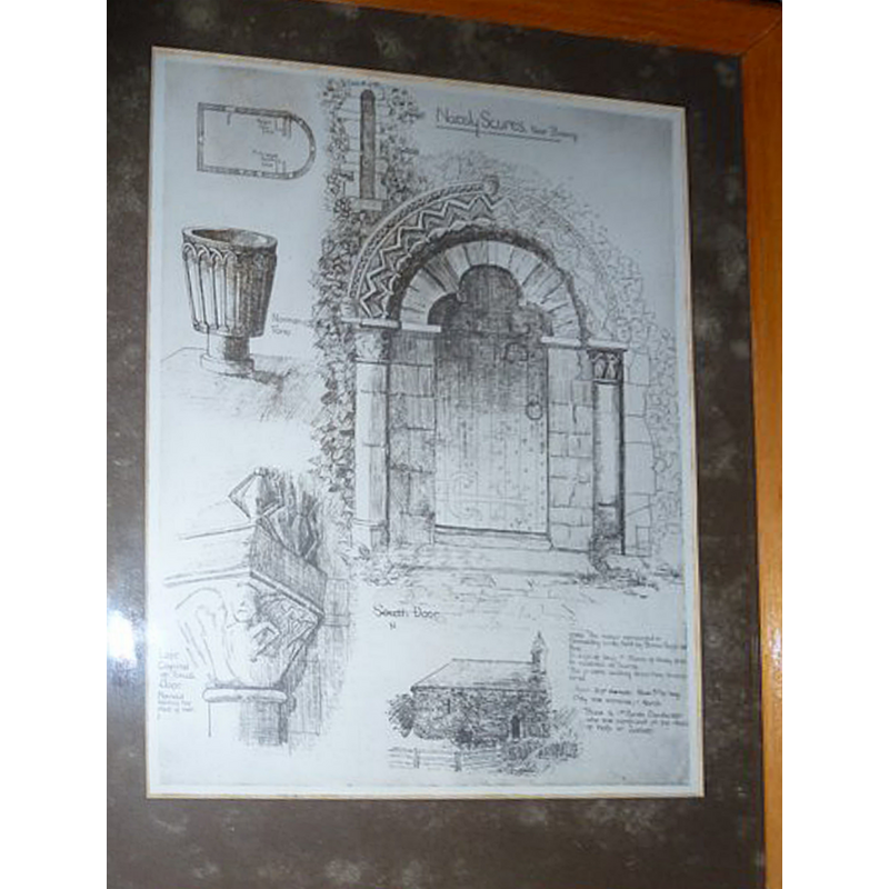
Scene Description: showing in it several details of the church, including the font
Copyright Statement: Image copyright © Basher Eyre, 2011
Image Source: digital photograph taken 30 November 2011 by Basher Eyre [www.geograph.org.uk/photo/2715796] [accessed 8 August 2018]
Copyright Instructions: CC-BY-SA-2.0
INFORMATION
Font ID: 17201SCU
Object Type: Baptismal Font1?
Font Century and Period/Style: 12th century (late?), Late Norman? / Transitional?
Church / Chapel Name: Parish Church of St. Swithun
Font Location in Church: [cf. FontNotes]
Church Patron Saint(s): St. Swithun [aka Swithin]
Church Notes: this late-12thC (?) church has only one entrance, on the north side
Church Address: Nately Scures, Hook RG27 9PH, UK
Site Location: Hampshire, South East, England, United Kingdom
Directions to Site: Located off (S) the A30 [aka London Rd], 3 km SW of Hook, 6 km E of Basingstoke
Ecclesiastic Region: Diocese of Winchester
Historical Region: Hundred of Basingstoke
Additional Comments: disappeared font? (the one from the late-12thC church here)
Font Notes:
Click to view
White (1878) reports "a new font" in this Norman-style church. The Victoria County History (Hampshire, vol. 4, 1911) notes: "The history of the church is of the simplest, the whole structure, practically as it stands to-day, having been built in the third quarter of the 12th century [...] The font is circular and of late date and a poor imitation of 12th-century work." The font consists of a bucket-shaped basin decorated with a an arcade of beaded-tape intersecting arches resting on columns with capitals and bases, raised of a plain cylindrical pedestal base and a circular lower base; it is, as indicated in the VCH, in the style of 12th-century Norman fonts. The entry for this 12th-century church in Historic England [Listing NGR: SU7011753738] mentions no font in it. [NB: we have no information on the medieval font of this church]
COORDINATES
UTM: 30U 639337 5681968
Latitude & Longitude (Decimal): 51.272, -1.0025
Latitude & Longitude (DMS): 51° 16′ 19.2″ N, 1° 0′ 9″ W
REFERENCES
- Victoria County History [online], University of London, 1993-. URL: https://www.british-history.ac.uk.
- White, William, History, gazetteer and directory of the County of Hampshire including the Isle of Wight, and [...], Sheffield: William White, 1878, p. 334